MyTopo
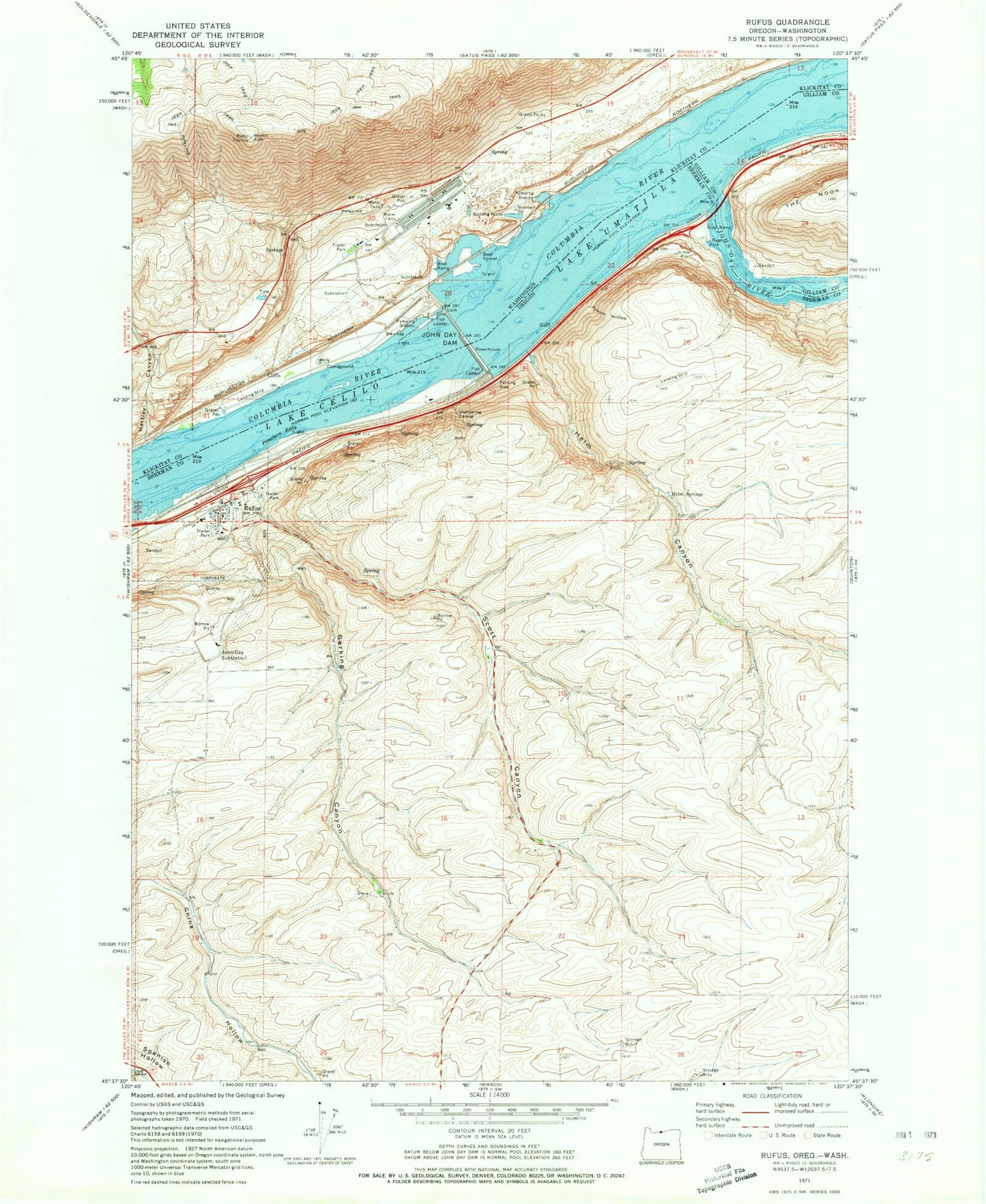
Classic USGS Rufus Oregon 7.5'x7.5' Topo Map
Couldn't load pickup availability
Historical USGS topographic quad map of Rufus in the states of Oregon, Washington. Map scale may vary for some years, but is generally around 1:24,000. Print size is approximately 24" x 27"
This quadrangle is in the following counties: Gilliam, Klickitat, Sherman.
The map contains contour lines, roads, rivers, towns, and lakes. Printed on high-quality waterproof paper with UV fade-resistant inks, and shipped rolled.
Contains the following named places: City of Rufus, Cliffs, Day, Gerking Canyon, Giles French Park Boat Ramp, Goff, Hartley Canyon, Hellroaring Canyon, Helm Canyon, Helm Springs, John Day Dam, John Day Dam Fish Ladder, John Day River, John Day Substation, John Days, Le Page Park, Le Page Park Boat Ramp, Le Page Treaty Fishing Access Site, Le Paige Park Marina, Lower John Day Rapids, North Shore Treaty Fishing Access Site, Pioneer Spring, Preachers Eddy, Preachers Eddy Treaty Fishing Access Site, Pyburn Hollow, Rufus, Rufus City Hall, Rufus Community Center, Rufus Department of Public Works, Rufus Post Office, Rufus Sewer System, Rufus Treaty Fishing Access Site, Rufus Volunteer Fire Department and Ambulance Service, Schofield Rapids, Scott Canyon, Upper John Day Rapids