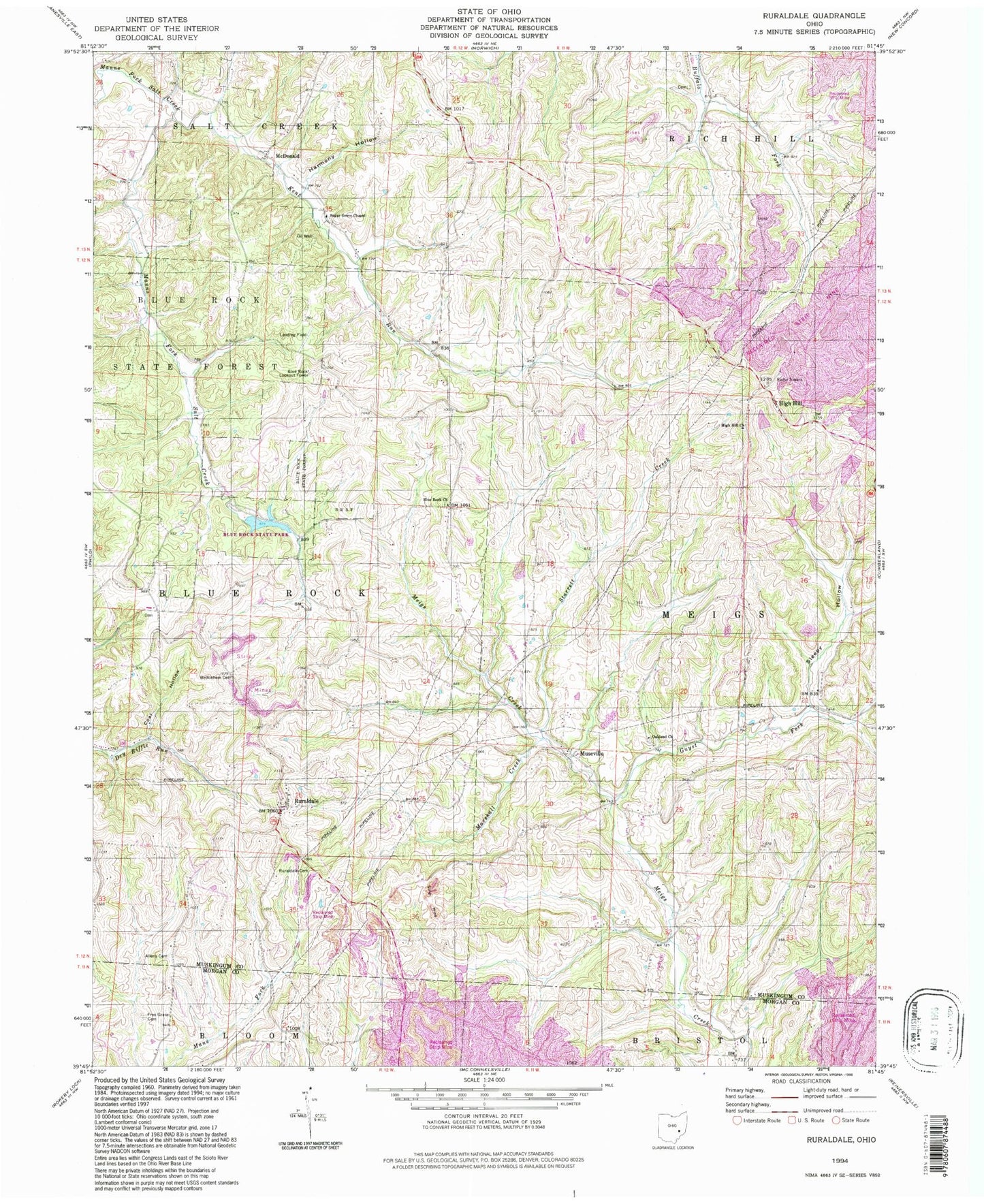
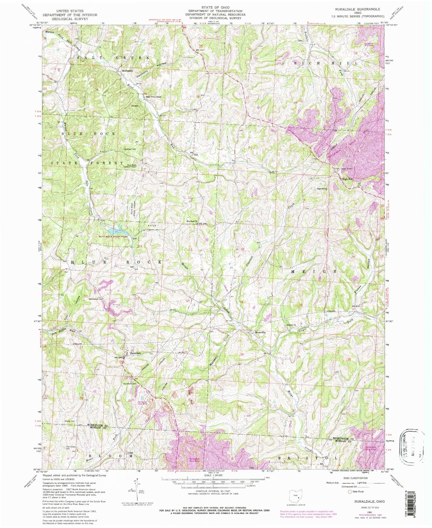
MyTopo
Classic USGS Ruraldale Ohio 7.5'x7.5' Topo Map
Couldn't load pickup availability
Historical USGS topographic quad map of Ruraldale in the state of Ohio. Typical map scale is 1:24,000, but may vary for certain years, if available. Print size: 24" x 27"
This quadrangle is in the following counties: Morgan, Muskingum.
The map contains contour lines, roads, rivers, towns, and lakes. Printed on high-quality waterproof paper with UV fade-resistant inks, and shipped rolled.
Contains the following named places: Allens Cemetery, Bethlehem Cemetery, Blue Rock State Forest, Coal Hollow, Free Grace Cemetery, Guyst Fork, Harmony Hollow, Marshall Creek, Ruraldale Cemetery, Sleepy Hollow, High Hill, Toadtown School (historical), Smith School (historical), Harmony School (historical), Hedge School (historical), West School (historical), Sleepy Hollow School (historical), Lyon School (historical), Bethlehem School (historical), Quailtrap School (historical), Elliott School (historical), Starrett Creek, Blue Rock State Park, McDonald, High Hill, Kent Run, Confederate Crossroads (historical), Cutler Lake, High Hill Presbyterian Church, Blue Rock Baptist Church, Museville, Oakland Methodist Church, Ruraldale, Sugar Grove Chapel, Blue Rock Lake Dam, Blue Rock Lookout Tower, Township of Blue Rock, Township of Meigs, Blue Rock Baptist Cemetery, McNaughton Cemetery, Oakland Methodist Cemetery, Stone Church Cemetery, Sugar Grove Cemetery, High Hill Post Office (historical), McDonald post office (historical), Museville Post Office (historical), Ruraldale Post Office (historical)