MyTopo
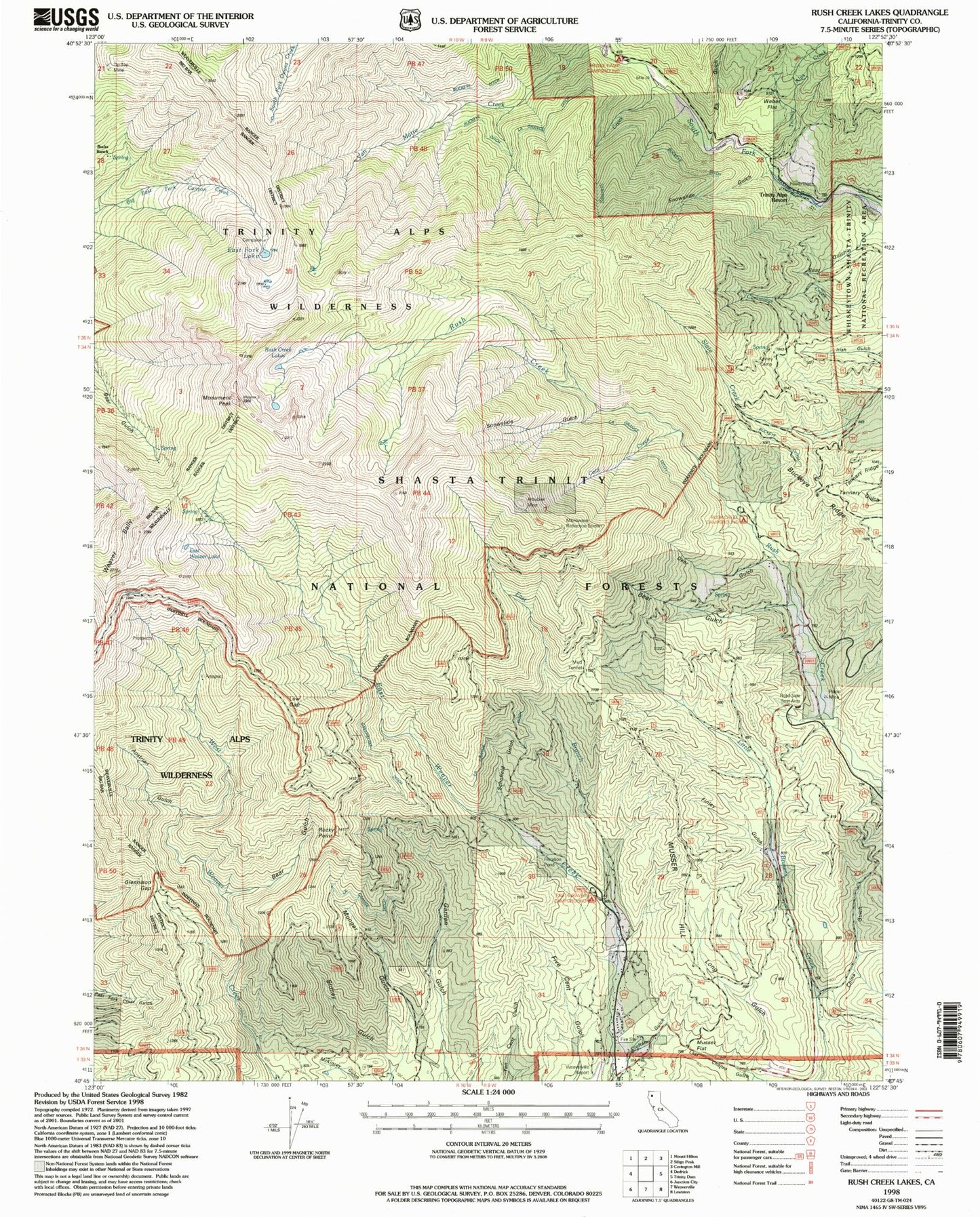
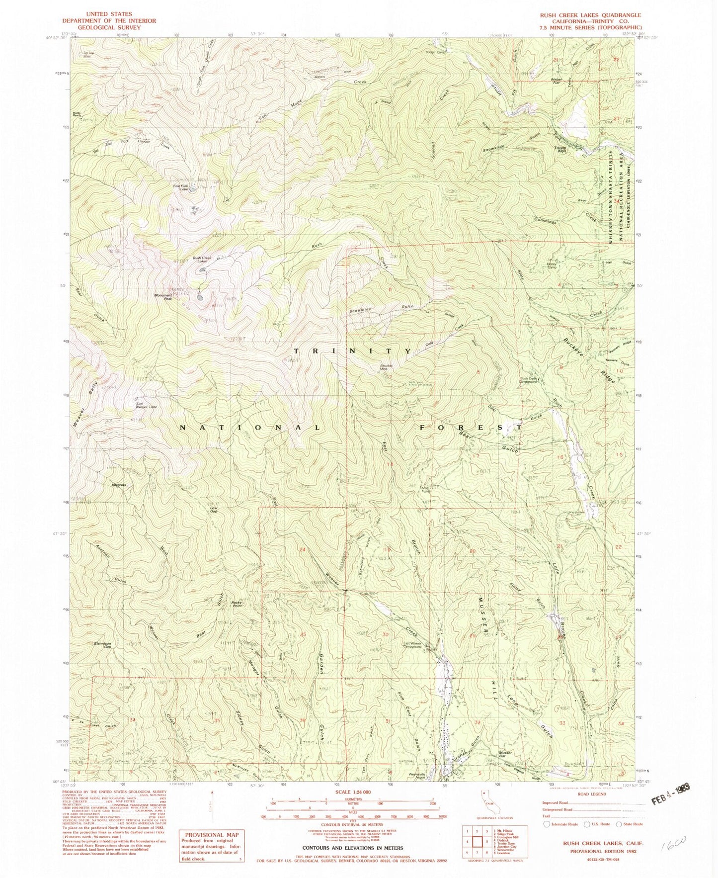
Classic USGS Rush Creek Lakes California 7.5'x7.5' Topo Map
Couldn't load pickup availability
Historical USGS topographic quad map of Rush Creek Lakes in the state of California. Map scale may vary for some years, but is generally around 1:24,000. Print size is approximately 24" x 27"
This quadrangle is in the following counties: Trinity.
The map contains contour lines, roads, rivers, towns, and lakes. Printed on high-quality waterproof paper with UV fade-resistant inks, and shipped rolled.
Contains the following named places: Adams Ranch, Arbuckel Mine, Austrian Gulch, Bear Gulch, Bridge Camp, Bucks Ranch, China Gulch, Cold Creek, Deer Gulch, East Branch East Weaver Creek, East Fork Lakes, East Weaver Campground, East Weaver Lake, Elk Gulch, Finley Gulch, Glennison Gap, Haypress, Howes Ditch, Kinney Camp, Long Gulch, Low Gap, Monument Peak, Mud Tunnel, Munger Gulch, Musser Flat, Rocky Point, Rush Creek Campground, Rush Creek Lakes, Sawmill Creek, Schofield Gulch, Snowslide Gulch, Sweepstake Ditch, Tannery Ridge, Tip Top Mine, Trinity Alps, Trinity Alps Creek, Van Matre Creek, Weaver Bally, Weber Flat, Zig Zag Trail, ZIP Code: 96093