MyTopo
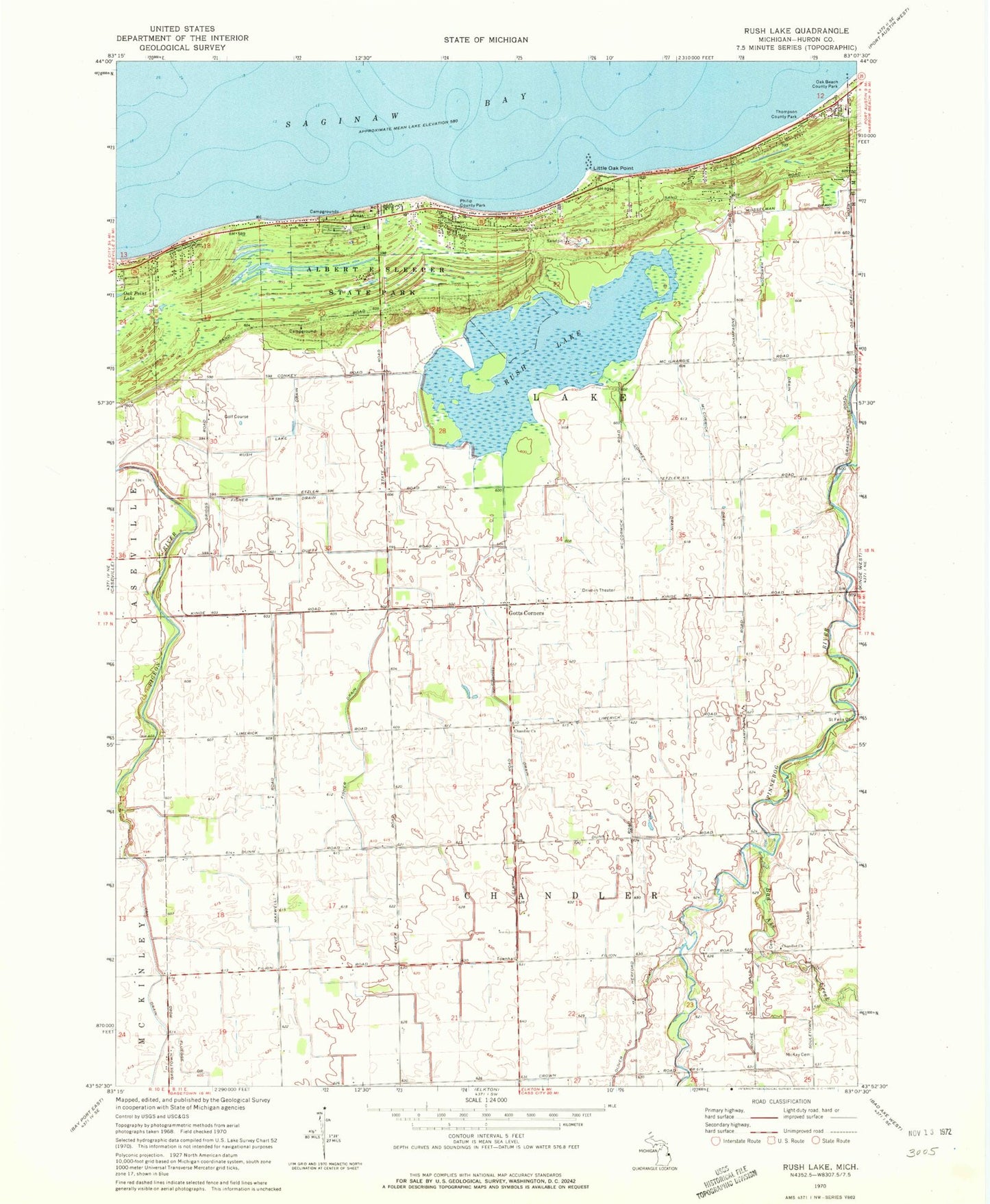
Classic USGS Rush Lake Michigan 7.5'x7.5' Topo Map
Couldn't load pickup availability
Historical USGS topographic quad map of Rush Lake in the state of Michigan. Map scale may vary for some years, but is generally around 1:24,000. Print size is approximately 24" x 27"
This quadrangle is in the following counties: Huron.
The map contains contour lines, roads, rivers, towns, and lakes. Printed on high-quality waterproof paper with UV fade-resistant inks, and shipped rolled.
Contains the following named places: Albert E Sleeper State Park, Albert E Sleeper State Park Campground, Bad Axe Creek, Caseville Golf Course, Chandler Church, Chandler Township Cemetery, Conkey Drain, Depener Farms, Fisher Drain, Gotts Corners, Gotts Post Office, Harrison Drain, Little Oak Point, McCormick Drain, McKay Cemetery, Musselman Drain, Oak Beach County Park, Phillip County Park, Roundtree Dairy, Rush Lake, Rush Lake Drain, Tait Farms, Thompson County Park, Thompson Drain, Township of Chandler, Van Drain, ZIP Code: 48725