MyTopo
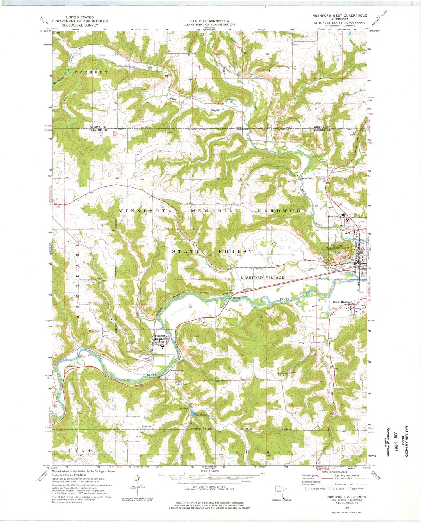
Classic USGS Rushford West Minnesota 7.5'x7.5' Topo Map
Couldn't load pickup availability
Historical USGS topographic quad map of Rushford West in the state of Minnesota. Map scale may vary for some years, but is generally around 1:24,000. Print size is approximately 24" x 27"
This quadrangle is in the following counties: Fillmore, Winona.
The map contains contour lines, roads, rivers, towns, and lakes. Printed on high-quality waterproof paper with UV fade-resistant inks, and shipped rolled.
Contains the following named places: Big Springs Creek, Bluffview Park Mobile Home Park, City of Peterson, City of Rushford, City of Rushford Village, Depot Museum, East Grace Cemetery, Emmanuel Episcopal Church, Ferndale Country Club, Good Shepherd Lutheran Church, Grace Lutheran Church, Hemingway Creek, Hungerholdt Cemetery, Johnson Cemetery, Magelssen Bluff Park, Northend Campground, Peterson, Peterson Post Office, Peterson RV Campsite, Peterson Wayside Park, Pine Creek, Robert Highum Dam, Root River Community Church, Rushford, Rushford Clinic, Rushford Community Ambulance, Rushford Fire Department, Rushford Lutheran Church, Rushford Municipal Airport-Robert W Bunke Field, Rushford Peterson High School, Rushford Peterson Middle School, Rushford Police Department, Rushford Post Office, Rushford Public Library, Rushford Village, Saint John's Lutheran Church, Saint Joseph Cemetery, Saint Joseph's Catholic Church, Saint Mark's Lutheran Church, South Rushford, West Grace Cemetery, ZIP Codes: 55962, 55971