MyTopo
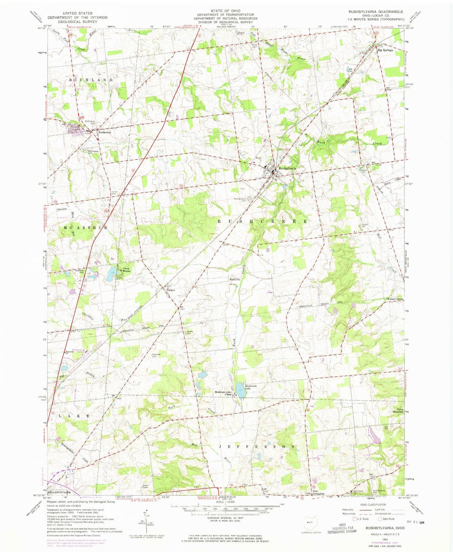
Classic USGS Rushsylvania Ohio 7.5'x7.5' Topo Map
Couldn't load pickup availability
Historical USGS topographic quad map of Rushsylvania in the state of Ohio. Map scale may vary for some years, but is generally around 1:24,000. Print size is approximately 24" x 27"
This quadrangle is in the following counties: Logan.
The map contains contour lines, roads, rivers, towns, and lakes. Printed on high-quality waterproof paper with UV fade-resistant inks, and shipped rolled.
Contains the following named places: Appleseed Ridge Lake Number One, Appleseed Ridge Lake Number One Dam, Appleseed Ridge Lake Number Two, Appleseed Ridge Lake Number Two Dam, Bellefontaine Municipal Airport, Benjamin Logan Middle School, Camp Wesley, Camp Wesley Lake, Camp Wesley Lake Dam, Cherokee Run Landfill, Culp Field, Day Cemetery, Dorman Cemetery, Easton Cemetery, Equality Cemetery, Equality School, Fulton Cemetery, Harper, Harper Cemetery, Harper Post Office, Hopewell Church, Jasinsky Cemetery, Marl City, McKirahan Cemetery, Miami Cemetery, Mountain Lake Camp, New Salem Cemetery, New Salem Church, Northwood, Northwood Cemetery, Northwood Post Office, Rushcreek Lake, Rushcreek Township Volunteer Fire Department, Rushsylvania, Rushsylvania Cemetery, Rushsylvania Post Office, School Number 1, School Number 10, School Number 2, School Number 5, Smoky Row School, Stanfield Cemetery, Township of Rushcreek, Turkey Ridge School, Village of Rushsylvania, ZIP Code: 43347