MyTopo
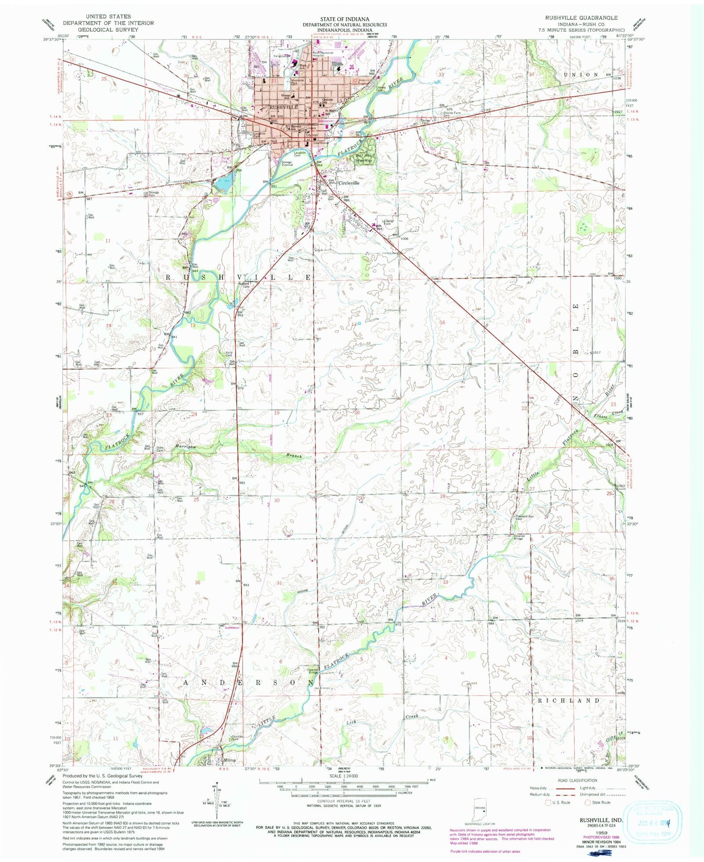
Classic USGS Rushville Indiana 7.5'x7.5' Topo Map
Couldn't load pickup availability
Historical USGS topographic quad map of Rushville in the state of Indiana. Map scale may vary for some years, but is generally around 1:24,000. Print size is approximately 24" x 27"
This quadrangle is in the following counties: Rush.
The map contains contour lines, roads, rivers, towns, and lakes. Printed on high-quality waterproof paper with UV fade-resistant inks, and shipped rolled.
Contains the following named places: Air Evacuation Lifeteam - Rushville, Calvary Cemetery, Circleville, City of Rushville, County Farm Cemetery, D and R Airport, Duke Cemetery, East Hill Cemetery, Frazee Creek, Graham School, Gregg School, Harrigan Branch, Havens School, Kelly Cemetery, Laughlin Cemetery, Laughlin Park, Matlock Cemetery, Memorial Park, Moore Ditch, Pleasant Run Cemetery, Rush County, Rush Memorial Hospital, Rushville, Rushville Consolidated High School, Rushville Fire Department, Rushville Police Department, Rushville Post Office, Rushville Township Volunteer Fire Department, Saint Mary Elementary School, Thomas Cemetery, Township of Rushville, Webb School, ZIP Code: 46173