MyTopo
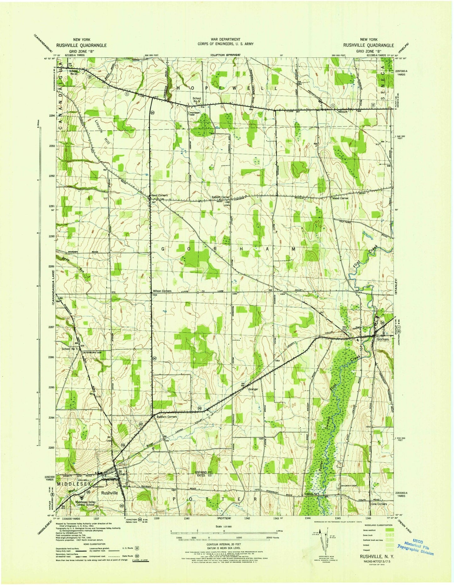
Classic USGS Rushville New York 7.5'x7.5' Topo Map
Couldn't load pickup availability
Historical USGS topographic quad map of Rushville in the state of New York. Map scale may vary for some years, but is generally around 1:24,000. Print size is approximately 24" x 27"
This quadrangle is in the following counties: Ontario, Yates.
The map contains contour lines, roads, rivers, towns, and lakes. Printed on high-quality waterproof paper with UV fade-resistant inks, and shipped rolled.
Contains the following named places: Aldrich Trailer Park, Aloquin, Babbitt Corner, Baldwin Cemetery, Baldwin Corners, Bethel Baptist Church, Cole Corners, Gorham, Gorham Cemetery, Gorham Census Designated Place, Gorham Elementary School, Gorham Fire Department, Gorham Free Library, Gorham Post Office, Grace Bible Baptist Church, Granger, Harkness Hill, Hopewell Burying Ground, Hopewell Volunteer Fire Department Station 2, Lazarus Hill, Lewis Cemetery, Lincoln Hill, Marcus Whitman High School, Marcus Whitman Middle School, Mead Corner, Middlesex Valley Central School, Midlakes Airport, Parkway Drive-In, Pickett's Corners Cemetery, Pioneer Cemetery, Reed Corner Federated Church, Reed Corners, Reed's Corners Cemetery, Rushville, Rushville Hose Company, Rushville Post Office, Rushville United Methodist Church, Rushville Village Cemetery, School Number 1, School Number 10, School Number 5, School Number 9, Shuman Cemetery, Stanley Hall Gorham Ambulance Corps, Thomas Estates Mobile Home Park, Town of Gorham, United Methodist Church of Gorham, Village of Rushville, Washburn Cemetery, Wilson Corners, ZIP Codes: 14544, 14561