MyTopo
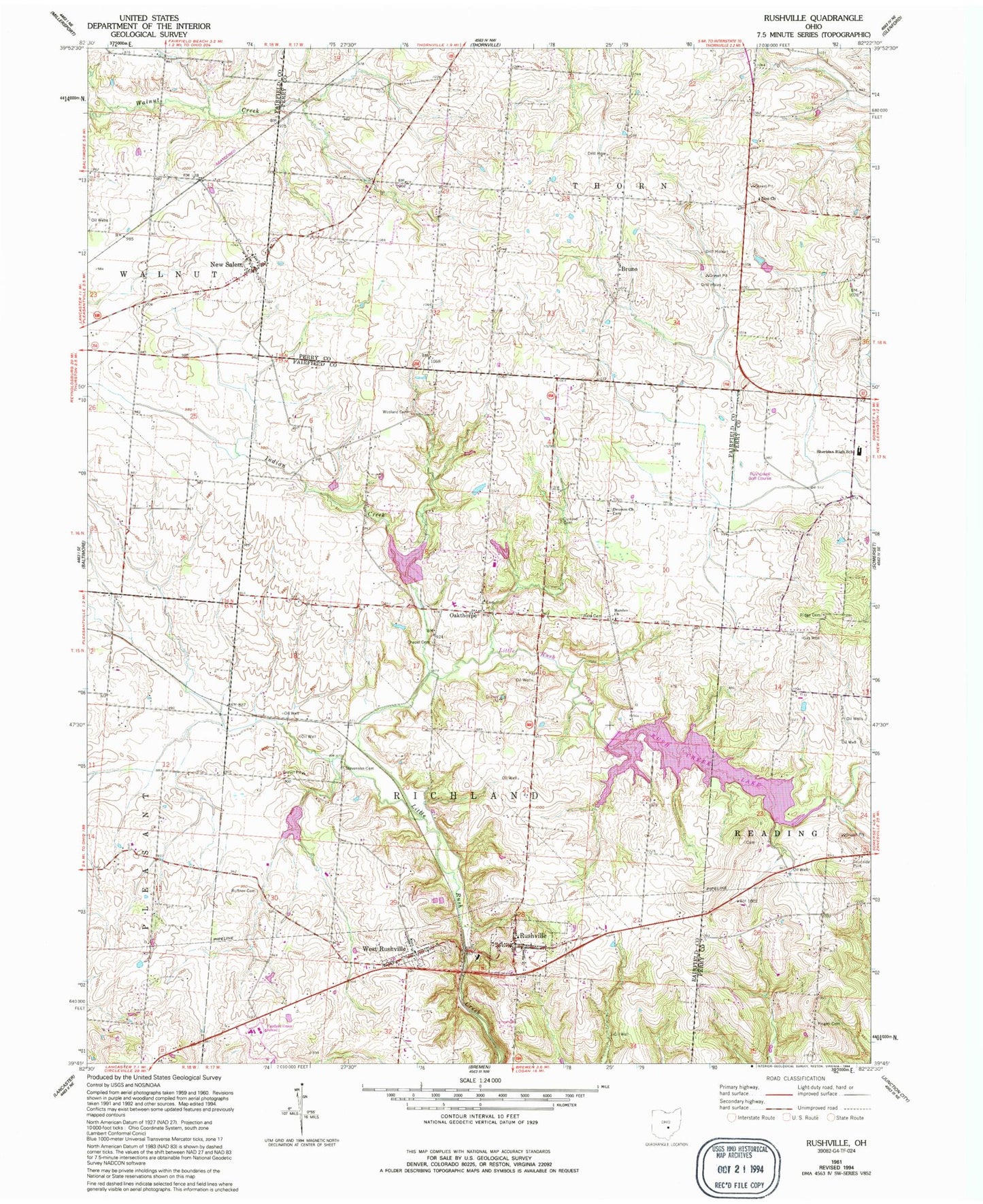
Classic USGS Rushville Ohio 7.5'x7.5' Topo Map
Couldn't load pickup availability
Historical USGS topographic quad map of Rushville in the state of Ohio. Map scale may vary for some years, but is generally around 1:24,000. Print size is approximately 24" x 27"
This quadrangle is in the following counties: Fairfield, Perry.
The map contains contour lines, roads, rivers, towns, and lakes. Printed on high-quality waterproof paper with UV fade-resistant inks, and shipped rolled.
Contains the following named places: Bruno, Bruno Post Office, Chapel Cemetery, Cloud Cemetery, Combs Family Cemetery, Crists Cemetery, Custard Cemetery, Devils Den School, Drumm Cemetery, Drumm Church, Fairfield Union School, Friend Ruffner Cemetery, Indian Creek, Kaufman - Valentine Cemetery, Kurlin School, Marshes Church, Memory Lanes Park Lake, Memory Lanes Park Lake Dam, New Oakthorpe Cemetery, New Salem, New Salem Methodist Episcopal Cemetery, New Salem Methodist Protestant Cemetery, New Salem Post Office, Oakthorpe, Oakthorpe Lake, Oakthorpe Post Office, Old Oakthorpe Cemetery, Pisgah Cemetery, Pisgah School, Reid Cemetery, Richland Township Fire Department, Ridge Cemetery, Ridge School, Rush Creek Conservation District Structure 6d Dam, Rush Creek Lake, Rush Creek Watershed Structure VI Reservoir, Rush Creek Watershed Structure VI-D Dam, Rushcreek Golf Course, Rushville, Rushville Cemetery, Rushville Historic District, Rushville Middle School, Rushville Post Office, Shakes Run School, Sheridan High School, Stevenson Cemetery, Township of Richland, Village of Rushville, Village of West Rushville, West Rushville, West Rushville Cemetery, West Rushville Post Office, Willard School, Woolard Cemetery, Zion Church, Zion Reformed Cemetery, ZIP Codes: 43148, 43150