MyTopo
Classic USGS Rusk Indiana 7.5'x7.5' Topo Map
Couldn't load pickup availability
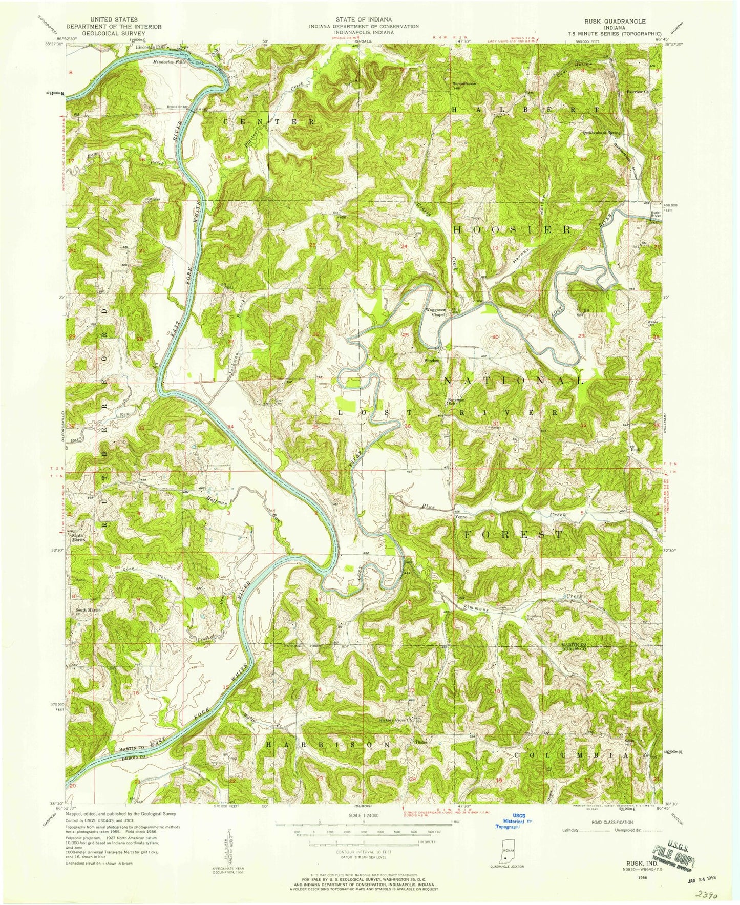
Historical USGS topographic quad map of Rusk in the state of Indiana. Map scale may vary for some years, but is generally around 1:24,000. Print size is approximately 24" x 27"
This quadrangle is in the following counties: Dubois, Martin.
The map contains contour lines, roads, rivers, towns, and lakes. Printed on high-quality waterproof paper with UV fade-resistant inks, and shipped rolled.
Contains the following named places: Barn Run, Bateman School, Blue Creek, Brooks Bridge, Butler Bridge, Coal Hollow, Coon Hollow, Crooked Creek, Elm Creek, Fairview Church, Goss Hill, Grassy Creek, Green Cemetery, Harner Hollow, Haw Creek, Hickory Grove Church, Hindostan Falls, Hoffman Run, Holtsclaw Cemetery, Jackman Branch, Lost River, Lost River Volunteer Fire Department, Miller Fork, Plaster Creek, Poplar Creek, Qualkenbush Hollow, Qualkenbush Spring, Rusk, Schoolhouse Hill, Simmons Cemetery, Simmons Creek, South Martin, South Martin Church, Thales, Township of Lost River, Virginia Rill, Waggoner Chapel, Walker Cemetery, Willow Creek, Windom, Wolfe Creek, Yenne