MyTopo
Classic USGS Rusk Wisconsin 7.5'x7.5' Topo Map
Couldn't load pickup availability
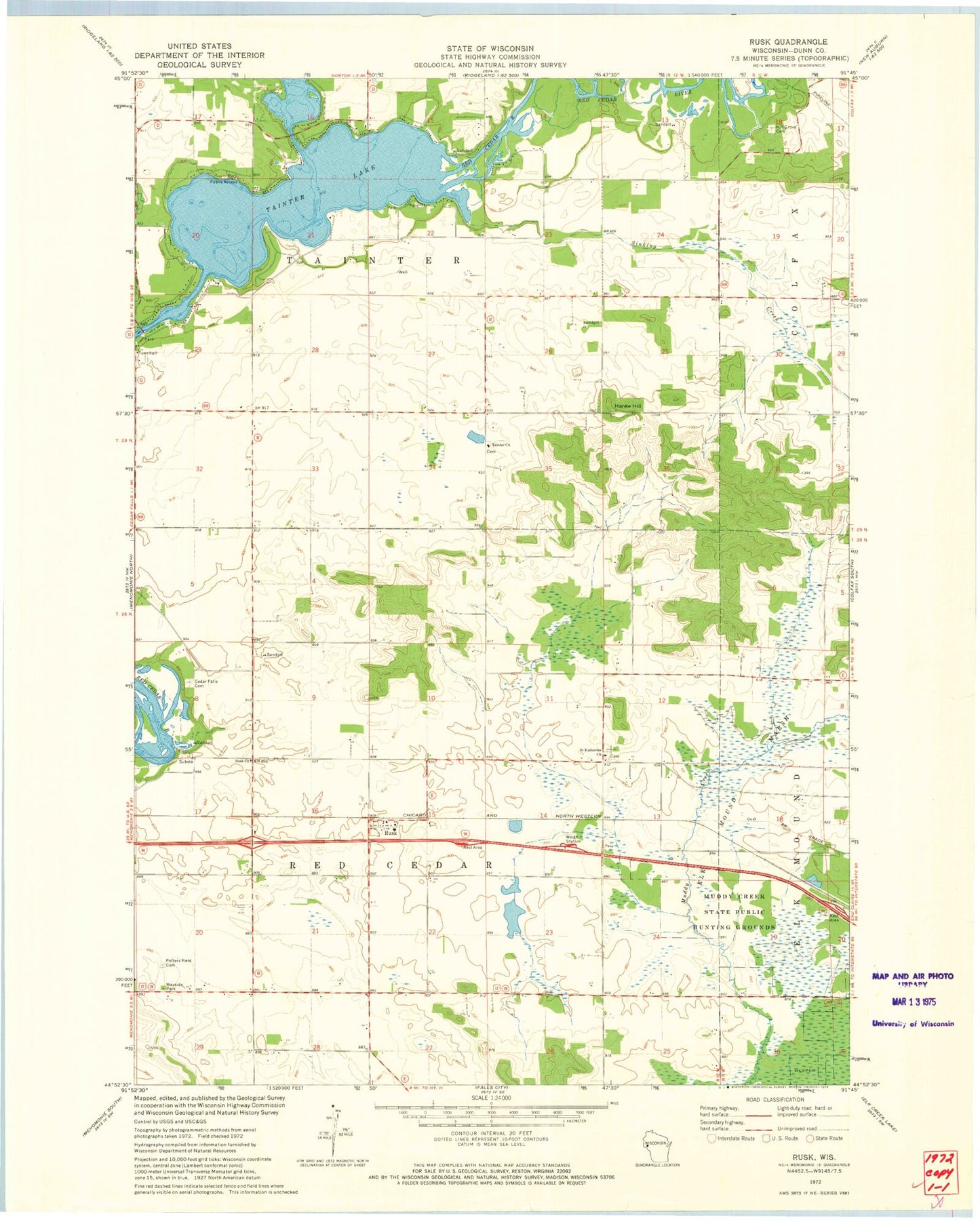
Historical USGS topographic quad map of Rusk in the state of Wisconsin. Map scale may vary for some years, but is generally around 1:24,000. Print size is approximately 24" x 27"
This quadrangle is in the following counties: Dunn.
The map contains contour lines, roads, rivers, towns, and lakes. Printed on high-quality waterproof paper with UV fade-resistant inks, and shipped rolled.
Contains the following named places: Beyer Settlement School, Cedar Falls Cemetery, Clearview School, Elk Mound Marsh, Hanke Hill, Hill Grove Cemetery, Knapp Settlement School, Lone Pine School, Lyndale School, Menomonie Municipal Airport-Score Field, Muddy Creek State Public Hunting Grounds, Ney School, Potters Field Cemetery, Prairie School, Rusk, Rusk Church, Rusk Post Office, Rusk School, Saint Katherine Church, Sherbourne Prairie, Sinking Creek, Tainter Church, Tainter Lake, Tainter Lake Census Designated Place, Town of Red Cedar, Town of Tainter