
MyTopo
Classic USGS Russell Mountain Maine 7.5'x7.5' Topo Map
Couldn't load pickup availability
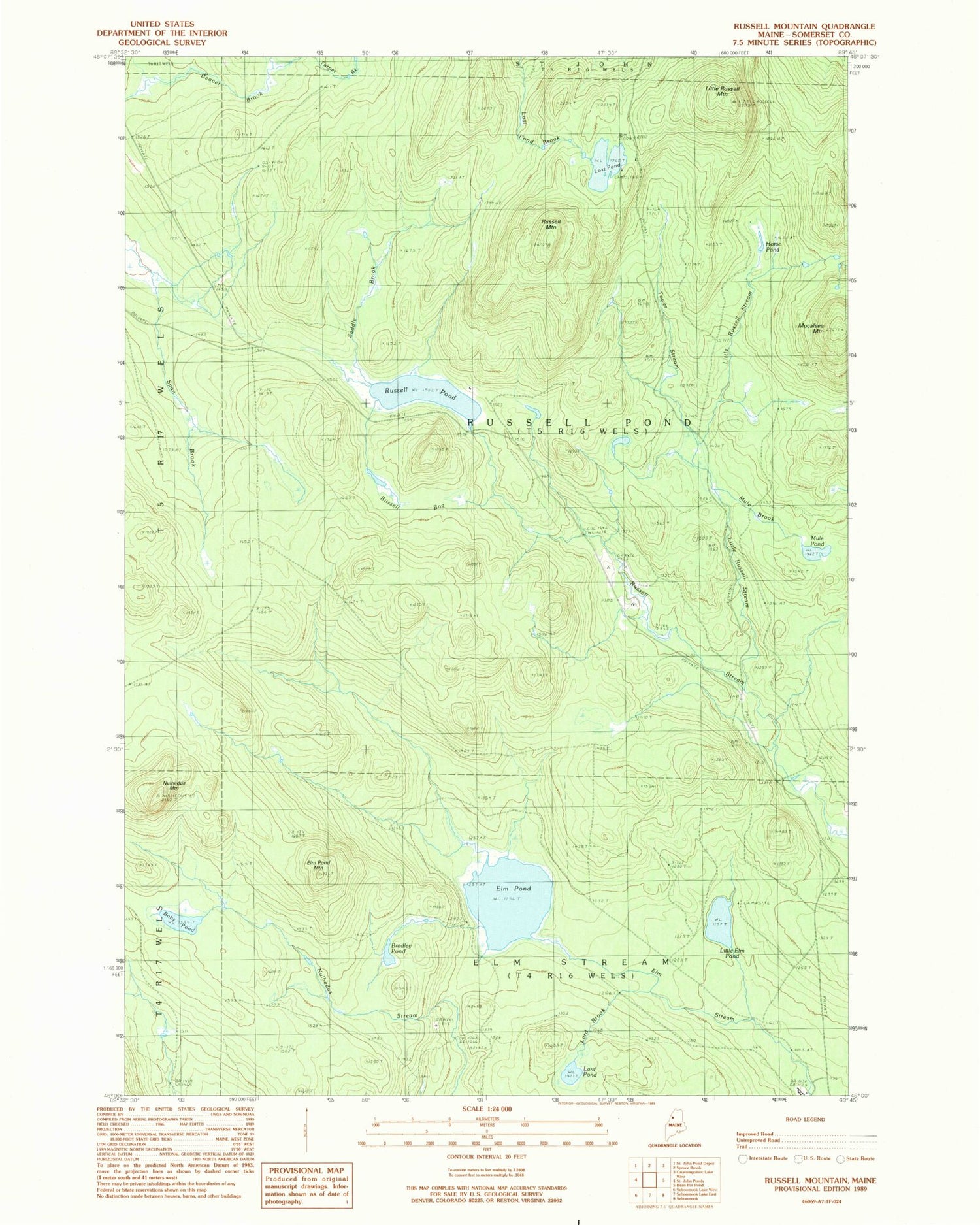
Historical USGS topographic quad map of Russell Mountain in the state of Maine. Map scale may vary for some years, but is generally around 1:24,000. Print size is approximately 24" x 27"
This quadrangle is in the following counties: Somerset.
The map contains contour lines, roads, rivers, towns, and lakes. Printed on high-quality waterproof paper with UV fade-resistant inks, and shipped rolled.
Contains the following named places: Bobs Pond, Bradley Pond, Elm Pond, Elm Pond Mountain, Elm Stream Township, Horse Pond, Lard Brook, Lard Pond, Little Elm Pond, Little Russell Mountain, Little Russell Stream, Lost Pond, Mucalsea Mountain, Mule Brook, Mule Pond, Nulhedus Mountain, Russell Bog, Russell Mountain, Russell Pond, Russell Pond Township, Saddle Brook, Span Brook, Tower Stream


