MyTopo
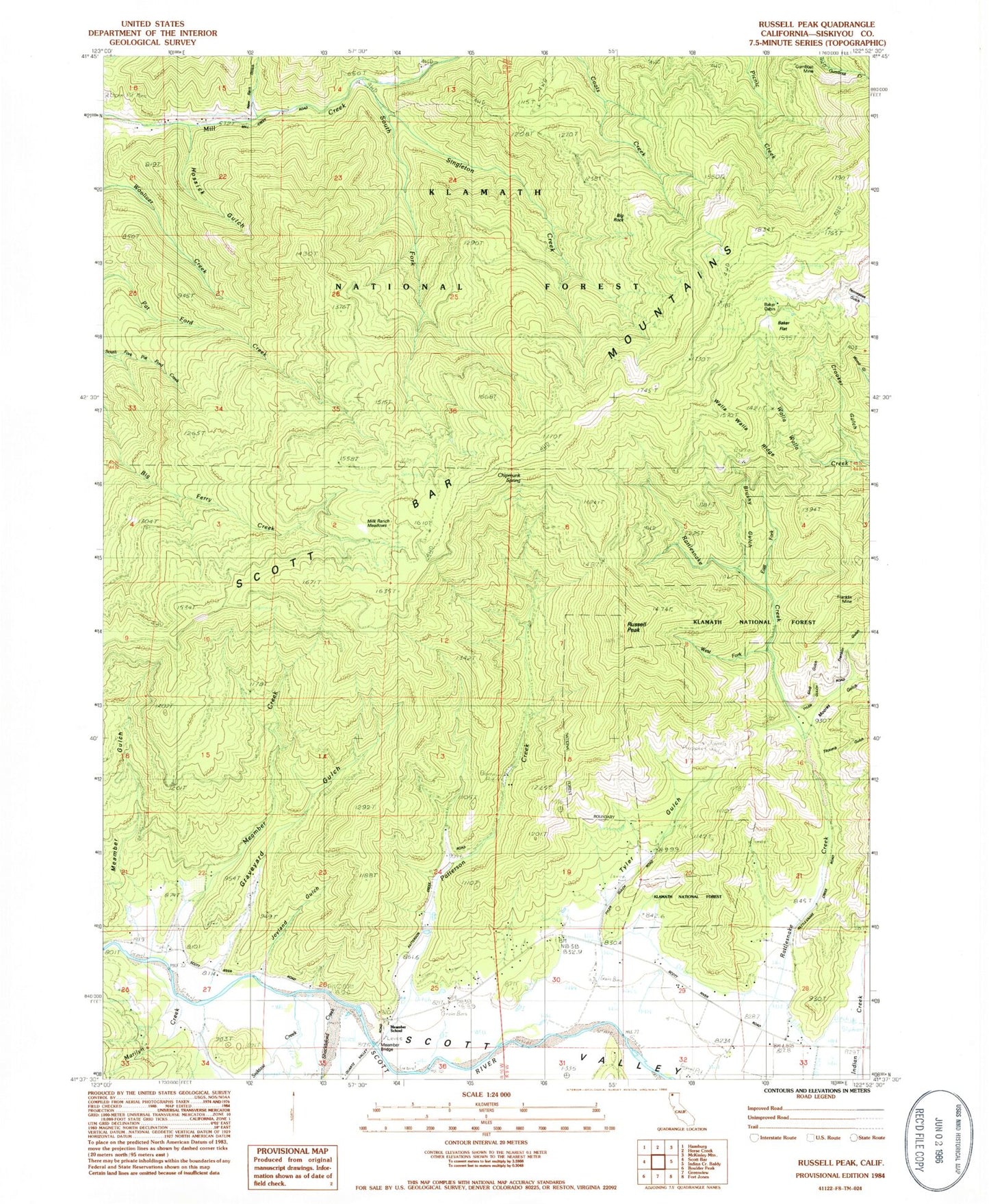
Classic USGS Russell Peak California 7.5'x7.5' Topo Map
Couldn't load pickup availability
Historical USGS topographic quad map of Russell Peak in the state of California. Map scale may vary for some years, but is generally around 1:24,000. Print size is approximately 24" x 27"
This quadrangle is in the following counties: Siskiyou.
The map contains contour lines, roads, rivers, towns, and lakes. Printed on high-quality waterproof paper with UV fade-resistant inks, and shipped rolled.
Contains the following named places: Baker Cabin, Baker Flat, Big Rock, Brushy Gulch, Chipmunk Spring, Crooker Gulch, East Fork Rattlesnake Creek, Fort Jones Division, Franklin Gulch, Franklin Mine, Graveyard Gulch, Gumboot Mine, Hossick Gulch, Hunters Gulch, Joyland Gulch, Lone Star School, Marilyn Creek, Meamber Bridge, Meamber Creek, Meamber Gulch, Meamber School, Milk Ranch Meadows, Moores Gulch, New Barn Gulch, Patterson Creek, Quartz Valley, Russell Peak, Scott Valley, Scott Valley Fire Protection District Scott River, Shackleford Creek, Sheba Mine, Shelba Mine, Singleton Creek, Slug Creek, Slug Gulch, Sniktaw Creek, South Fork Mill Creek, Titcomb Gulch, Tyler Gulch, Walla Walla Ridge, West Fork Rattlesnake Creek