MyTopo
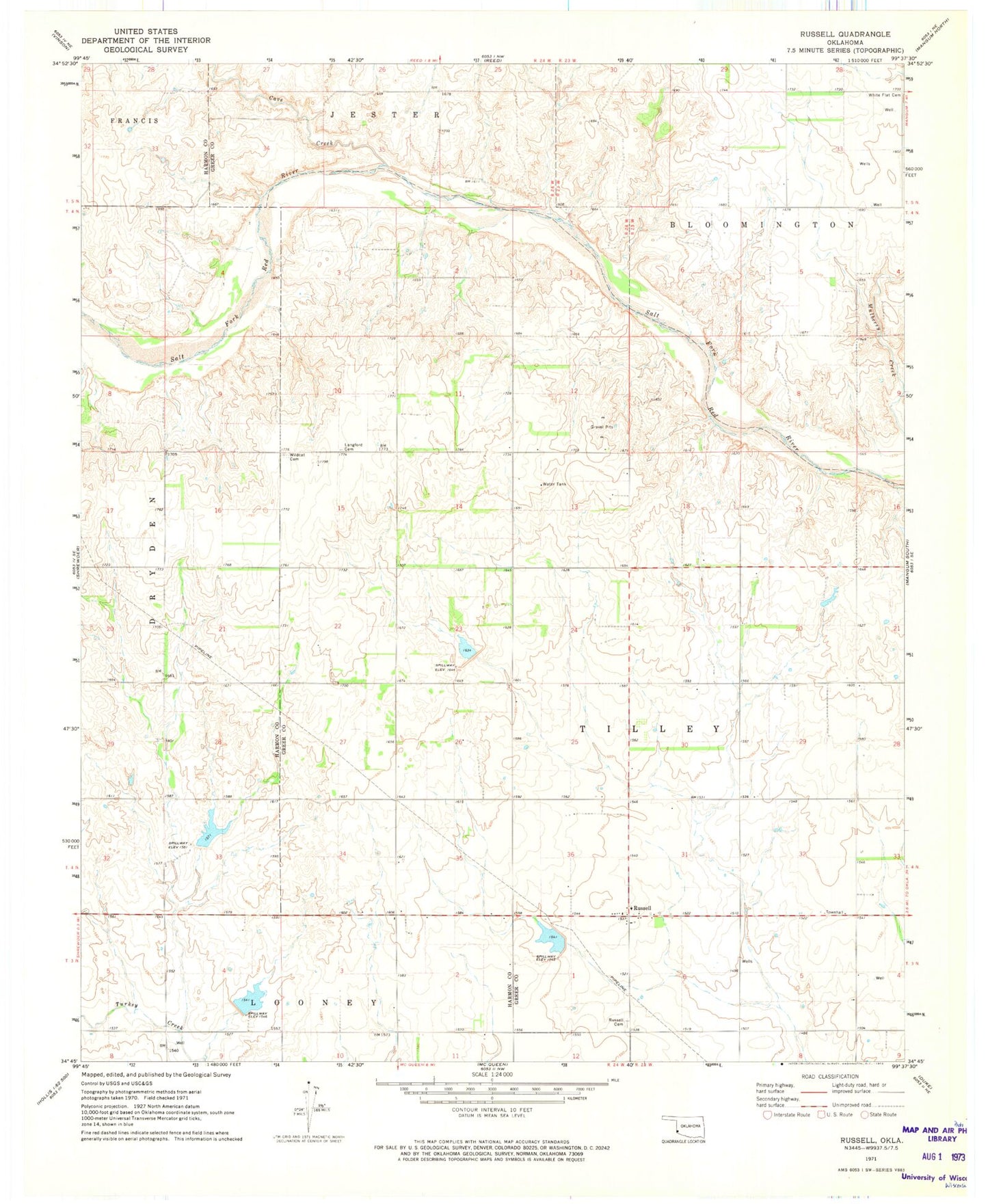
Classic USGS Russell Oklahoma 7.5'x7.5' Topo Map
Couldn't load pickup availability
Historical USGS topographic quad map of Russell in the state of Oklahoma. Map scale may vary for some years, but is generally around 1:24,000. Print size is approximately 24" x 27"
This quadrangle is in the following counties: Greer, Harmon.
The map contains contour lines, roads, rivers, towns, and lakes. Printed on high-quality waterproof paper with UV fade-resistant inks, and shipped rolled.
Contains the following named places: Cave Creek, Langford Cemetery, Russell, Russell Cemetery, Tri County Turkey Creek Site 4 Reservoir, Tri-County Turkey Creek Site 14a Dam, Tri-County Turkey Creek Site 14a Reservoir, Tri-County Turkey Creek Site 15 Dam, Tri-County Turkey Creek Site 15 Reservoir, Tri-County Turkey Creek Site 2a Dam, Tri-County Turkey Creek Site 2a Reservoir, Tri-County Turkey Creek Site 4 Dam, White Flat Cemetery, Wildcat Cemetery