MyTopo
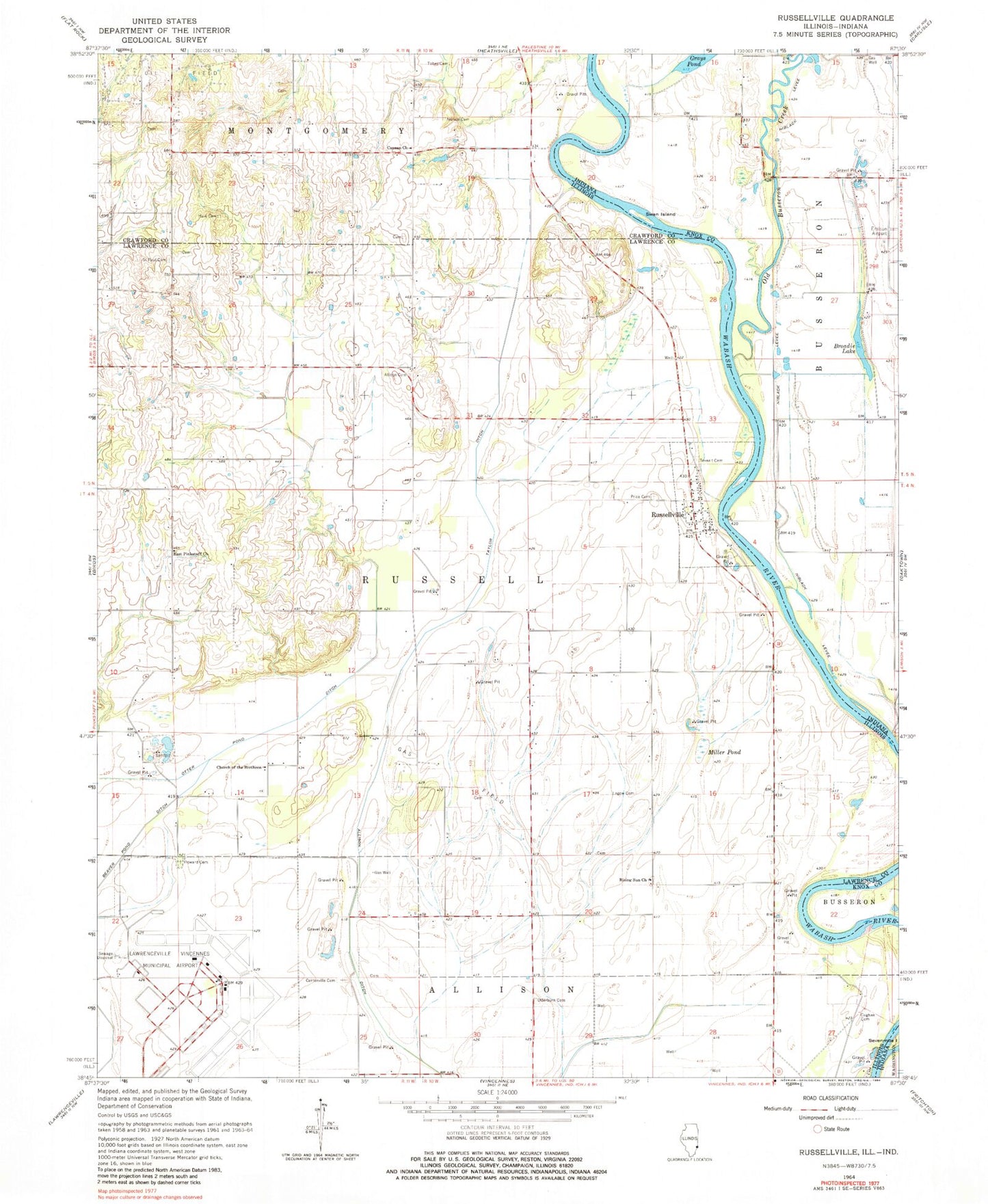
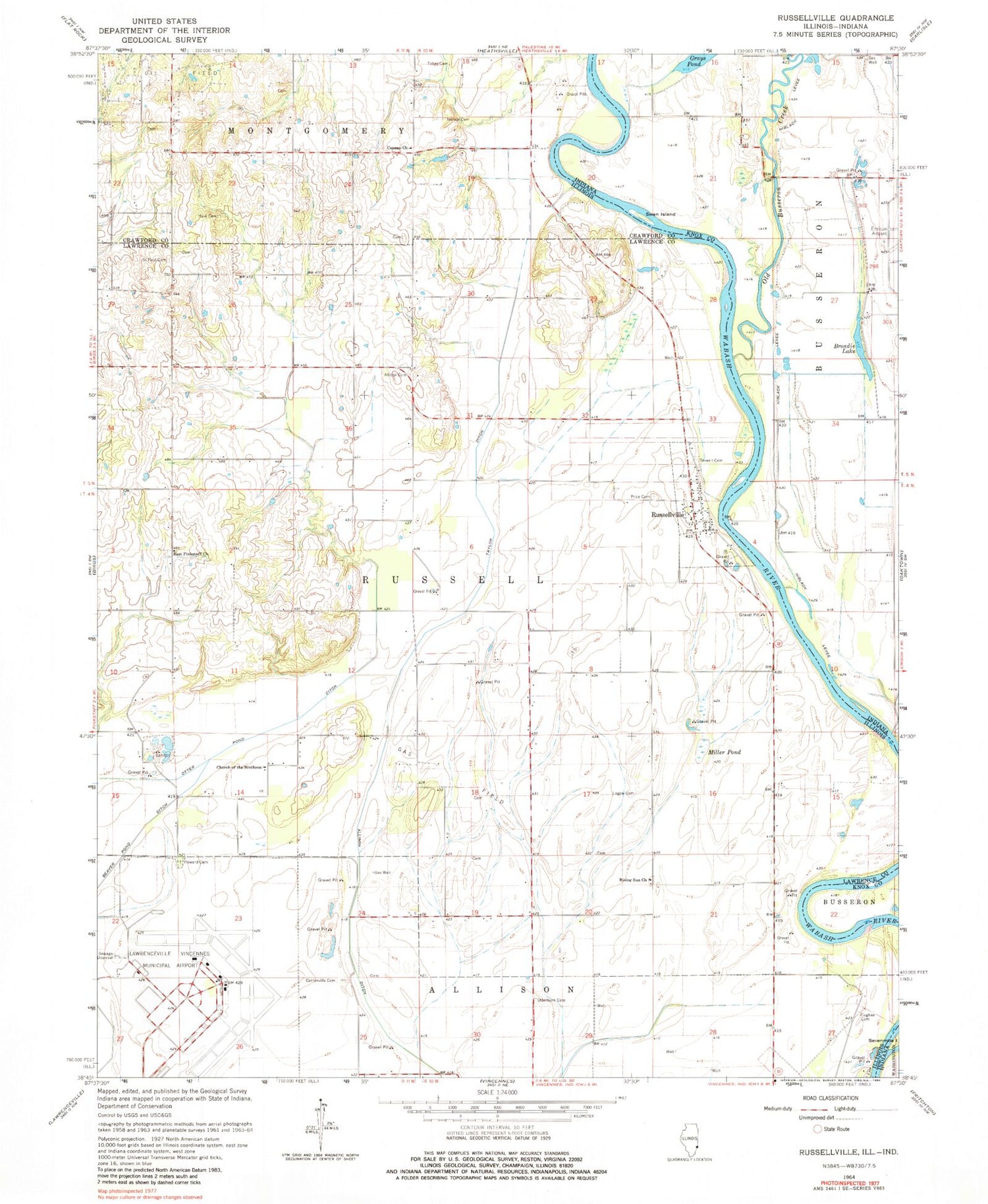
Classic USGS Russellville Illinois 7.5'x7.5' Topo Map
Couldn't load pickup availability
Historical USGS topographic quad map of Russellville in the states of Illinois, Indiana. Map scale may vary for some years, but is generally around 1:24,000. Print size is approximately 24" x 27"
This quadrangle is in the following counties: Crawford, Knox, Lawrence.
The map contains contour lines, roads, rivers, towns, and lakes. Printed on high-quality waterproof paper with UV fade-resistant inks, and shipped rolled.
Contains the following named places: Allison Cemetery, Allison Post Office, Brick School Number 3, Broadie Lake, Canaan Primitive Baptist Church, Canaan School, Centerville Cemetery, Centerville School, Church of the Brethren, Cughan Cemetery, Davy, Ditch Number 2, East Pinkstaff Church, East Pinkstaff School, Ed-Air Airport, Ferrell Cemetery, Hale Cemetery, Hazel Dell School, Higgins Cemetery, Higgins School, Howard Cemetery, Lagow Cemetery, Lawrenceville-Vincennes International Airport, M and J Farms, Miller Pond, Miller School, Mohn School, Niblack Levee, North Center School, Norton Cemetery, Old Busseron Creek, Otterburn Cemetery, Price Cemetery, Rising Sun Church, Rising Sun School, Russellville, Saint Paul Cemetery, Swan Island, Taylor Ditch, Tevealt Cemetery, Tobey Cemetery, Township of Russell, Union School, Village of Russellville, Vincennes Executive Inn Airport