MyTopo
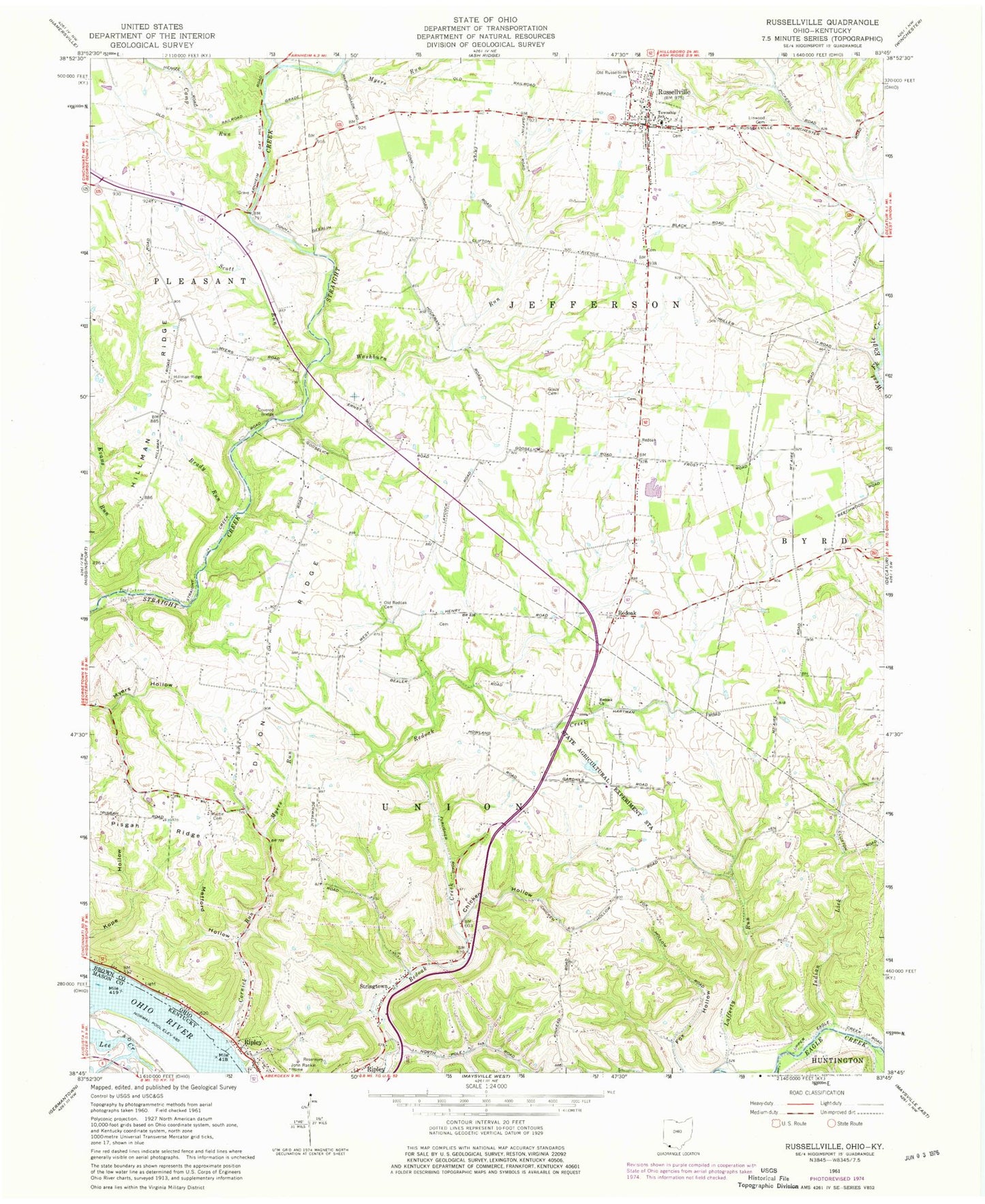
Classic USGS Russellville Ohio 7.5'x7.5' Topo Map
Couldn't load pickup availability
Historical USGS topographic quad map of Russellville in the states of Ohio, Kentucky. Map scale may vary for some years, but is generally around 1:24,000. Print size is approximately 24" x 27"
This quadrangle is in the following counties: Brown, Mason.
The map contains contour lines, roads, rivers, towns, and lakes. Printed on high-quality waterproof paper with UV fade-resistant inks, and shipped rolled.
Contains the following named places: Associated Reformed Churchyard, Beechwood School, Brady Run, Bull Run, Camp Run, Chicken Hollow, Conn School, Cornick Run, Devore Family Cemetery, Dixon Ridge, Donaldson School, Dye Cemetery, Faith in God Fellowship, Flaugher School, Fox Hollow, Glaze Cemetery, Hillman, Hillman Ridge, Hillman Ridge Cemetery, Indian Lick, Iron Bridge School, John Rankin Home, Kinkead School, Lafferty Run, Lee Creek, Linwood Cemetery, Martin Cemetery, Mefford Hollow, Mefford School, Mount Ayr School, Myers Hollow, Myers Run, Old Redoak Cemetery, Old Russellville Cemetery, Pisgah Ridge, Port Chardon Mobile Home Park, Presbyterian Cemetery, Rankin House State Memorial, Red Oak Post Office, Red Oak Presbyterian Church, Redoak, Rocky Run, Rossman School, Russellville, Russellville Elementary School, Russellville Police Department, Russellville Volunteer Fire Department, Russelville Post Office, Salisbury School, School Number 4, School Number 6, Scott Run, Stringtown, Sutherland Run, Township of Jefferson, Township of Union, Village of Russellville, Washburn Run, WAXZ-FM (Georgetown), West Fork Redoak Creek, Western Mills, ZIP Codes: 45167, 45168