MyTopo
Classic USGS Russian Knoll Utah 7.5'x7.5' Topo Map
Regular price
$16.95
Regular price
Sale price
$16.95
Unit price
per
Couldn't load pickup availability
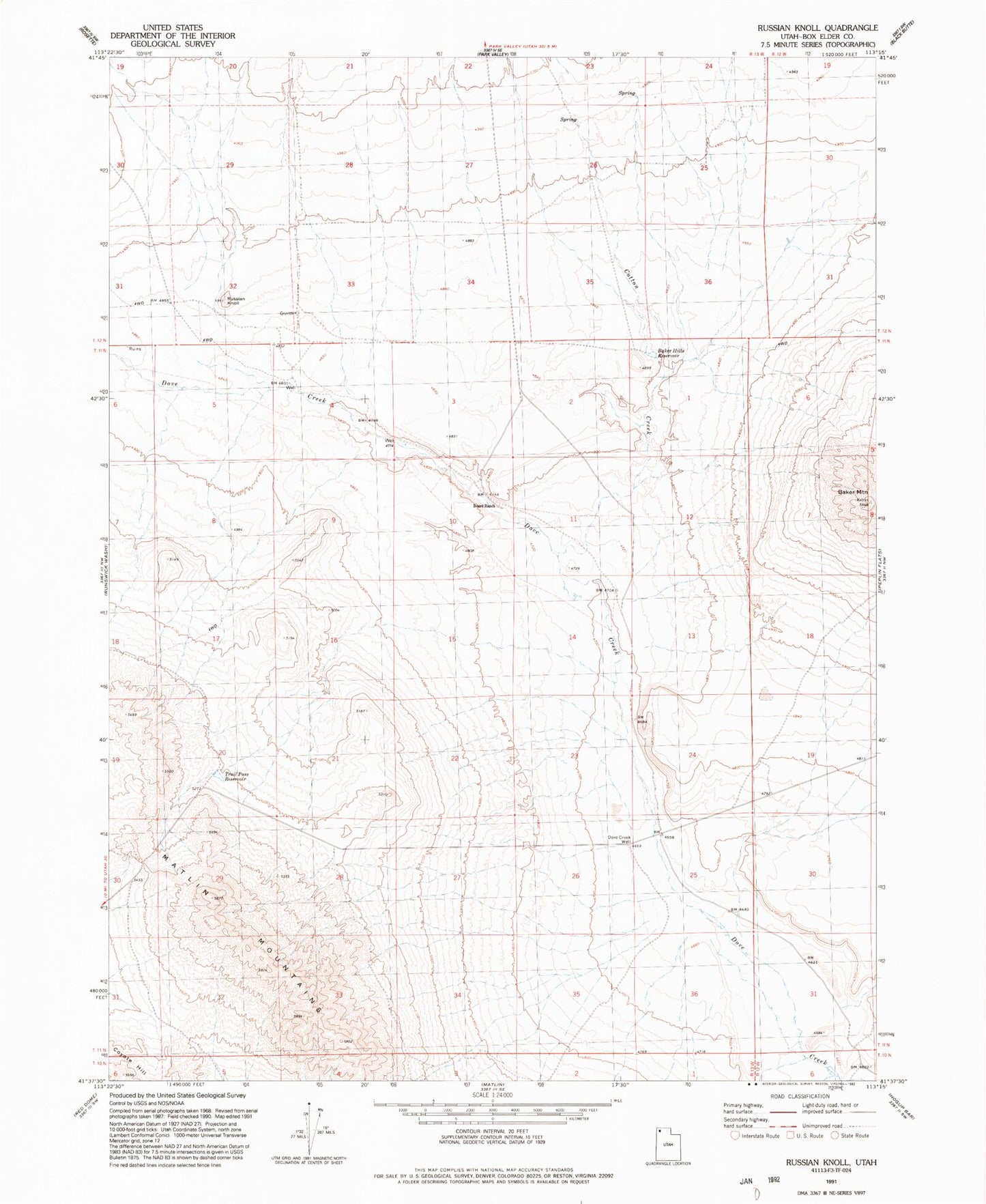
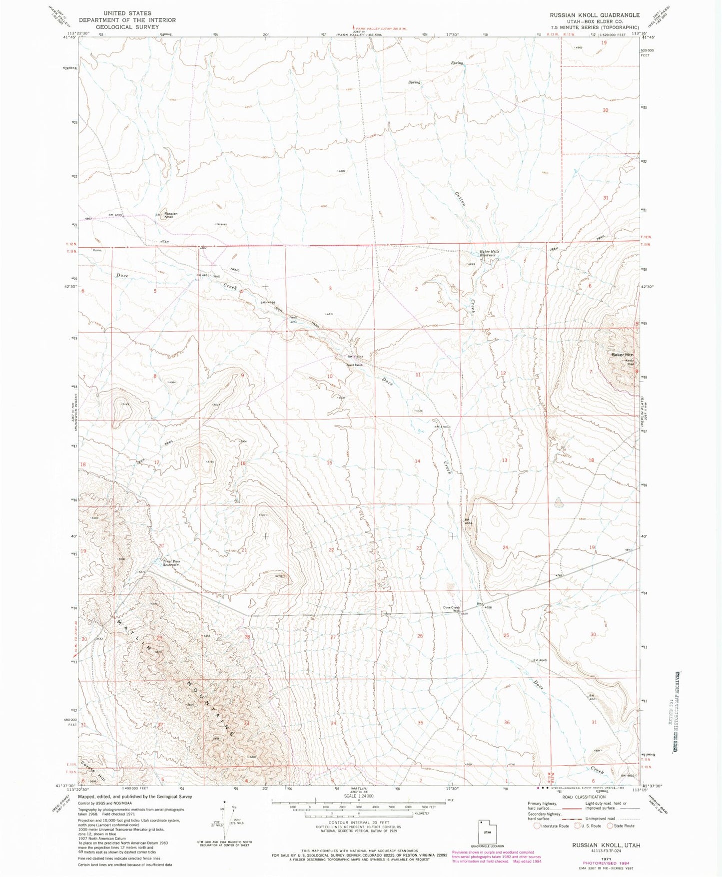
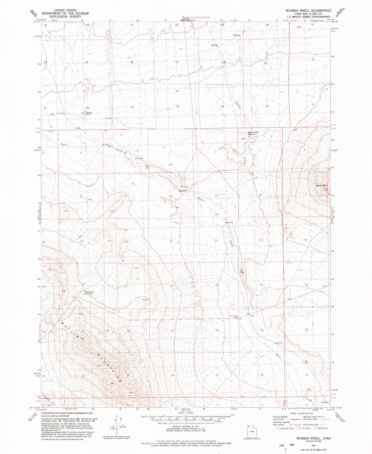
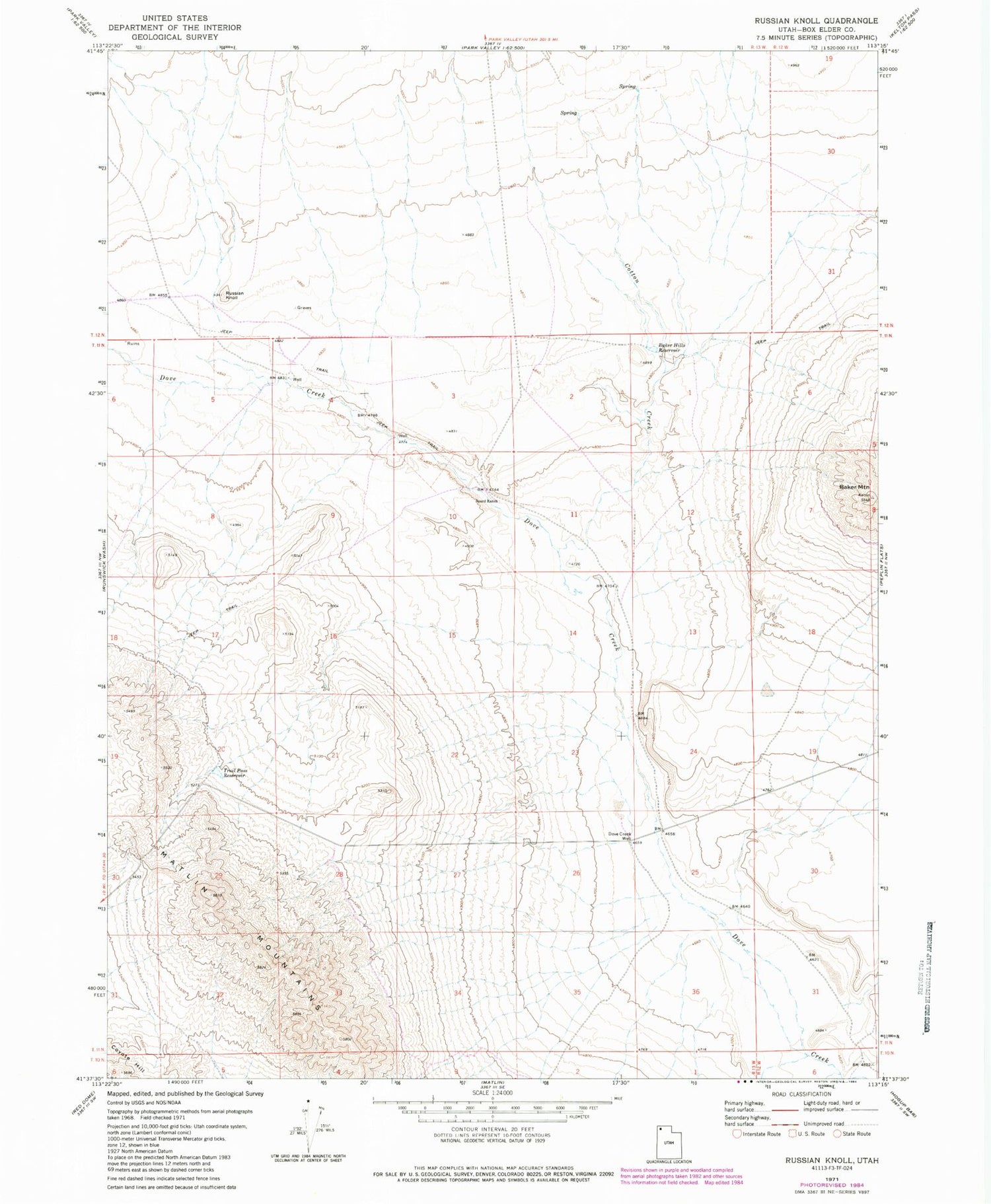
Historical USGS topographic quad map of Russian Knoll in the state of Utah. Map scale may vary for some years, but is generally around 1:24,000. Print size is approximately 24" x 27"
This quadrangle is in the following counties: Box Elder.
The map contains contour lines, roads, rivers, towns, and lakes. Printed on high-quality waterproof paper with UV fade-resistant inks, and shipped rolled.
Contains the following named places: Baker Hills Reservoir, Baker Mountain, Board Ranch, Cotton Creek, Dove Creek Well, Matlin Mountains, Russian Knoll, Russian Settlement Celmetery, Trail Pass Reservoir