MyTopo
Classic USGS Rutan Alabama 7.5'x7.5' Topo Map
Couldn't load pickup availability
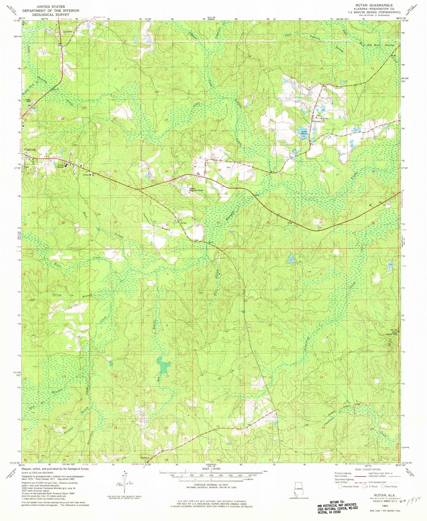
Historical USGS topographic quad map of Rutan in the state of Alabama. Map scale may vary for some years, but is generally around 1:24,000. Print size is approximately 24" x 27"
This quadrangle is in the following counties: Washington.
The map contains contour lines, roads, rivers, towns, and lakes. Printed on high-quality waterproof paper with UV fade-resistant inks, and shipped rolled.
Contains the following named places: Beach Store, Beaver Dam Creek, Beaverdam Creek, Bee Branch, Buck Branch, Bull Hall Swamp, Calf Pasture Swamp, Dearman Branch, Deerfield Country Club, Fairhope, Hobson, Hobson Assembly of God Church, Hobson Census Designated Place, Hobson Volunteer Fire Department, Johnson Creek, Lee Anderson Dam, Little Bassetts Creek, Marie Lake, Miles Creek, Mill Branch, Old Spring Branch, Pine Level Baptist Church, Pine Level Cemetery, Reed Branch, Richardson Cemetery, Roy Wilcox Airport, Rutan, Rutan Baptist Church, Rutan Cemetery, Rutan School, Simmons Creek, Town of Chatom, Washington County, Washington County Area Vocational Center, Washington County C and D Landfill, Washington County Hospital and Nursing Home, Washington County Public Library, Whiteoak Branch