MyTopo
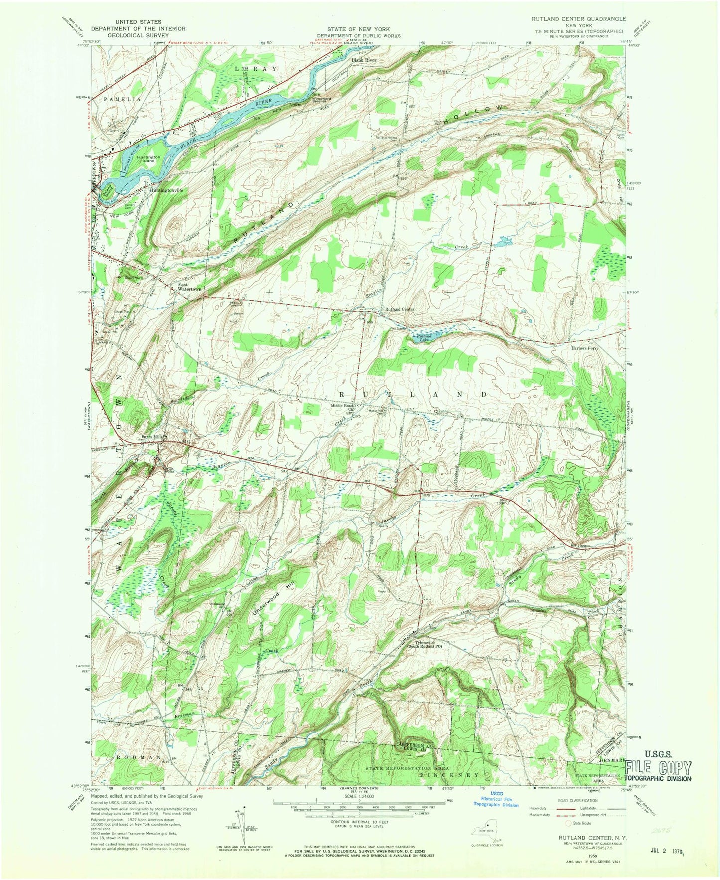
Classic USGS Rutland Center New York 7.5'x7.5' Topo Map
Couldn't load pickup availability
Historical USGS topographic quad map of Rutland Center in the state of New York. Map scale may vary for some years, but is generally around 1:24,000. Print size is approximately 24" x 27"
This quadrangle is in the following counties: Jefferson, Lewis.
The map contains contour lines, roads, rivers, towns, and lakes. Printed on high-quality waterproof paper with UV fade-resistant inks, and shipped rolled.
Contains the following named places: Boynton Creek, Burrs Mills, Burrville Cider Mill Falls, Burrville Congregational Church, Butternut Falls, Calvary Cemetery, Christian Life Center, Clark Cemetery, Cotes Cemetery, Delano Island, East Watertown, Harpers Ferry, Harpers Ferry Church, Huntington Island, Huntingtonville, Jacobs Creek, Maple Hill Cemetery, Middle Road Church, New Testament Fellowship, Orvis Hill, Rutland Center, Rutland Fire Department Station 2, Rutland Hollow, Rutland Hollow Cemetery, Rutland Lake, School Number 10, School Number 2, School Number 4, School Number 5, School Number 6, School Number 7, School Number 8, School Number 9, Staplin Creek, Stebbins Creek, Town of Rutland, Tylersville, Underwood Cemetery, Underwood Hill, United Pentecostal Church, Watertown Quarry, Watertown Volunteer Fire Department Station 2, WCIZ-FM (Watertown), Woodward Sidehill, ZIP Code: 13612