MyTopo
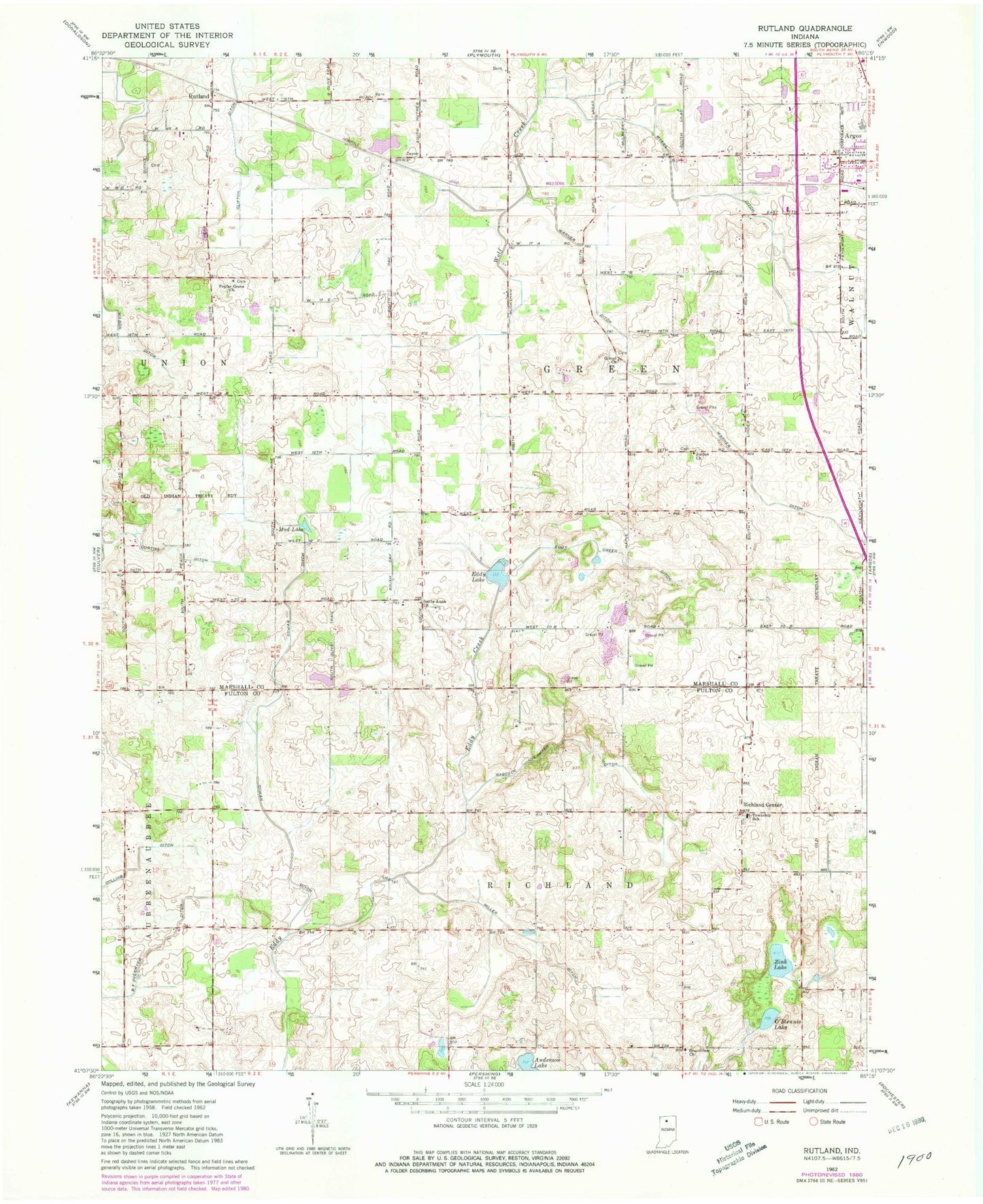
Classic USGS Rutland Indiana 7.5'x7.5' Topo Map
Couldn't load pickup availability
Historical USGS topographic quad map of Rutland in the state of Indiana. Map scale may vary for some years, but is generally around 1:24,000. Print size is approximately 24" x 27"
This quadrangle is in the following counties: Fulton, Marshall.
The map contains contour lines, roads, rivers, towns, and lakes. Printed on high-quality waterproof paper with UV fade-resistant inks, and shipped rolled.
Contains the following named places: Anderson Lake, Argos Community Elementary School, Argos Community Junior-Senior High School, Argos Holstein Farm, B F Overmyer Ditch, Babcock Overmyer Ditch, Clifton Ditch, Cowan Ditch, Curtiss Ditch, DDT Field, Eddy Creek Ditch, Eddy Lake, Gilead Church, Grandview Church, Jordan Church, McGee Farms, Miller Ditch, Mud Lake, Myers Ditch, O'Blennis Lake, Poplar Grove Church, Richland Center, Rutland, Santa Anna Church, Town of Argos, Township of Green, Township of Richland, Warner Ditch, Zink Lake