MyTopo
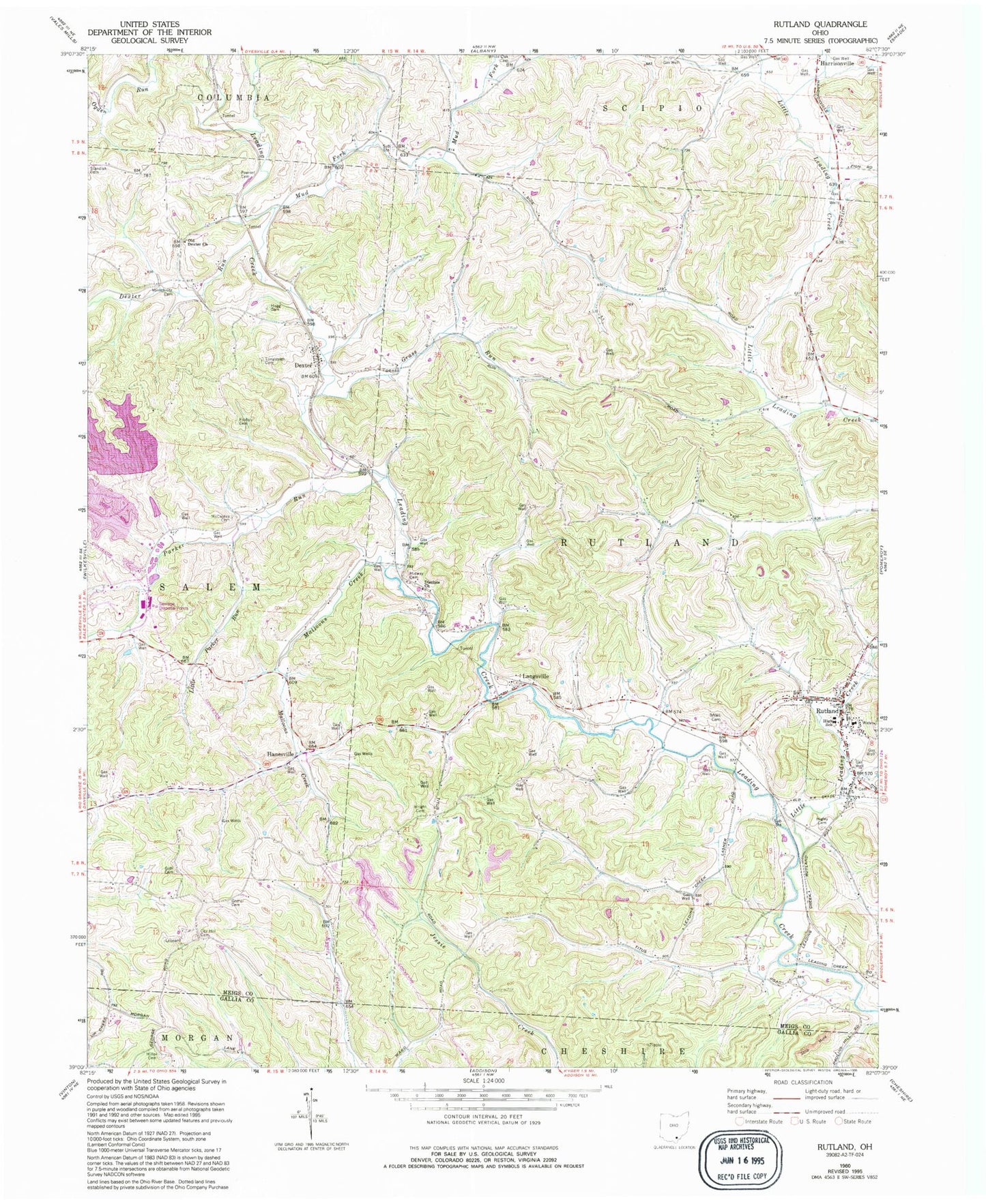
Classic USGS Rutland Ohio 7.5'x7.5' Topo Map
Couldn't load pickup availability
Historical USGS topographic quad map of Rutland in the state of Ohio. Map scale may vary for some years, but is generally around 1:24,000. Print size is approximately 24" x 27"
This quadrangle is in the following counties: Gallia, Meigs.
The map contains contour lines, roads, rivers, towns, and lakes. Printed on high-quality waterproof paper with UV fade-resistant inks, and shipped rolled.
Contains the following named places: Buckhorn, Coy Hill Cemetery, Dexter, Dexter Church of Christ, Dexter Post Office, Dexter Run, Disciple Church, Folden Cemetery, Goff Cemetery, Gomer Cemetery, Grass Run, Hanesville, Hanesville Post Office, Higley Cemetery, Hugg Cemetery, Lambert Pond, Lambert Pond Dam, Langsville, Langsville Post Office, Little Leading Creek, Little Parker Run, Longstretch Cemetery, Malloons Creek, Martinsburg, McCaskey Cemetery, Meigs Mine Number One Water Supply Dam, Meigs Mine Number One Water Supply Reservoir, Midway Cemetery, Miles Cemetery, Miller Cemetery, Mud Fork, Old Dexter Church, Parker Run, Pearsol Cemetery, Rutland, Rutland Church of Christ, Rutland Elementary School, Rutland Emergency Medical Services, Rutland Fire Department, Rutland High School, Rutland Post Office, Township of Rutland, Village of Rutland, Vonschriltz Cemetery, White Oak Cemetery, Wright Cemetery, ZIP Codes: 45741, 45775