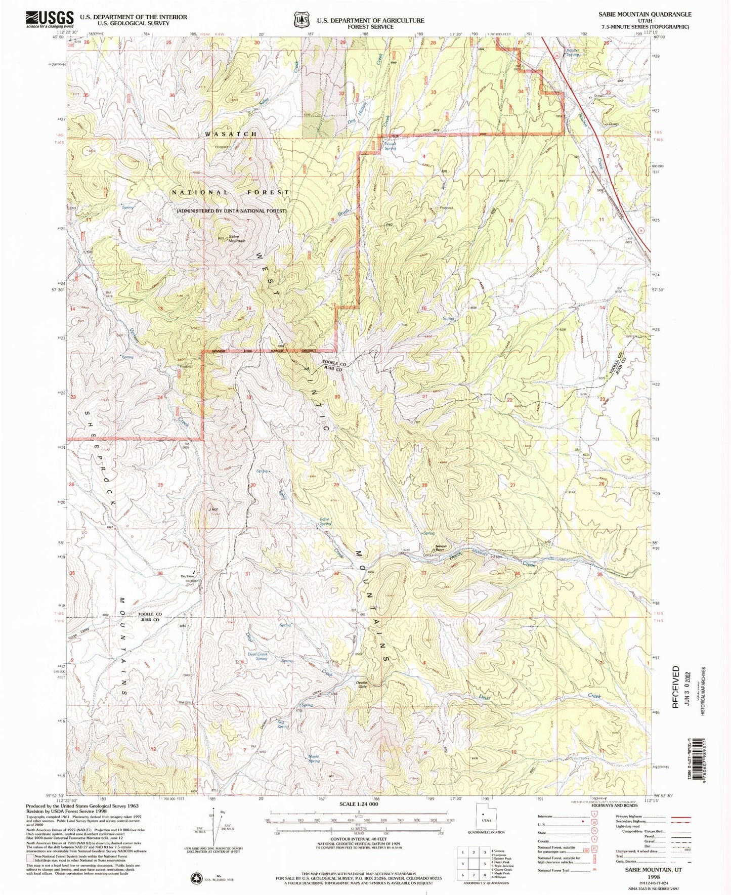
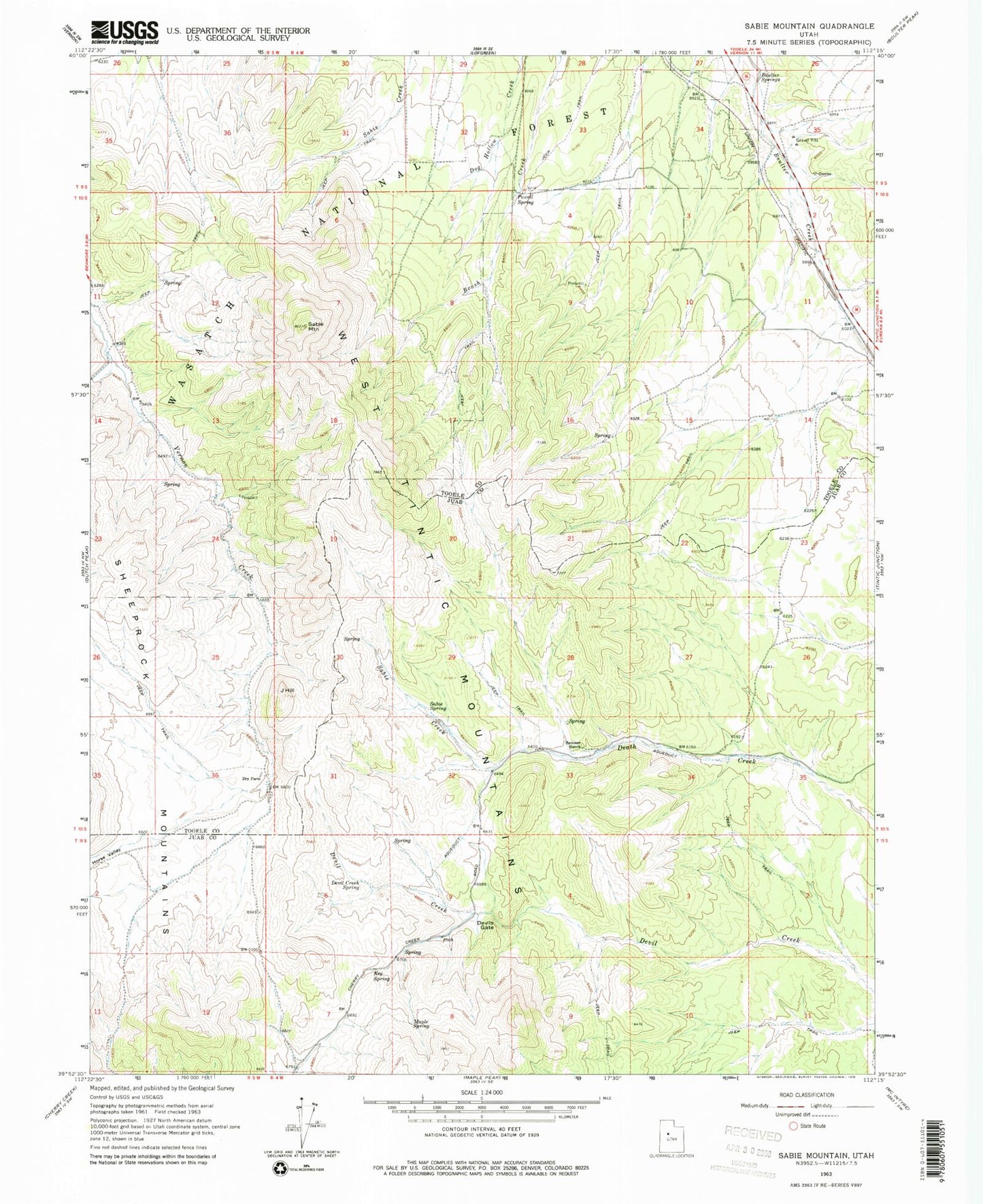
MyTopo
Classic USGS Sabie Mountain Utah 7.5'x7.5' Topo Map
Regular price
$16.95
Regular price
Sale price
$16.95
Unit price
per
Couldn't load pickup availability
Historical USGS topographic quad map of Sabie Mountain in the state of Utah. Map scale may vary for some years, but is generally around 1:24,000. Print size is approximately 24" x 27"
This quadrangle is in the following counties: Juab, Tooele.
The map contains contour lines, roads, rivers, towns, and lakes. Printed on high-quality waterproof paper with UV fade-resistant inks, and shipped rolled.
Contains the following named places: Boulter Springs, Devil Creek Spring, Devils Gate, Dry Farm, Horse Valley, J Hill, Keg Spring, Little Valley Creek, Maple Spring, Powell Spring, Sabie Creek, Sabie Mountain, Sabie Spring, Summer Ranch