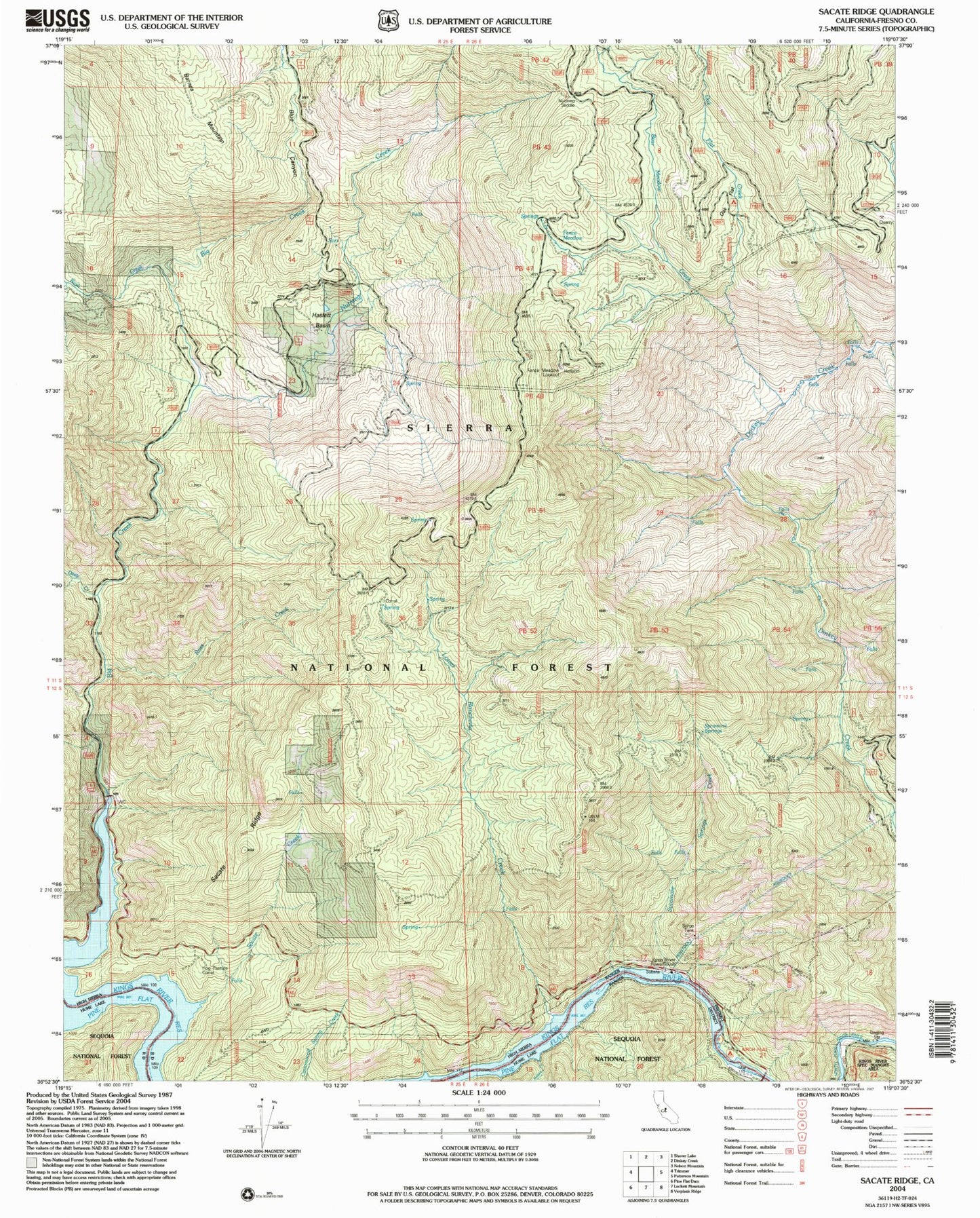
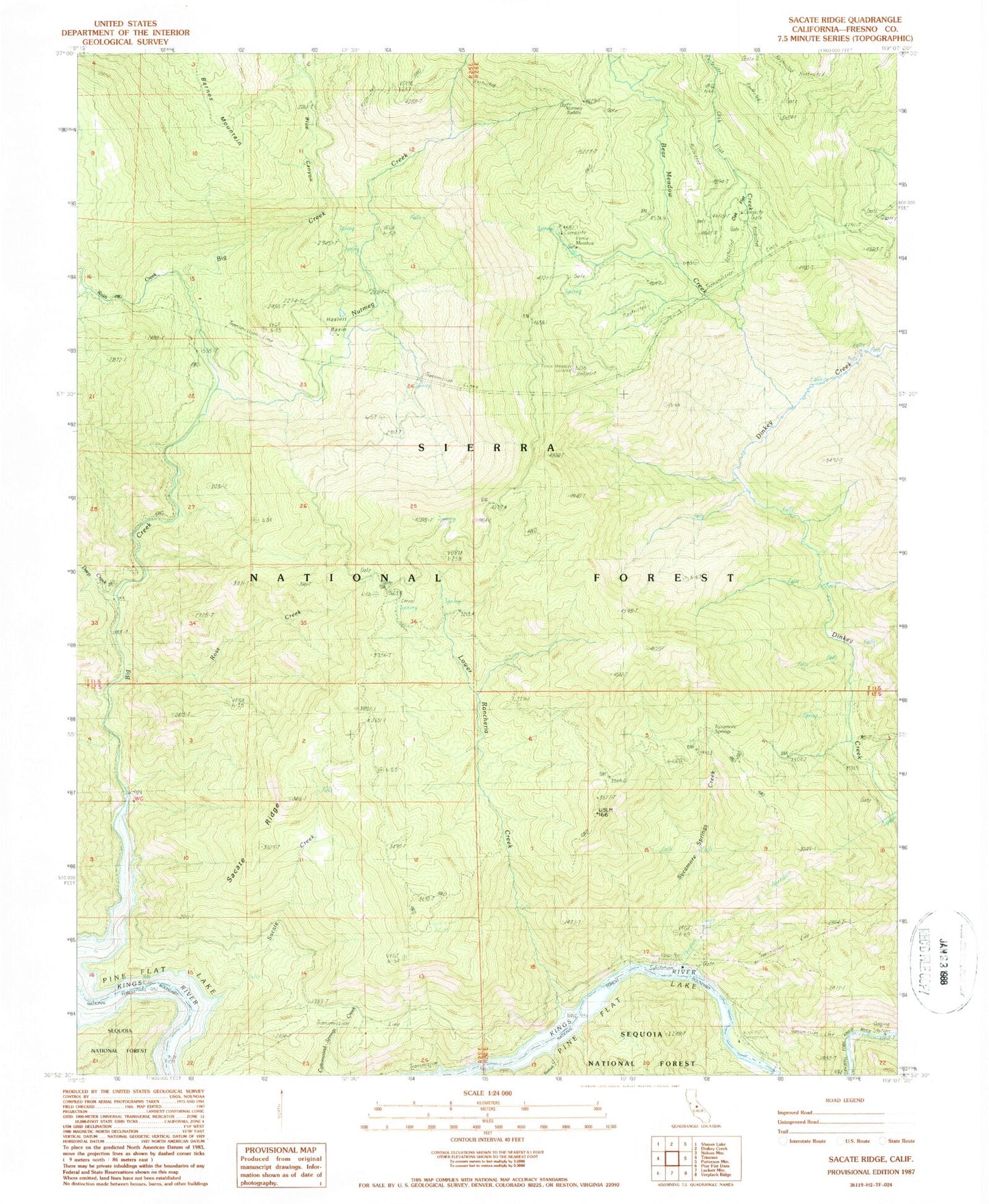
MyTopo
Classic USGS Sacate Ridge California 7.5'x7.5' Topo Map
Couldn't load pickup availability
Historical USGS topographic quad map of Sacate Ridge in the state of California. Map scale may vary for some years, but is generally around 1:24,000. Print size is approximately 24" x 27"
This quadrangle is in the following counties: Fresno.
The map contains contour lines, roads, rivers, towns, and lakes. Printed on high-quality waterproof paper with UV fade-resistant inks, and shipped rolled.
Contains the following named places: Balch Camp Heliport, Bear Meadow Creek, Bear Wallow Creek, Big Creek, Blue Canyon, Cats Head Campground, Deep Creek, Fence Meadow, Fence Meadow Lookout, Haslett Basin, Kings River Powerhouse, Kirch Flat, Kirch Flat Campground, Lower Rancheria Creek, Nutmeg Campground, Nutmeg Creek, Nutmeg Saddle, Oak Flat, Oak Flat Campground, Oak Flat Creek, Prices Camp, Redoak Creek, Ross Creek, Ross Crossing, Rush Creek, Sacate Creek, Sacate Ridge, Sycamore Springs, Sycamore Springs Creek