MyTopo
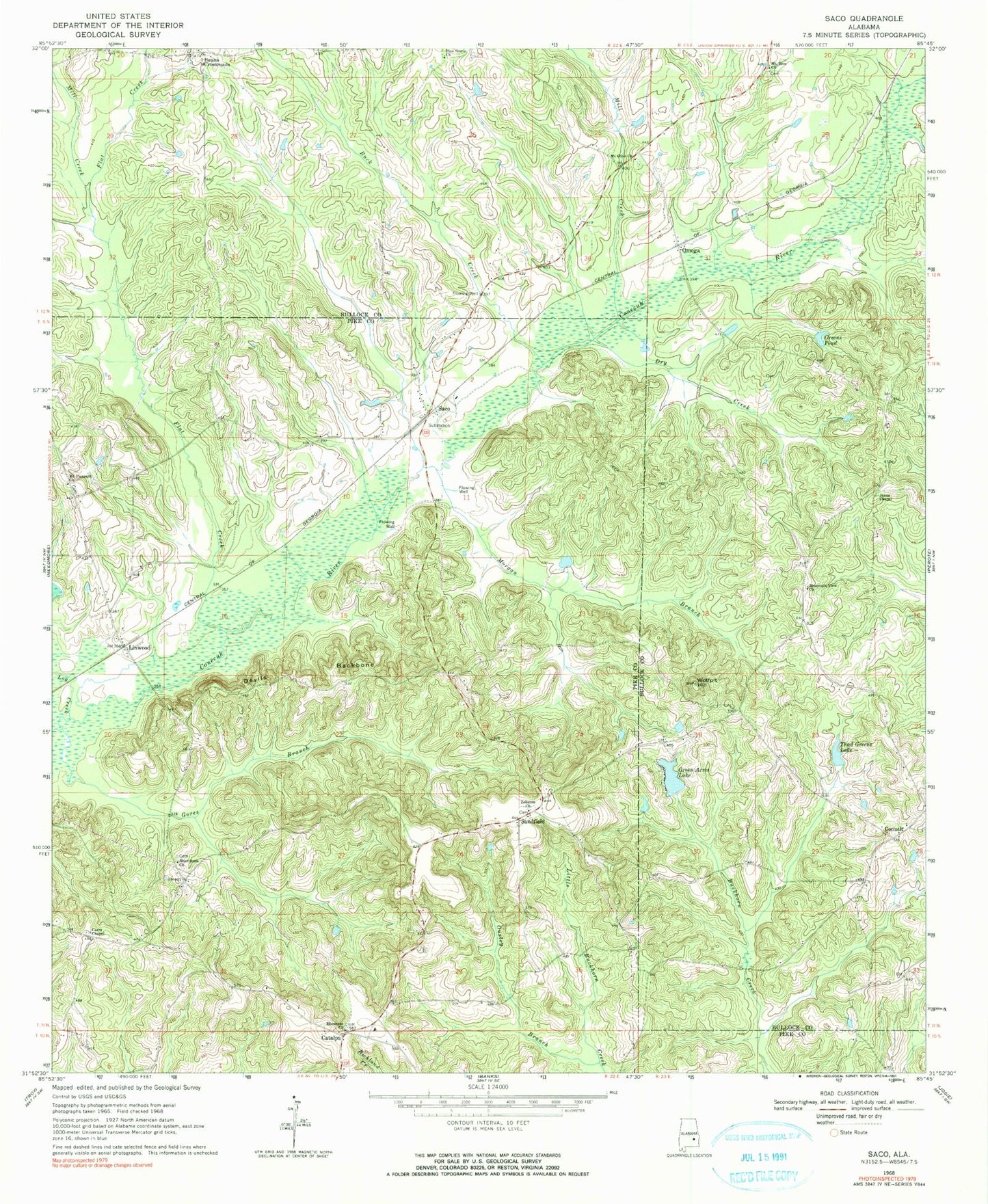
Classic USGS Saco Alabama 7.5'x7.5' Topo Map
Couldn't load pickup availability
Historical USGS topographic quad map of Saco in the state of Alabama. Map scale may vary for some years, but is generally around 1:24,000. Print size is approximately 24" x 27"
This quadrangle is in the following counties: Bullock, Pike.
The map contains contour lines, roads, rivers, towns, and lakes. Printed on high-quality waterproof paper with UV fade-resistant inks, and shipped rolled.
Contains the following named places: Barnette Cemetery, Beans Crossroads, Buck Creek, Canaan Church, Carrs Chapel, Catalpa, Catalpa Cemetery, Colina, Corinth, Corinth Church, Devils Backbone, Dry Creek, Ebenezer Baptist Church, Ezell, Flat Creek, Gores Branch, Graddy Gin, Green Acres Lake, Green Dam, Greens Pond, Heads Store, Inverness Division, Jones Chapel, Kelley Cemetery, Linwood, Log Creek, Macedonia Church, Mill Creek, Morgan Branch, Mount Olive Church, Mount Pleasant Church, Mount Zion Church, Mountain View Church, New Hope Church, Old Canaan Cemetery, Omega, Pine Grove Baptist Church, Riley Store, Saco, Saco Volunteer Fire Department, Sandfield, Sandfield Cemetery, Sellers Crossroads, Thad Greens Lake, Troy Rod and Gun Club, Wolfpit Hill, Zebulon Church