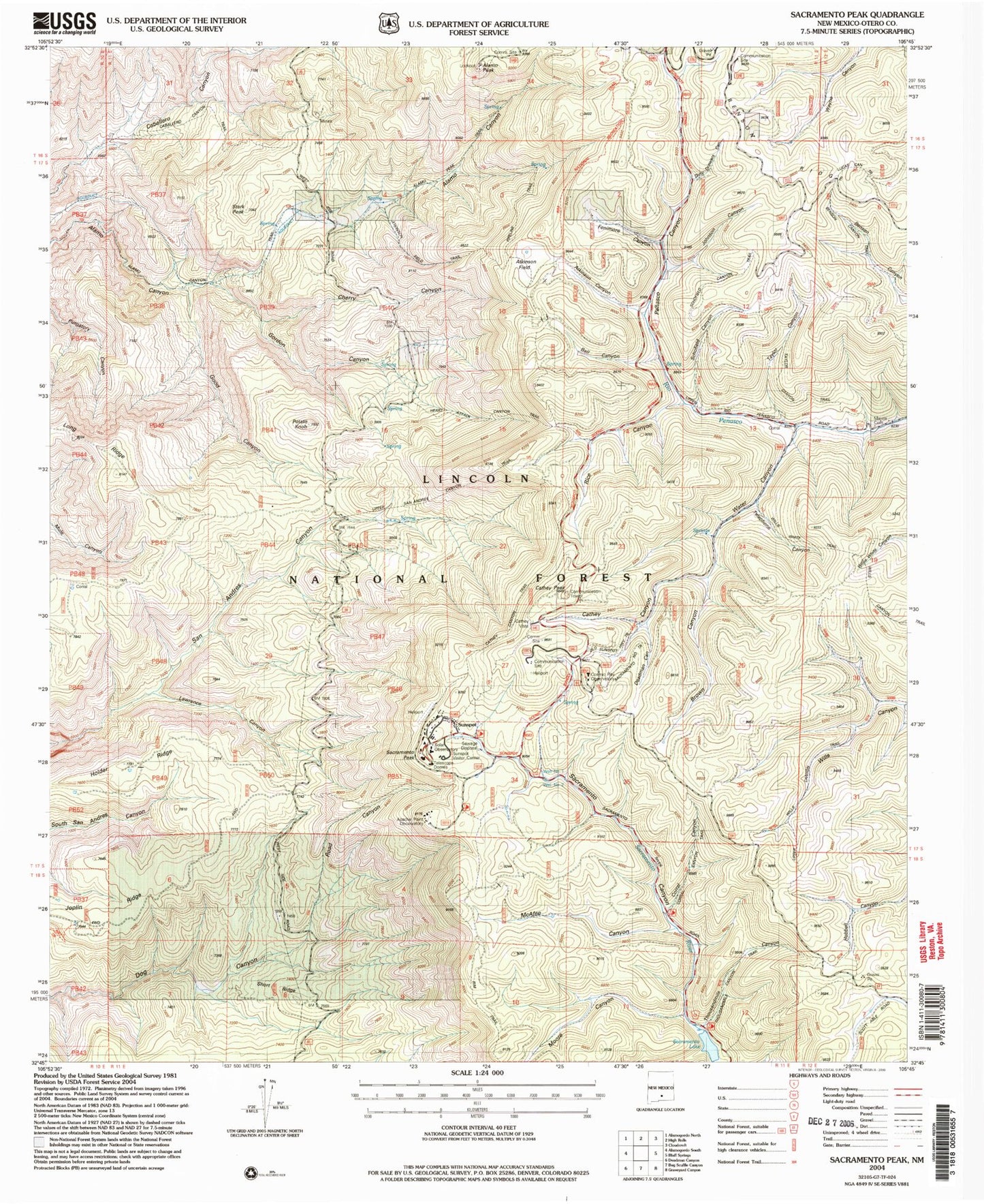
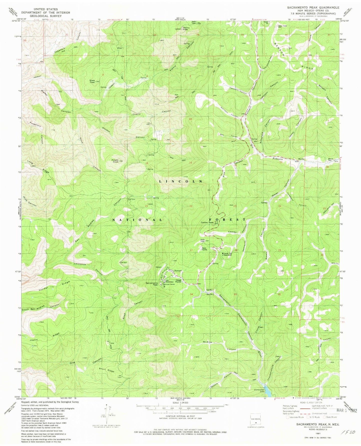
MyTopo
Classic USGS Sacramento Peak New Mexico 7.5'x7.5' Topo Map
Couldn't load pickup availability
Historical USGS topographic quad map of Sacramento Peak in the state of New Mexico. Typical map scale is 1:24,000, but may vary for certain years, if available. Print size: 24" x 27"
This quadrangle is in the following counties: Otero.
The map contains contour lines, roads, rivers, towns, and lakes. Printed on high-quality waterproof paper with UV fade-resistant inks, and shipped rolled.
Contains the following named places: Cathey Vista, Alamo Canyon Springs, Atkinson Canyon, Ball Canyon, Cherry Canyon, Corral Canyon, Johnson Canyon, Lamalone Lodge, Marcia, McAfee Canyon, Moore Canyon, Penasco Canyon, Rice Canyon, Sacramento Peak, Thousandmile Canyon, Water Canyon, Holder Ridge, Cathey Canyon, Ady, Dirty Drawers Canyon, Alamo Peak, Well Number One, Alamo Lookout Tower, Atkinson Field, Mountain Laboratory, Apache Point Observatory, Sunspot, Sunspot Post Office (historical), Marcia Post Office (historical), Stark Peak, Potato Knob, Marcia Cemetery, Cathey Peak, Well Number Two, Joplin Ridge, Short Ridge, Sacramento Lake, Fenimore Canyon, Good Canyon, Gordon Canyon, Schofield Canyon, Taylor Canyon, Telephone Canyon, Deadman Canyon, Brown Canyon, Lawrence Canyon, Road Canyon, Sunspot Volunteer Fire Department