MyTopo
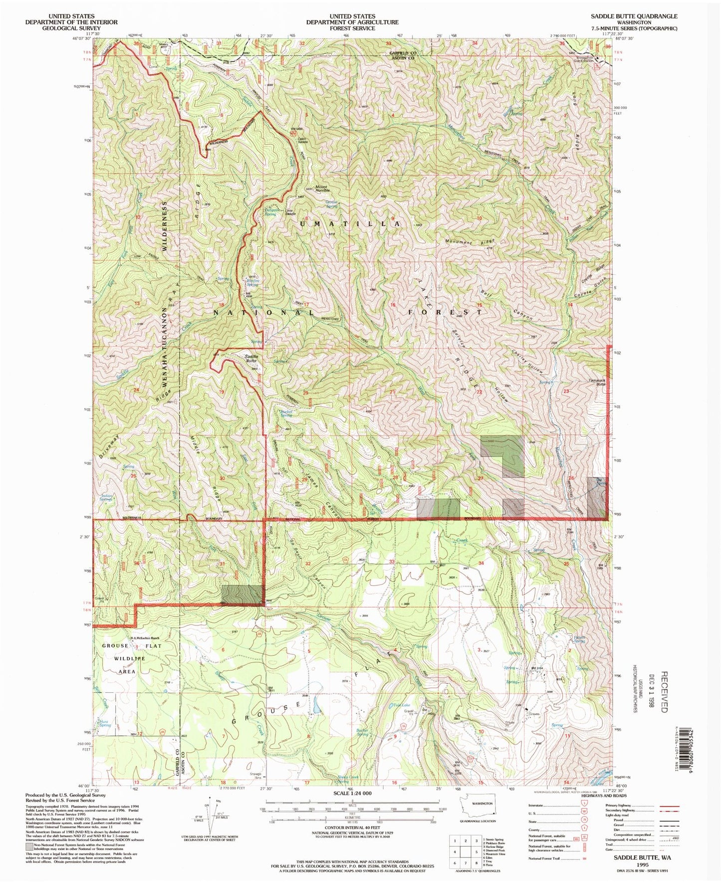
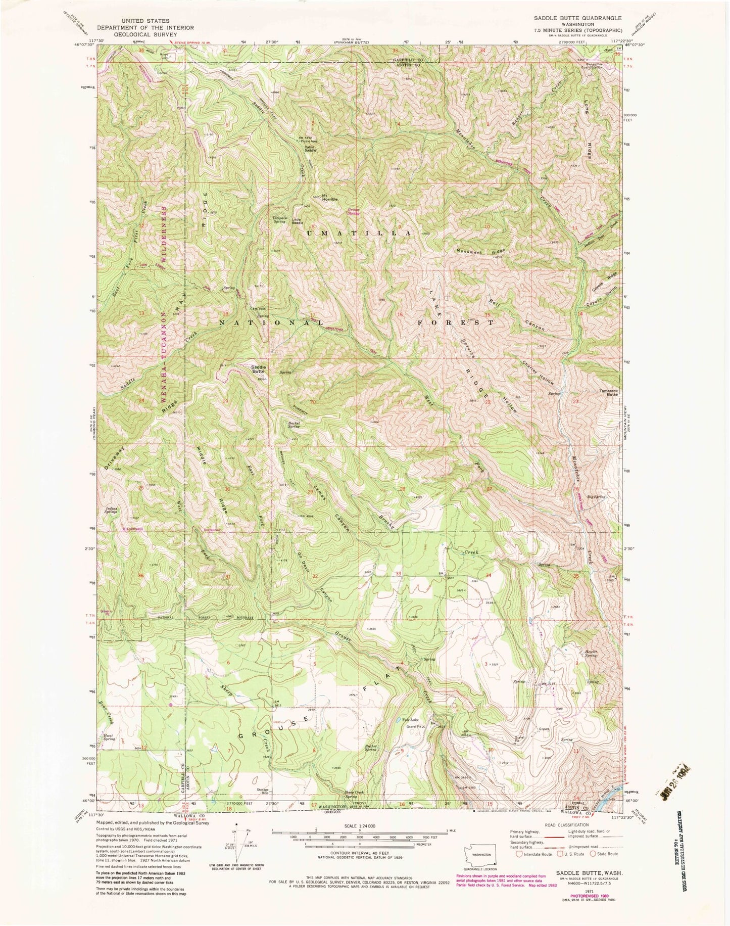
Classic USGS Saddle Butte Washington 7.5'x7.5' Topo Map
Couldn't load pickup availability
Historical USGS topographic quad map of Saddle Butte in the state of Washington. Typical map scale is 1:24,000, but may vary for certain years, if available. Print size: 24" x 27"
This quadrangle is in the following counties: Asotin, Garfield.
The map contains contour lines, roads, rivers, towns, and lakes. Printed on high-quality waterproof paper with UV fade-resistant inks, and shipped rolled.
Contains the following named places: Bell Canyon, Big Spring, Brushy Creek, Bucher Spring, Bucket Spring, Cabin Saddle, Charley Hollow, Coyote Gulch, DeSpain Spring, Driveway Ridge, East Fork Grouse Creek, Go Devil Canyon, Grouse Flat, Hewitt Spring, Hunt Spring, Indian Tom Creek, James Canyon, Lake Ridge, Little Saddle, Long Ridge, Middle Ridge, Misery Spring Campground, Monument Ridge, Ranger Creek, Ray Ridge, Saddle Springs Guard Station, Service Hollow, Sheep Creek Spring, Tule Lake, Wenatchee Guard Station, West Fork Grouse Creek, West Fork Menatchee Creek, Wenatchee Creek Trail, Grouse Spring, West Wenatchee Trail, Low Saddle Trail, Misery Spring, Grouse, Saddle Spring, Indian Springs, Mount Horrible, Saddle Butte, Tamarack Butte, Road Ridge, Green School, Cecil Slaybaugh, Sunbeam Ranch, Grouse Flat State Wildlife Recreation Area, H A McEachan Ranch