MyTopo
Classic USGS Saddle Mountain Oklahoma 7.5'x7.5' Topo Map
Couldn't load pickup availability
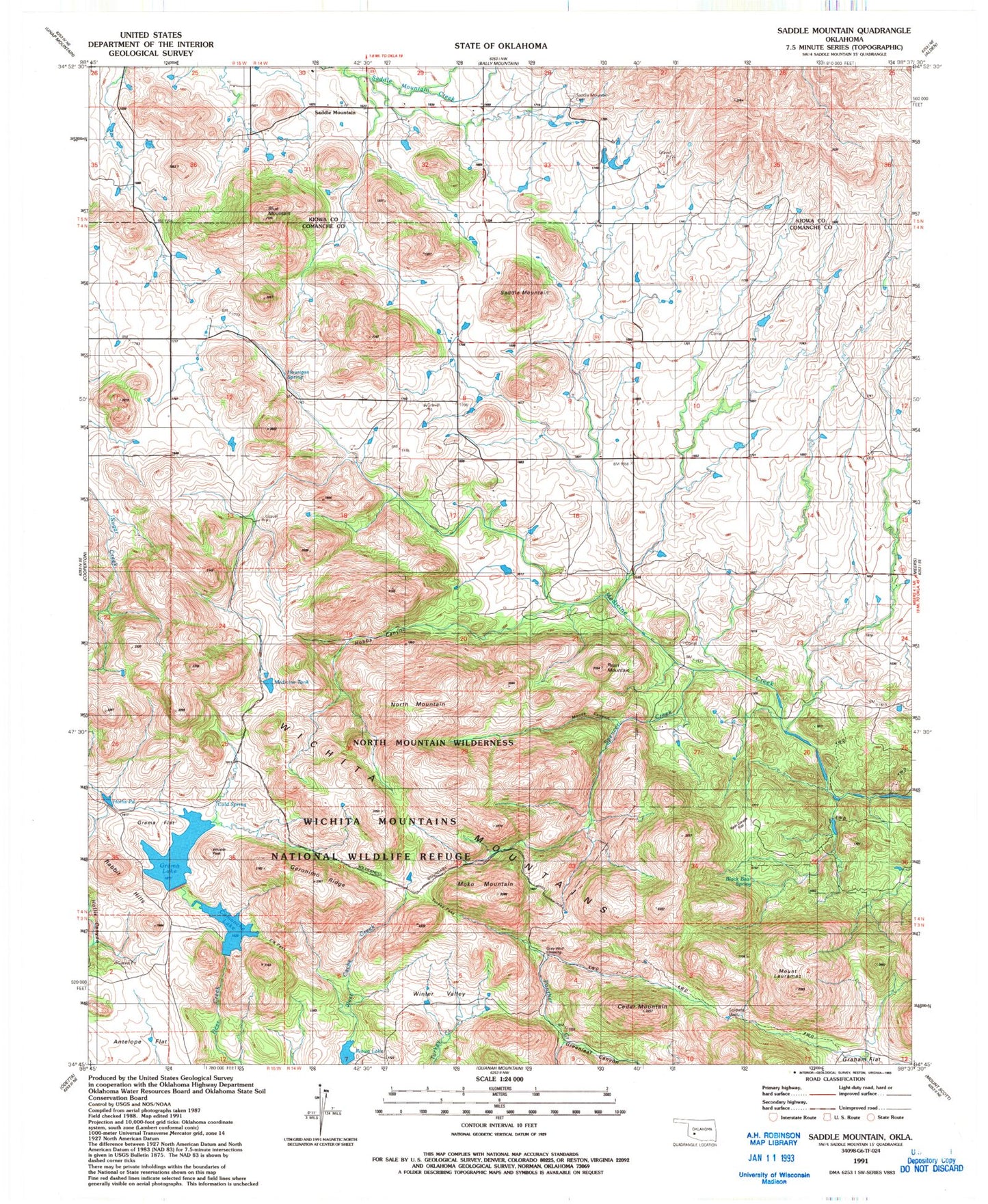
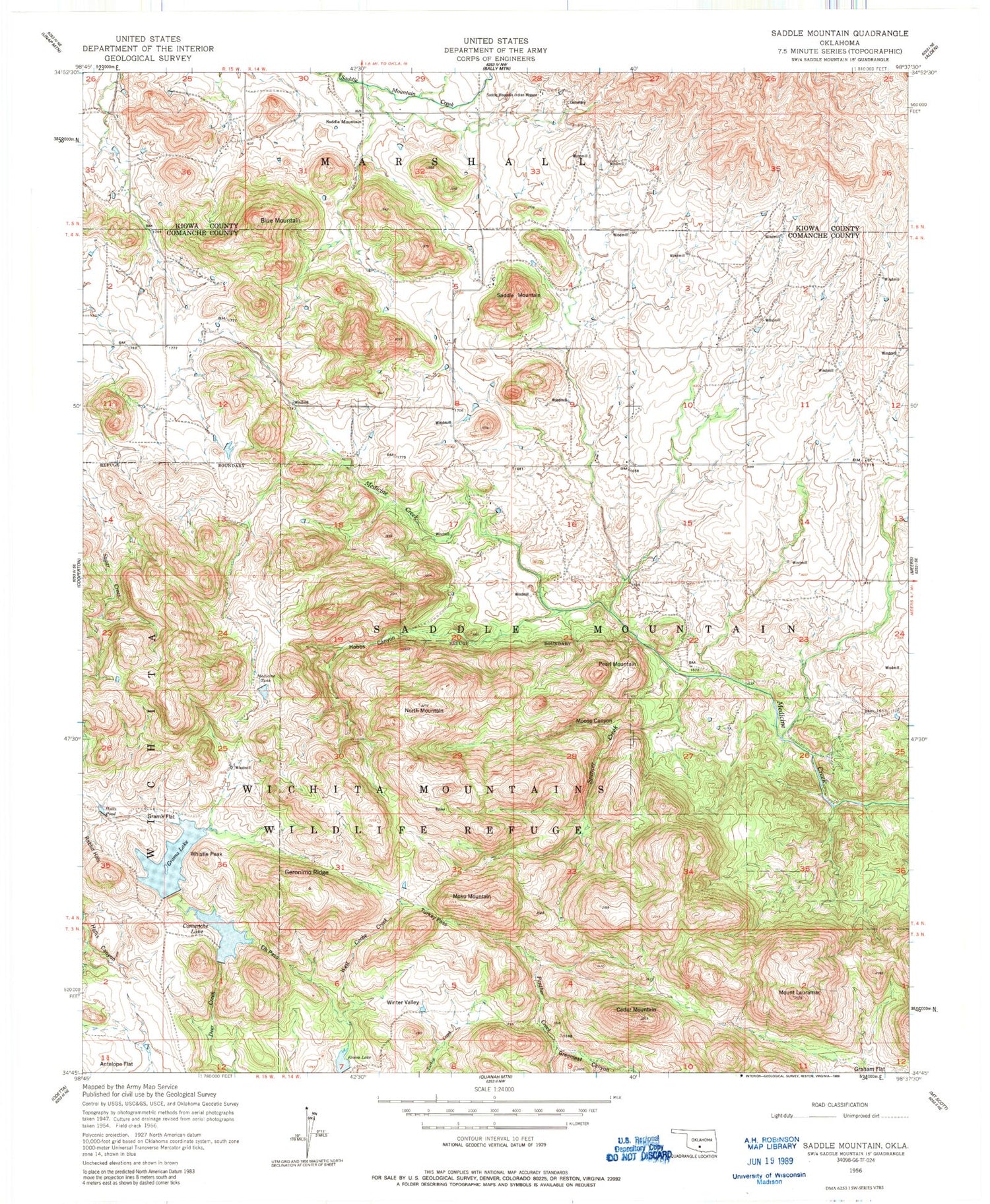
Historical USGS topographic quad map of Saddle Mountain in the state of Oklahoma. Typical map scale is 1:24,000, but may vary for certain years, if available. Print size: 24" x 27"
This quadrangle is in the following counties: Comanche, Kiowa.
The map contains contour lines, roads, rivers, towns, and lakes. Printed on high-quality waterproof paper with UV fade-resistant inks, and shipped rolled.
Contains the following named places: Blue Mountain, Cedar Mountain, Comanche Lake, Elk Pass, Geronimo Ridge, Grama Flat, Greenleaf Canyon, Hobbs Canyon, Hollis Pond, Kiowa Lake, Mount Lauramac, Medicine Tank, Moko Mountain, Moose Canyon, North Mountain, Pearl Mountain, Saddle Mountain, Saddle Mountain, Spencer Creek, Turkey Pass, Whistle Peak, Winter Valley, Wichita Mountains Wildlife Refuge, Antelope Flat, Harrington Spring, Saddle Mountain Cemetery, Cold Spring, Gray Wolf Spring, Wichita Mountains Wilderness (North Mountain Unit), Rain Gauge Flat, Soldiers Dam, Black Bear Spring, Saddle Mountain Indian Mission (historical), Wichita Mountains, Gramma Lake Dam, Grama Lake, Kiowa Lake Dam, Comanche Lake Dam, Oknoname 123006 Dam, Oknoname 123006 Reservoir, Gray Wolf Crossing, Hourigan Spring, Township of Saddle Mountain, Wichita Mountains Wilderness (North Mountain Unit), Saddle Mountain Fire Department