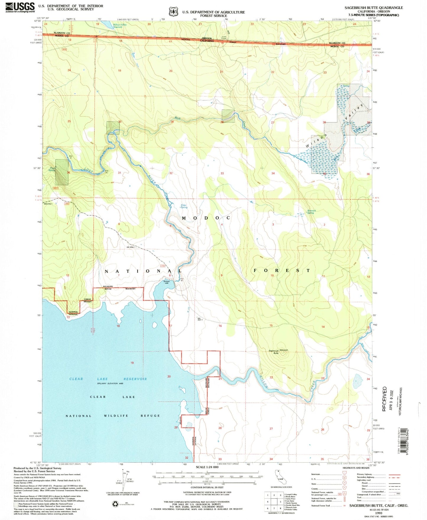
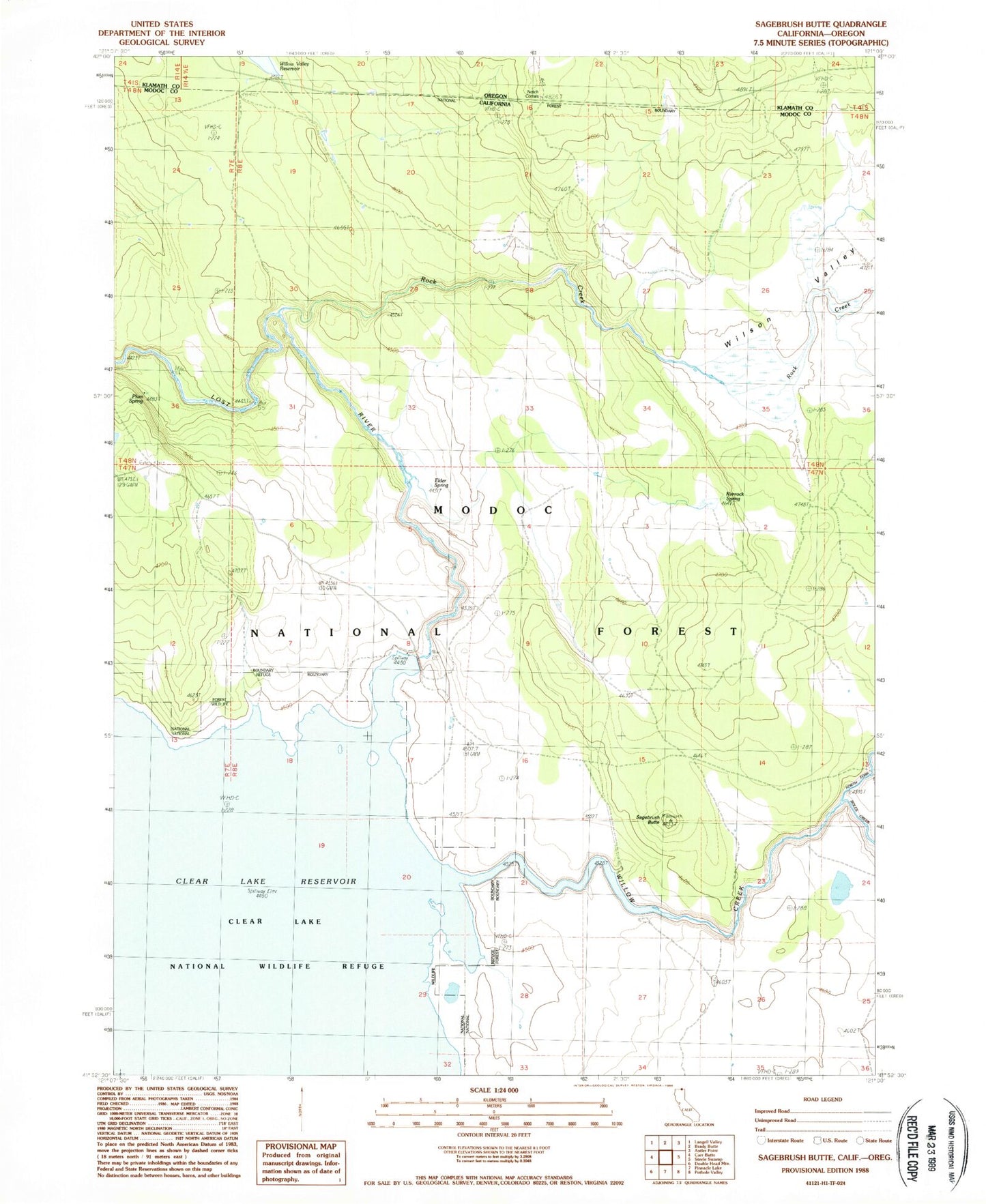
MyTopo
Classic USGS Sagebrush Butte California 7.5'x7.5' Topo Map
Regular price
$16.95
Regular price
Sale price
$16.95
Unit price
per
Couldn't load pickup availability
Historical USGS topographic quad map of Sagebrush Butte in the states of California, Oregon. Map scale may vary for some years, but is generally around 1:24,000. Print size is approximately 24" x 27"
This quadrangle is in the following counties: Klamath, Modoc.
The map contains contour lines, roads, rivers, towns, and lakes. Printed on high-quality waterproof paper with UV fade-resistant inks, and shipped rolled.
Contains the following named places: Boles Creek, Clear Lake Dam, Elder Spring, Mammoth Springs, North Fork Willow Creek, Notch Corrals, Plum Spring, Rimrock Spring, Rock Creek, Sagebrush Butte, Willow Creek, Wilson Valley