MyTopo
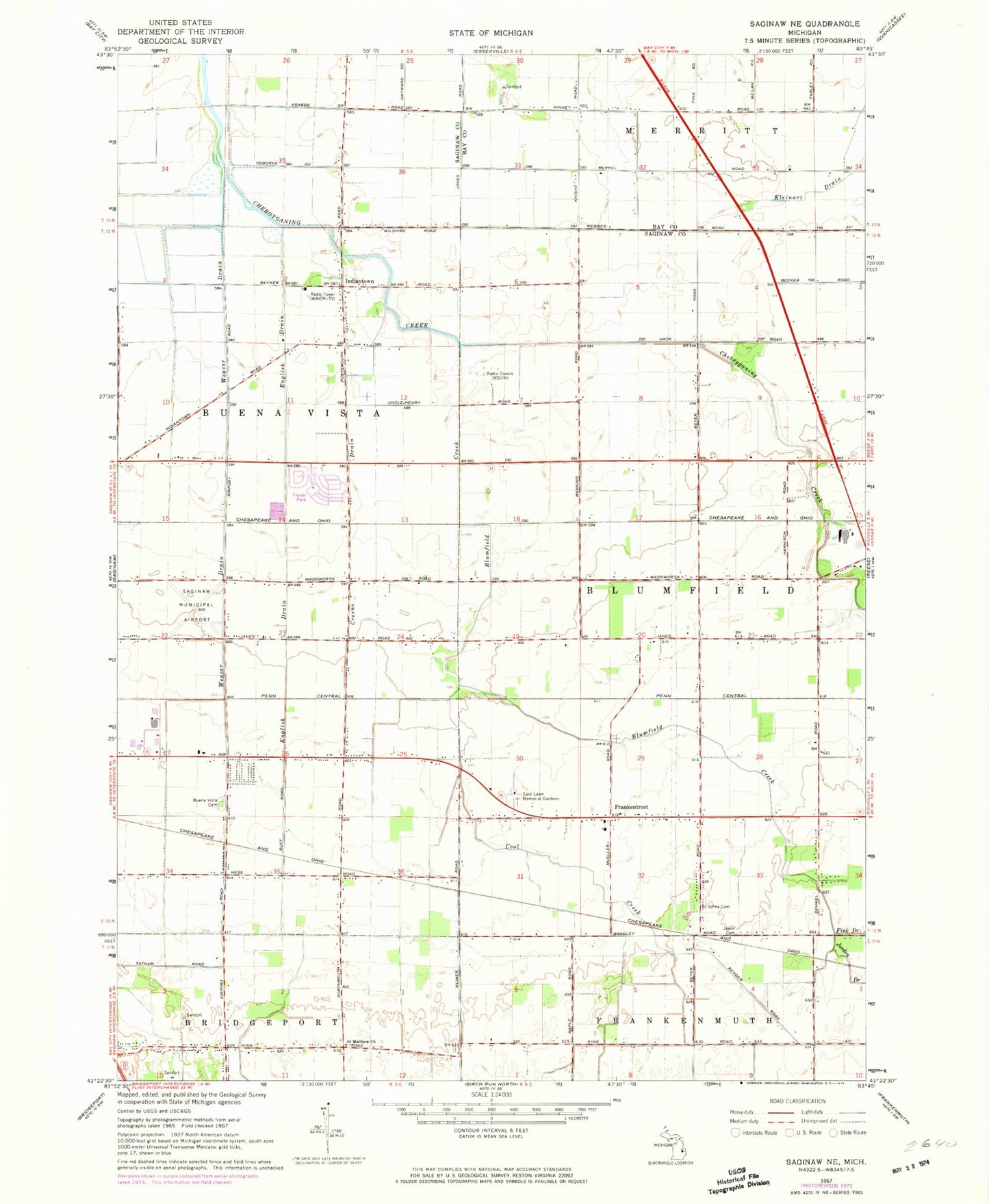
Classic USGS Saginaw NE Michigan 7.5'x7.5' Topo Map
Couldn't load pickup availability
Historical USGS topographic quad map of Saginaw NE in the state of Michigan. Map scale may vary for some years, but is generally around 1:24,000. Print size is approximately 24" x 27"
This quadrangle is in the following counties: Bay, Saginaw.
The map contains contour lines, roads, rivers, towns, and lakes. Printed on high-quality waterproof paper with UV fade-resistant inks, and shipped rolled.
Contains the following named places: Blumfield Creek, Blumfield Township Fire Department, Buena Vista Cemetery, Charter Township of Buena Vista, Cool Creek, Creens Drain, Eastlawn Memorial Gardens and Mausoleum, English Drain, Faulkwood Shores Golf Club, Frankentrost, Immanuel Lutheran Church, Indiantown, Jason Cemetery, Jordon Drain, Kleinart Drain, Kulmbach Post Office, Kulmbach Station, Robin Glen-Indiantown Census Designated Place, Saginaw County H W Browne Airport, Saint John's Cemetery, Saint Matthew Church, Township of Blumfield, Trostville Post Office, Weaver Drain, WIOG-FM (Bay City), WNEM-TV (Bay City), WSGW-AM (Saginaw)