MyTopo
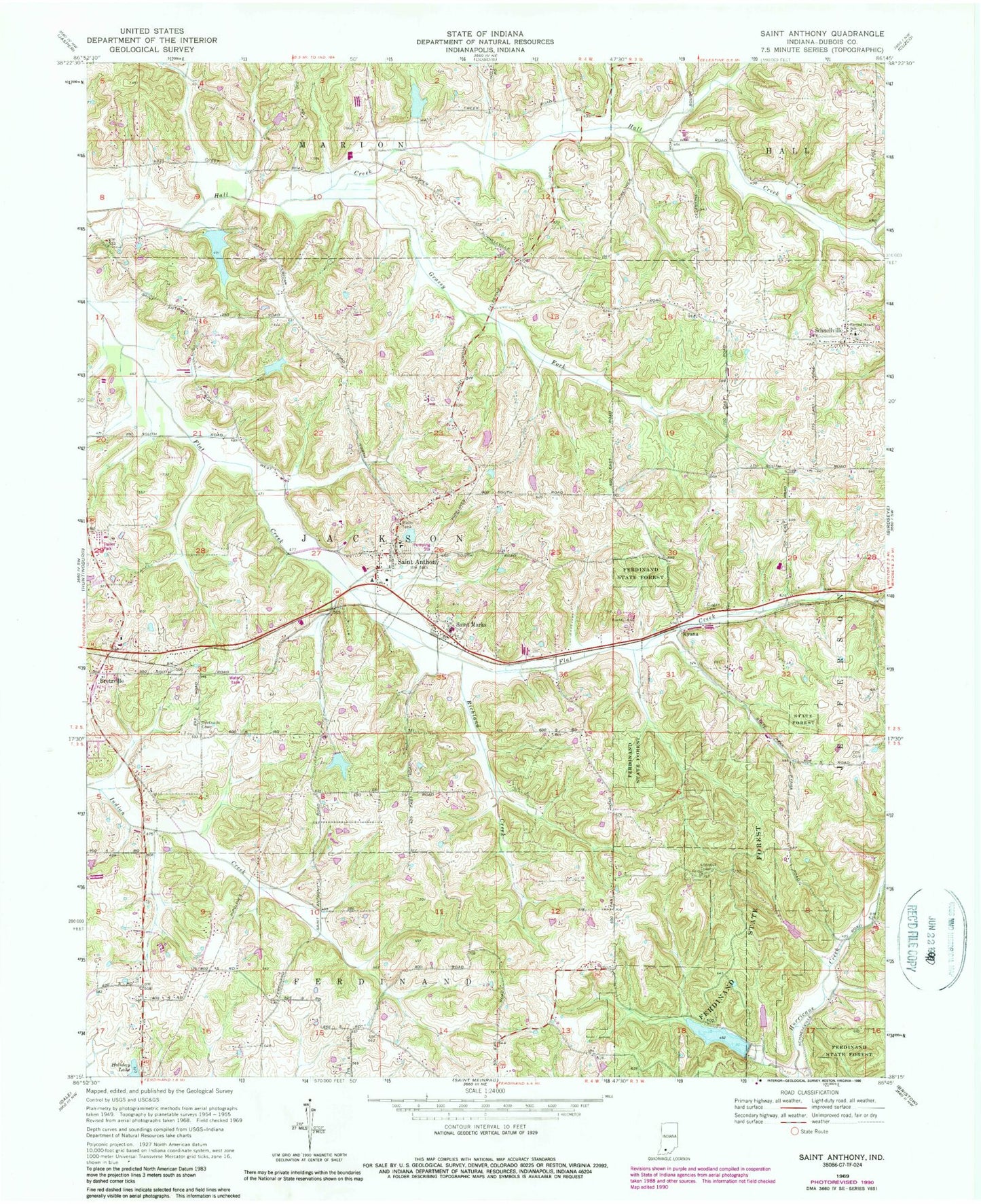
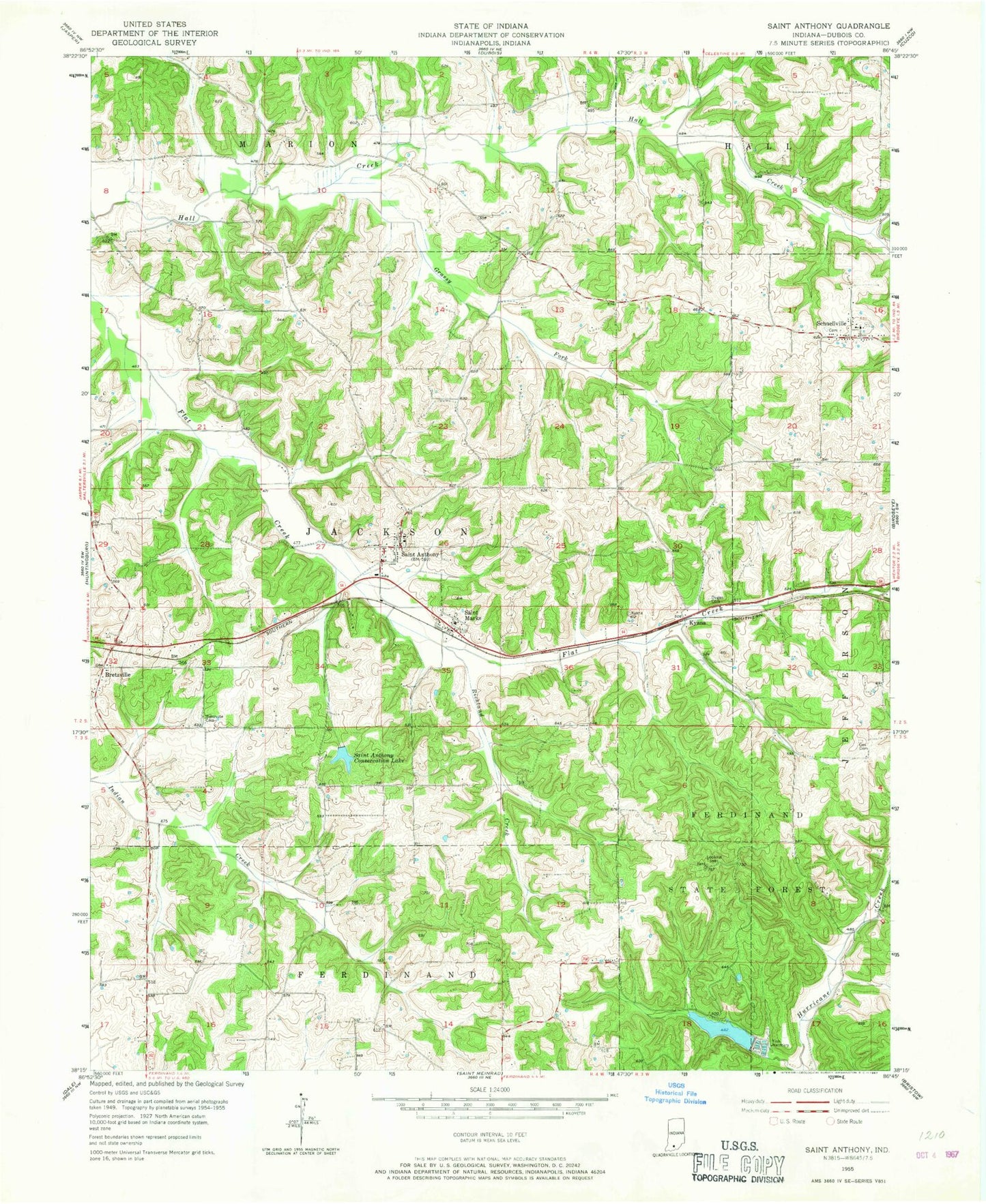
Classic USGS Saint Anthony Indiana 7.5'x7.5' Topo Map
Couldn't load pickup availability
Historical USGS topographic quad map of Saint Anthony in the state of Indiana. Map scale may vary for some years, but is generally around 1:24,000. Print size is approximately 24" x 27"
This quadrangle is in the following counties: Dubois.
The map contains contour lines, roads, rivers, towns, and lakes. Printed on high-quality waterproof paper with UV fade-resistant inks, and shipped rolled.
Contains the following named places: Birk Lake, Birk Lake Dam, Bretzville, Bretzville Cemetery, Camp Ground Lake, Cox Cemetery, Dungan Cemetery, Ferdinand Forest Dam, Ferdinand State Forest Lake, Grassy Fork, Habig Lake, Habig Lake Dam, Holiday Lake, Kyana, Larry Hopf Lake, Larry Hopf Lake Dam, Olinger Lake, Olinger Lake Dam, Richland Creek, Sacred Heart Cemetery, Sacred Heart School, Saint Anthony, Saint Anthony Cemetery, Saint Anthony Conservation Club Dam, Saint Anthony Conservation Club Lake, Saint Anthony Post Office, Saint Anthony School, Saint Anthony School Lake, Saint Anthony School Lake Dam, Saint Anthony Volunteer Fire Department, Saint Marks, Schnellville, Schnellville Volunteer Fire Department, Township of Jackson, ZIP Codes: 47575, 47580