MyTopo
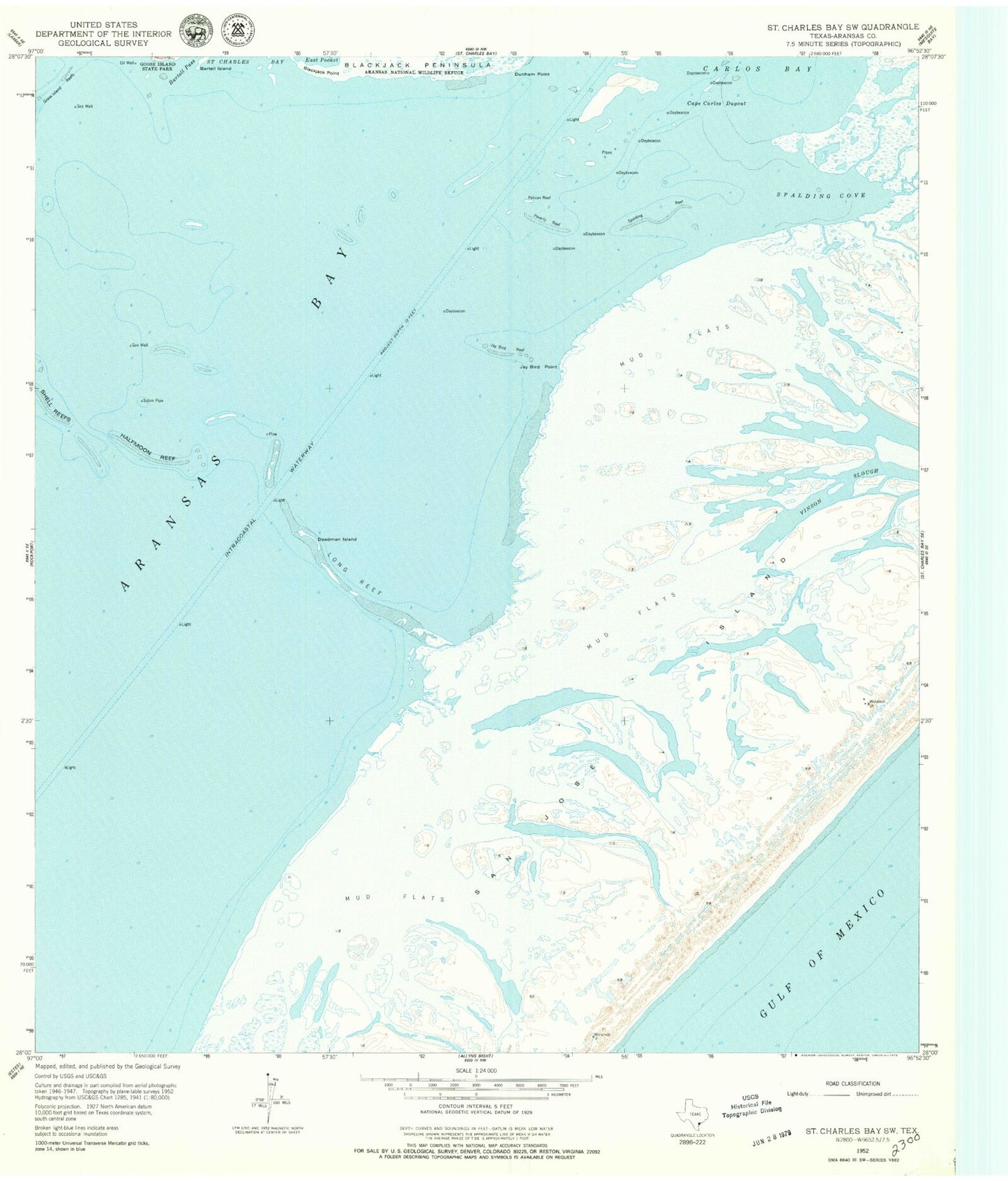
Classic USGS Saint Charles Bay SW Texas 7.5'x7.5' Topo Map
Couldn't load pickup availability
Historical USGS topographic quad map of Saint Charles Bay SW in the state of Texas. Map scale may vary for some years, but is generally around 1:24,000. Print size is approximately 24" x 27"
This quadrangle is in the following counties: Aransas.
The map contains contour lines, roads, rivers, towns, and lakes. Printed on high-quality waterproof paper with UV fade-resistant inks, and shipped rolled.
Contains the following named places: Aransas Bay, Aransas County, Ballou Island, Big Island, Blackjack Peninsula, Blackjack Point, Cape Carlos Dugout, Deadman Island, Dunham Island, Dunham Point, Fulton Division, Jay Bird Point, Jay Bird Reef, Long Reef, Mack Reef, Pauls Mott, Pauls Mott Reef, Pelican Reef, Poverty Reef, San Jose Island, Shell Reef, Spalding Bight, Spalding Reef, Thompsons Towheads, Towhead Reef