MyTopo
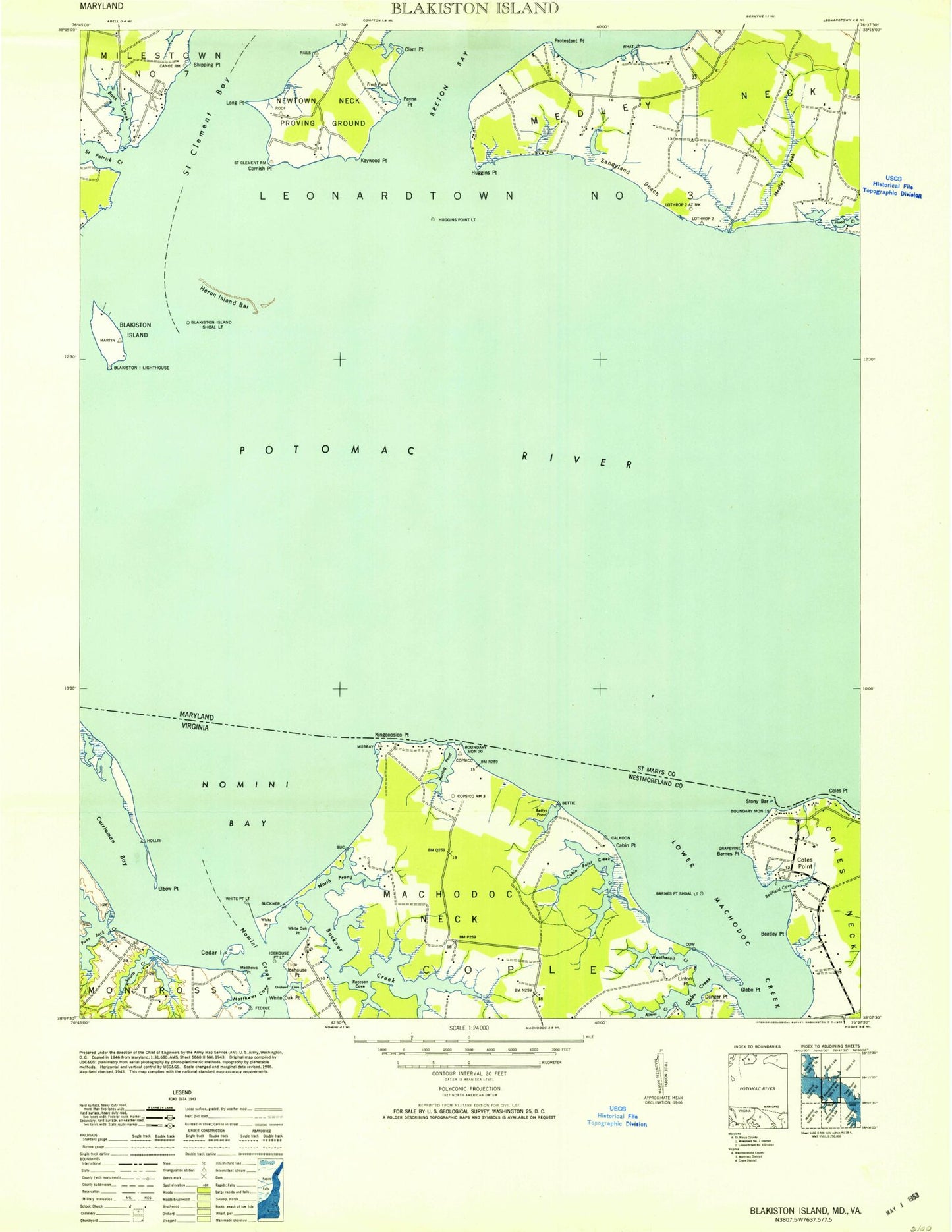
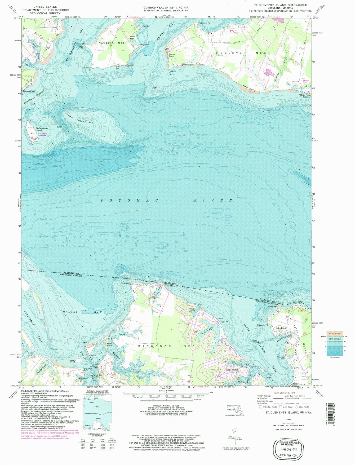
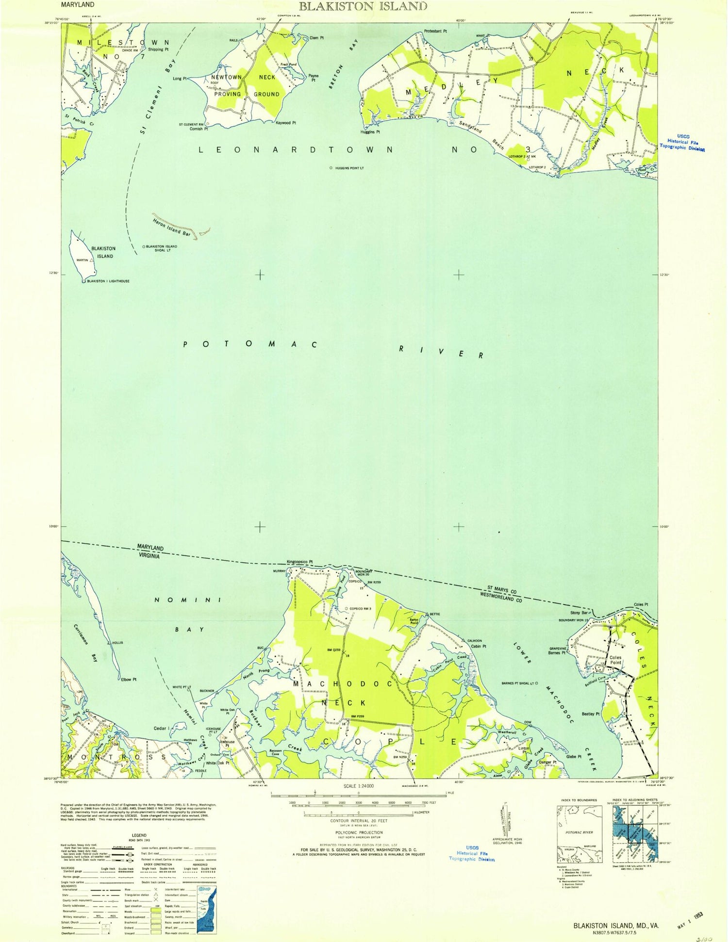
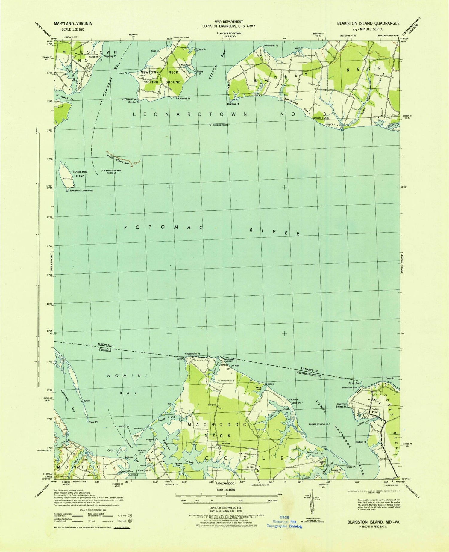
Classic USGS Saint Clements Island Maryland 7.5'x7.5' Topo Map
Couldn't load pickup availability
Historical USGS topographic quad map of Saint Clements Island in the states of Maryland, Virginia. Typical map scale is 1:24,000, but may vary for certain years, if available. Print size: 24" x 27"
This quadrangle is in the following counties: St. Mary's, Westmoreland.
The map contains contour lines, roads, rivers, towns, and lakes. Printed on high-quality waterproof paper with UV fade-resistant inks, and shipped rolled.
Contains the following named places: Saint Celments Bay, Back Creek, Blue Sow, Breton Beach, Clem Point, Cornish Point, Dukeharts Channel, Flood Creek, Fresh Pond, Heron Island Bar, Huggins Point, Kaywood Point, Long Point, Medleys Creek, Medleys Neck, Newtown Neck, Payne Point, Poseys Bluff, Protestant Point, Saint Clements Island, Saint Patrick Creek, Stone Cross, Saint Clements Bay, Sandyland Beach, Deerfield Airport, Hampton Airport, Bedlam Neck, Bloomsbury, Heron Island (historical), Newtown Neck Proving Ground (historical), Nuns Oak, Port Sunlight Beach, Saint Clements Island Lighthouse (historical), Saint Clements Island-Potomac River Museum, Sandyland Beach, Shipping Point, Ridge Volunteer Rescue Squad Company 49, Aimes Creek, Bettys Pond, Branson Cove, Buckner Creek, Cabin Point, Cabin Point Creek, Cedar Island, Coles Point, Danger Point, Elbow Point, Glebe Creek, Glebe Harbor, Glebe Point, Grannys Bar, Grapevine Point, Herring Pond, Icehouse Point, Kingcopsico Point, Linton Point, Lower Machodoc Creek, Machodoc Neck, Matthews Cove, Matthews Point, Nomini Bay, Nomini Creek, North Prong Buckner Creek, Poor Jack Creek, Smarts Creek, Snake Island, Stony Bar, Weatherall Creek, White Oak Point, White Point, Coles Point, Meter, Beatley Point, Orchard Cove, Raccoon Cove, Trent Island, Coles Point Post Office, Kilmarnock-Lancaster Volunteer Rescue Squad, Bushfield Golf Course, Saint Celments Bay, Back Creek, Blue Sow, Breton Beach, Clem Point, Cornish Point, Dukeharts Channel, Flood Creek, Fresh Pond, Heron Island Bar, Huggins Point, Kaywood Point, Long Point, Medleys Creek, Medleys Neck, Newtown Neck, Payne Point, Poseys Bluff, Protestant Point, Saint Clements Island, Saint Patrick Creek, Stone Cross, Saint Clements Bay, Sandyland Beach, Deerfield Airport, Hampton Airport, Bedlam Neck, Bloomsbury, Heron Island (historical), Newtown Neck Proving Ground (historical), Nuns Oak, Port Sunlight Beach, Saint Clements Island Lighthouse (historical), Saint Clements Island-Potomac River Museum, Sandyland Beach, Shipping Point, Ridge Volunteer Rescue Squad Company 49, Aimes Creek, Bettys Pond, Branson Cove, Buckner Creek, Cabin Point, Cabin Point Creek, Cedar Island, Coles Point, Danger Point, Elbow Point, Glebe Creek, Glebe Harbor, Glebe Point, Grannys Bar, Grapevine Point, Herring Pond, Icehouse Point, Kingcopsico Point, Linton Point, Lower Machodoc Creek, Machodoc Neck, Matthews Cove, Matthews Point, Nomini Bay, Nomini Creek, North Prong Buckner Creek, Poor Jack Creek, Smarts Creek, Snake Island, Stony Bar, Weatherall Creek, White Oak Point, White Point, Coles Point, Meter, Beatley Point, Orchard Cove, Raccoon Cove, Trent Island, Coles Point Post Office, Kilmarnock-Lancaster Volunteer Rescue Squad, Bushfield Golf Course