MyTopo
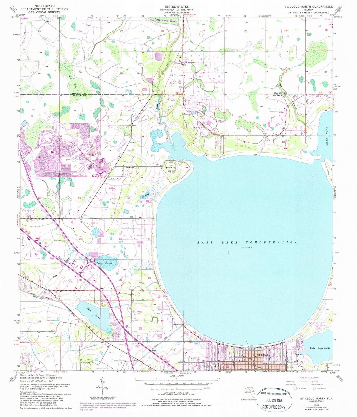
Classic USGS Saint Cloud North Florida 7.5'x7.5' Topo Map
Couldn't load pickup availability
Historical USGS topographic quad map of Saint Cloud North in the state of Florida. Map scale may vary for some years, but is generally around 1:24,000. Print size is approximately 24" x 27"
This quadrangle is in the following counties: Orange, Osceola.
The map contains contour lines, roads, rivers, towns, and lakes. Printed on high-quality waterproof paper with UV fade-resistant inks, and shipped rolled.
Contains the following named places: Azalea Park Church of Christ, Barber Cemetery, Bass Slough, Bear Bay, Big Sky Airpark, Boggy Creek, Buena Ventura Lakes Post Office, Buena Ventura Lakes Wastewater Treatment Facility, Buenaventura Lakes, Buenaventura Lakes Census Designated Place, Buenaventura Lakes Community Center, Church of Christ at Fortune Road, Church of New Birth School, Church of the Nazarene, Countryside Baptist Church, East Lake Cemetery, East Lake Fish Camp Marina, East Lake Seaplane Base, East Lake Tohopekaliga, Faith Baptist Church, Fennel Slough, First Baptist Church Markham Woods, First United Methodist Church Saint Cloud, Fish Lake, Florida Christian College Library, Frog Wells Airport, Gateway Baptist Church, Hillard Island, Hispanic Church of the Nazarene, Ibis Golf and Country Club, Imperial Golf Club, Indian River Club, Indianwood Adult Golf and Country Club, Jade Isles Trailer Park, Jim Branch, Lake Runnymede, Lake Runnymede Mobile Home Park, Lock Haven Church, Meadow Woods Census Designated Place, Northeast Christian Church, Orange County Fire Rescue Station 55, Osceola County Correctional Facility, Osceola County Fire Rescue and Emergency Medical Services Department Station 62, Osceola County Fire Rescue and Emergency Medical Services Station 63, Osceola County Library System Buenaventura Branch, Osceola County Sheriff's Office, Osceola County Sheriff's Office BVL Substation, Osceola County Sheriff's Office Corrections, Osceola County Stadium, Osceola Independent Private School, Osceola Memory Gardens Cemetary, Osceola Sheriff's Office Bronson Highway Heliport, Ox Pond, Partin Canal, Peace Lutheran Church, Pinecastle Church of the Nazarene, Saint Cloud Canal, Saint Cloud Post Office, Saint Francis Anglican Church, Sand Hill Cove Mobile Home Park, Seventh Day Adventist Church, Spanish Church of God, Sugar Mill Mobile Home Park, The Church of Jesus Christ of Latter Day Saints, Tohopikaliga, WFIV-AM (Kissimmee), Williams Trailer Park, WOOG-FM (Kissimmee), ZIP Codes: 34743, 34744


