MyTopo
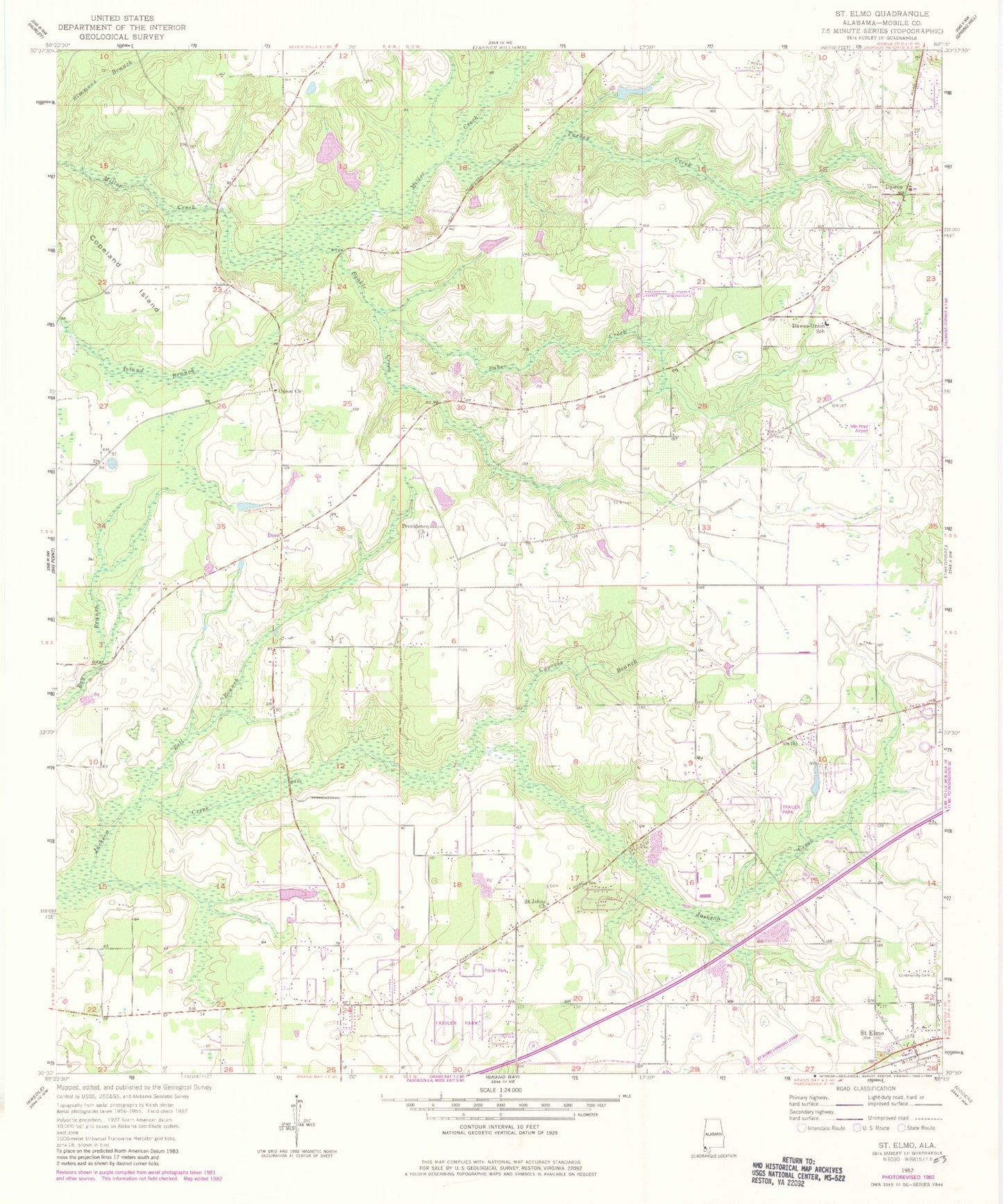
Classic USGS Saint Elmo Alabama 7.5'x7.5' Topo Map
Couldn't load pickup availability
Historical USGS topographic quad map of Saint Elmo in the state of Alabama. Map scale may vary for some years, but is generally around 1:24,000. Print size is approximately 24" x 27"
This quadrangle is in the following counties: Mobile.
The map contains contour lines, roads, rivers, towns, and lakes. Printed on high-quality waterproof paper with UV fade-resistant inks, and shipped rolled.
Contains the following named places: Abundant Life Church, Agape Church, Antioch Church of God and Christ, Baker Creek, Bell Branch, Constantines Pond, Constantines Pond Dam, Copeland Island, Cypress Branch, Dawes, Dawes Cemetery, Dawes Church, Dawes-Union Elementary School, Deakle Creek, Dees, First Baptist Church of Dawes, First Baptist Church of Saint Elmo, Flowerwood Nursery Number 3 Dam, Flowerwood Nursery Number Three Lake, Free Methodist Church, Grand Bay Volunteer Fire Department, Idle Hour Airport, Jamar Mobile Home Park, Joe McDavid Number 1 Dam, Joe McDavid Number 2 Dam, Lawn Haven Memorial Gardens, Laws Landing Trailer Park, Living World Church, McNeil Road Pit, Midway Church, Moore Life Church, New Welcome Church, Pit Development Corporation Pit 3, Providence Church, River of Life Church, Saint Elmo, Saint Elmo - Irvington Volunteer Fire Department Main Station, Saint Elmo Cemetery, Saint Elmo Church, Saint Elmo Post Office, Saint Johns Church, Serenity Memorial Gardens, Seven Hills Volunteer Fire Department, Seven Hills Volunteer Fire Department Station 3, Shady Oaks Mobile Home Park, Sibley Hamilton Dirt Pit, Southside Mobile Home Park, St Elmo Airport, Turkey Creek, Turpentine Branch, Union Baptist Church Cemetery, Union Church, Union School, Victory Christian Center, West Mobile Church, ZIP Code: 36568