MyTopo
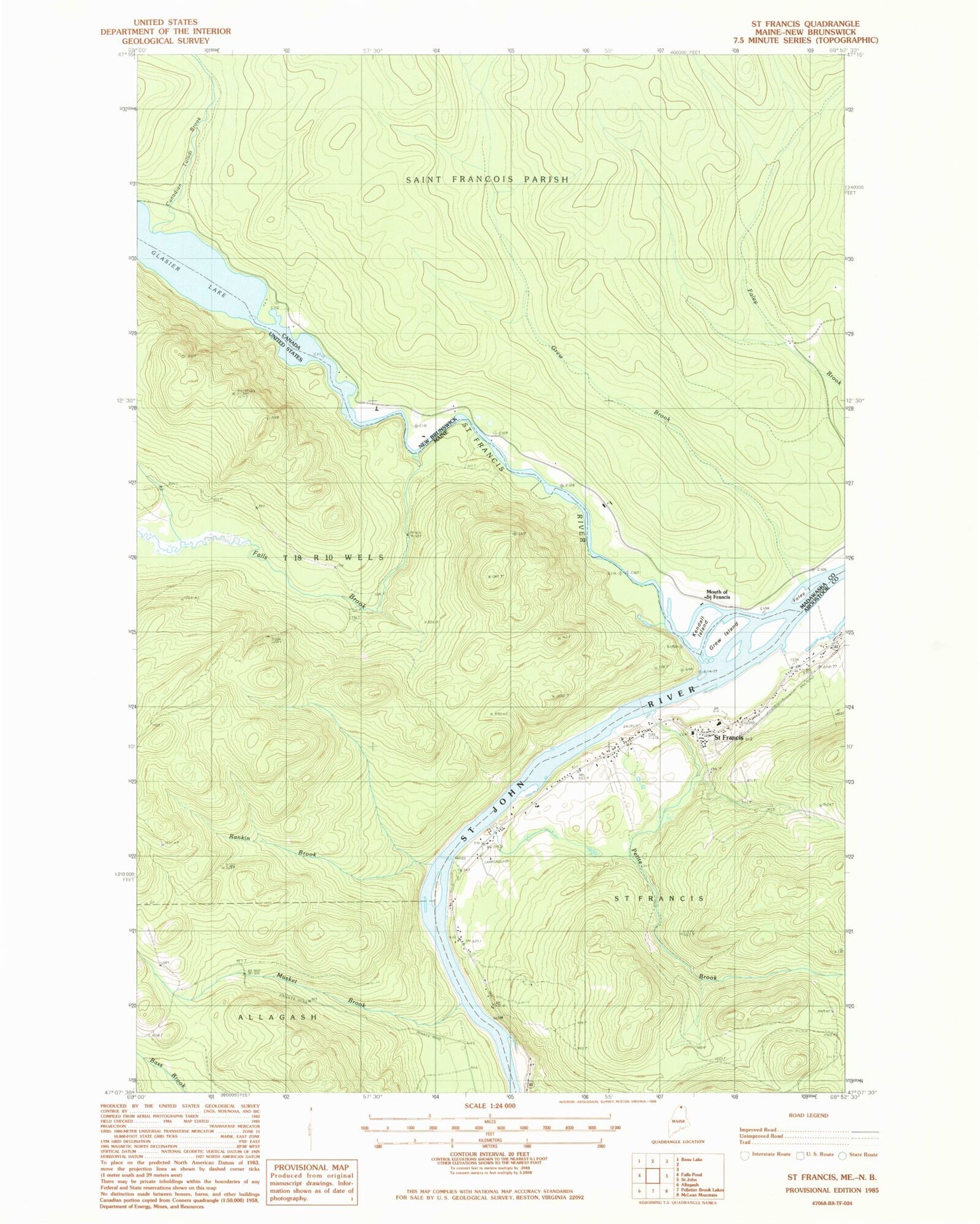
Classic USGS Saint Francis Maine 7.5'x7.5' Topo Map
Couldn't load pickup availability
Historical USGS topographic quad map of Saint Francis in the state of Maine. Map scale may vary for some years, but is generally around 1:24,000. Print size is approximately 24" x 27"
This quadrangle is in the following counties: Aroostook.
The map contains contour lines, roads, rivers, towns, and lakes. Printed on high-quality waterproof paper with UV fade-resistant inks, and shipped rolled.
Contains the following named places: Falls Brook, Glazier Lake, Grew Island, Lincoln School, McKinley School, Musket Brook, Old Saint Charles Cemetery, Petite Brook, Rankin Brook, Rankin Rapids, Saint Frances Fire Department, Saint Francis, Saint Francis Catholic Church, Saint Francis Elementary School, Saint Francis Post Office, Saint Francis River, Saint Pauls Congregational Cemetery, T18 R10 WELS, Town of Saint Francis