MyTopo
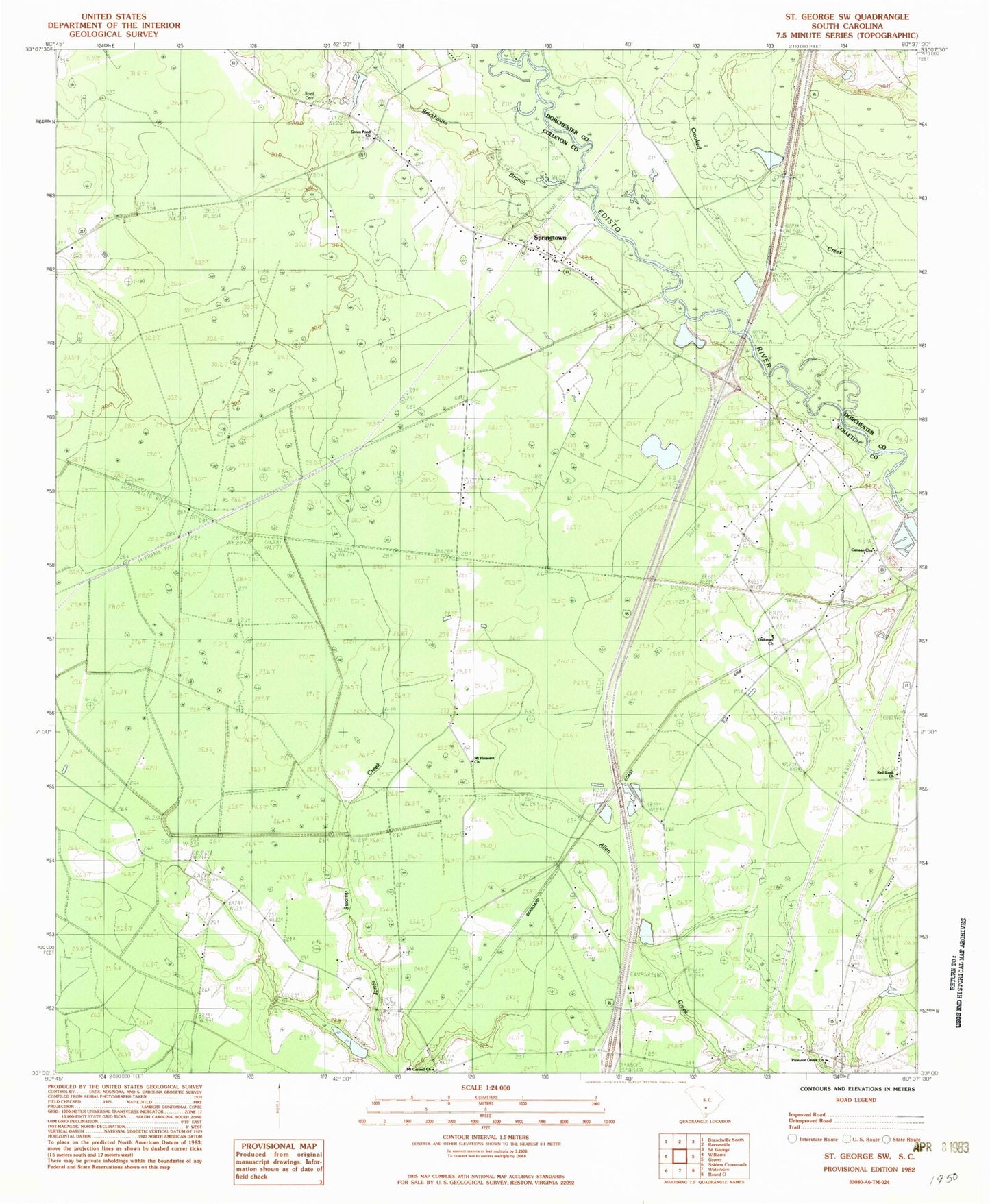
Classic USGS Saint George SW South Carolina 7.5'x7.5' Topo Map
Couldn't load pickup availability
Historical USGS topographic quad map of Saint George SW in the state of South Carolina. Map scale may vary for some years, but is generally around 1:24,000. Print size is approximately 24" x 27"
This quadrangle is in the following counties: Colleton, Dorchester.
The map contains contour lines, roads, rivers, towns, and lakes. Printed on high-quality waterproof paper with UV fade-resistant inks, and shipped rolled.
Contains the following named places: Brickhouse Branch, Canaan Church, Cokers Pond, Cokers Pond Dam D-0649, Green Pond, Green Pond Cemetery, Green Pond Church, Linder School, Mount Carmel Church, Mount Carmel School, Mount Pleasant Church, Mount Pleasant School, Oakman Branch School, Oakman Church, Pleasant Grove Church, Pleasant Grove School, Raysor Bridge, Red Bank, Red Bank Church, Roadside School, South Carolina Noname 15033 D-2388 Dam, Spell Cemetery, Springtown, Springtown Church, Springtown Fire Department Station 17, Springtown School, Stokes Lookout Tower, Weeks