MyTopo
Classic USGS Saint Helena Sound South Carolina 7.5'x7.5' Topo Map
Couldn't load pickup availability
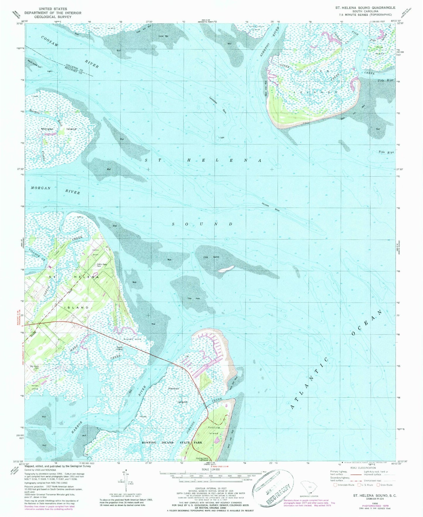
Historical USGS topographic quad map of Saint Helena Sound in the state of South Carolina. Map scale may vary for some years, but is generally around 1:24,000. Print size is approximately 24" x 27"
This quadrangle is in the following counties: Beaufort, Colleton.
The map contains contour lines, roads, rivers, towns, and lakes. Printed on high-quality waterproof paper with UV fade-resistant inks, and shipped rolled.
Contains the following named places: Ashepoo River, Big House Cemetery, Butchers Island, Cedar Reef Villas, Coffin Creek, Coffin Point, Coffin Point Cemetery, Coffin Point Plantation, Combahee Bank, Coosaw River, Egg Bank, Fish Creek, Fripps Point, Harbor Island, Harbor Island Census Designated Place, Horse Island, Hunting Island Lighthouse, Jefford Creek, Johnson Creek, Lee Rosenwald School, Marsh Island Spit, Morgan River, Nautical Watch Villas, Otter Creek, Otter Islands, Oyster Bank, Pelican Bank, Pelican Point, Pine Island, Pine Island Creek, Saint Helena Sound, Ward Creek, WHTK-FM (Port Royal)