MyTopo
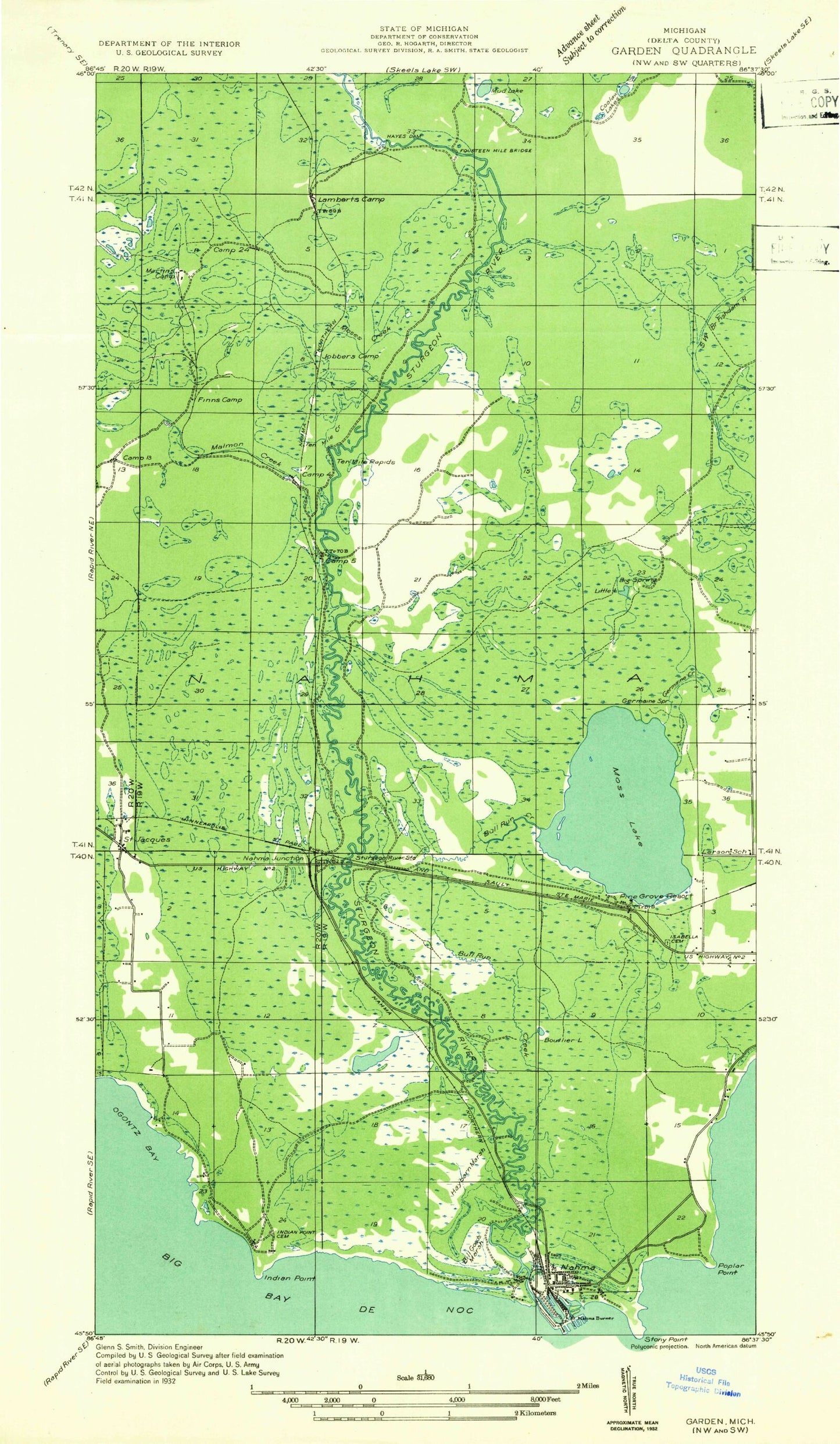
Classic USGS Saint Jacques Michigan 7.5'x7.5' Topo Map
Couldn't load pickup availability
Historical USGS topographic quad map of Saint Jacques in the state of Michigan. Map scale may vary for some years, but is generally around 1:24,000. Print size is approximately 24" x 27"
This quadrangle is in the following counties: Delta.
The map contains contour lines, roads, rivers, towns, and lakes. Printed on high-quality waterproof paper with UV fade-resistant inks, and shipped rolled.
Contains the following named places: Bourgois Lake, Cache Lake, Coolaw Lakes, Flowing Well, Flowing Well Campground, Fourteenmile Bridge, Germaine Creek, Germaine Spring, Isabella Cemetery, Little Lake, Little Moss Lake, Mormon Creek, Mormon Creek Picnic Grounds, Moses Creek, Moss Lake, Moss Lake Lookout Tower, Nahma Junction, Nahma Township Volunteer Fire Department, Saint Jacques, Saint Jacques' Cemetery, Saint Jacques Station, Saint Joseph's Post Office, Sturgeon Wild and Scenic River, Tenmile Creek, Tenmile Rapids, Township of Nahma, Tri - Star Emergency Medical Services Station 2