MyTopo
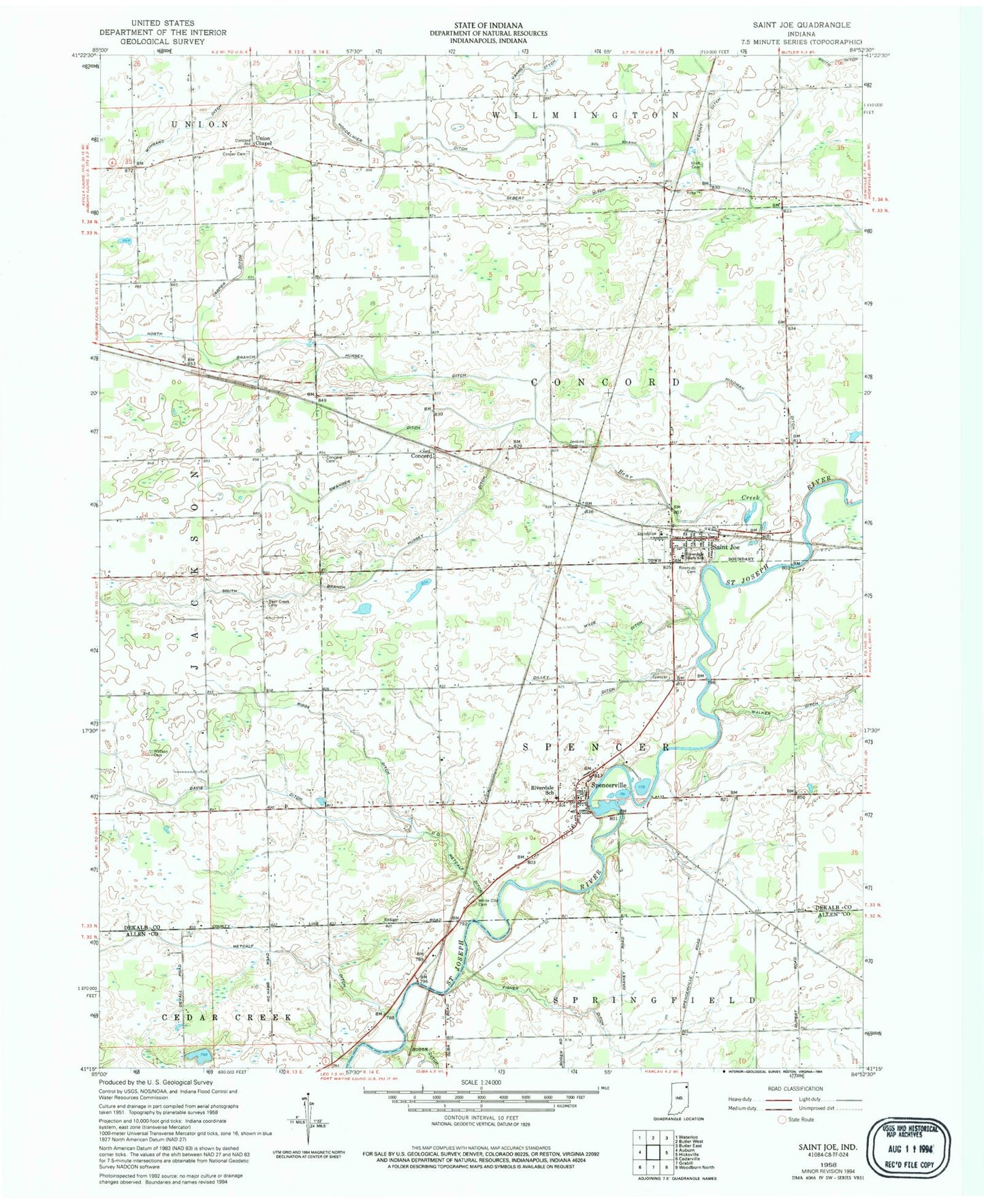
Classic USGS Saint Joe Indiana 7.5'x7.5' Topo Map
Couldn't load pickup availability
Historical USGS topographic quad map of Saint Joe in the state of Indiana. Map scale may vary for some years, but is generally around 1:24,000. Print size is approximately 24" x 27"
This quadrangle is in the following counties: Allen, DeKalb.
The map contains contour lines, roads, rivers, towns, and lakes. Printed on high-quality waterproof paper with UV fade-resistant inks, and shipped rolled.
Contains the following named places: Bear Creek, Bear Creek Cemetery, Carper Ditch, Concord, Concord Cemetery, Concord Township Fire Department, Cosper Cemetery, D D Metcalf Ditch, Davis Ditch, Dilley Ditch, Fisher Ditch, Hindman Ditch, Jenkins Cemetery, Kraft Cemetery, Metcalf Ditch, North Branch Hursey Ditch, Riggs Ditch, Riverdale Elementary School, Riverdale High School, Riverside Cemetery, Saint Joe, Saint Joe Post Office, Sebert Ditch, Sol Shank Ditch, South Branch Hursey Ditch, Spencerville, Spencerville Fire Department, Spencerville Pit, Spencerville Post Office, Swander Ditch, Town of Saint Joe, Township of Concord, Township of Spencer, Union Chapel, Wade Ditch, Watson Cemetery, Weicht Ditch, White City Cemetery, Wingard Ditch, ZIP Codes: 46785, 46788