MyTopo
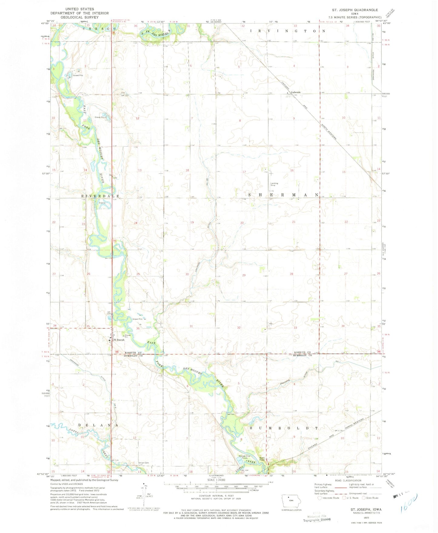
Classic USGS Saint Joseph Iowa 7.5'x7.5' Topo Map
Couldn't load pickup availability
Historical USGS topographic quad map of Saint Joseph in the state of Iowa. Map scale may vary for some years, but is generally around 1:24,000. Print size is approximately 24" x 27"
This quadrangle is in the following counties: Humboldt, Kossuth.
The map contains contour lines, roads, rivers, towns, and lakes. Printed on high-quality waterproof paper with UV fade-resistant inks, and shipped rolled.
Contains the following named places: Byron Post Office, Damman Cemetery, Devine Wildlife Area, Drainage Ditch Number 1, Drainage Ditch Number 116, Drainage Ditch Number 182, Drainage Ditch Number 8, Eber, Eber Post Office, Fourmile Creek, Galbraith, Galbraith Post Office, Kohlhaas Airport, Lotts Creek, Saint Joseph, Saint Joseph Catholic Church, Saint Joseph Census Designated Place, Saint Joseph Posot Office, Saint Joseph's Catholic Cemetery, Spring Valley Golf Course, Sumner, Township of Sherman, Union Cemetery