MyTopo
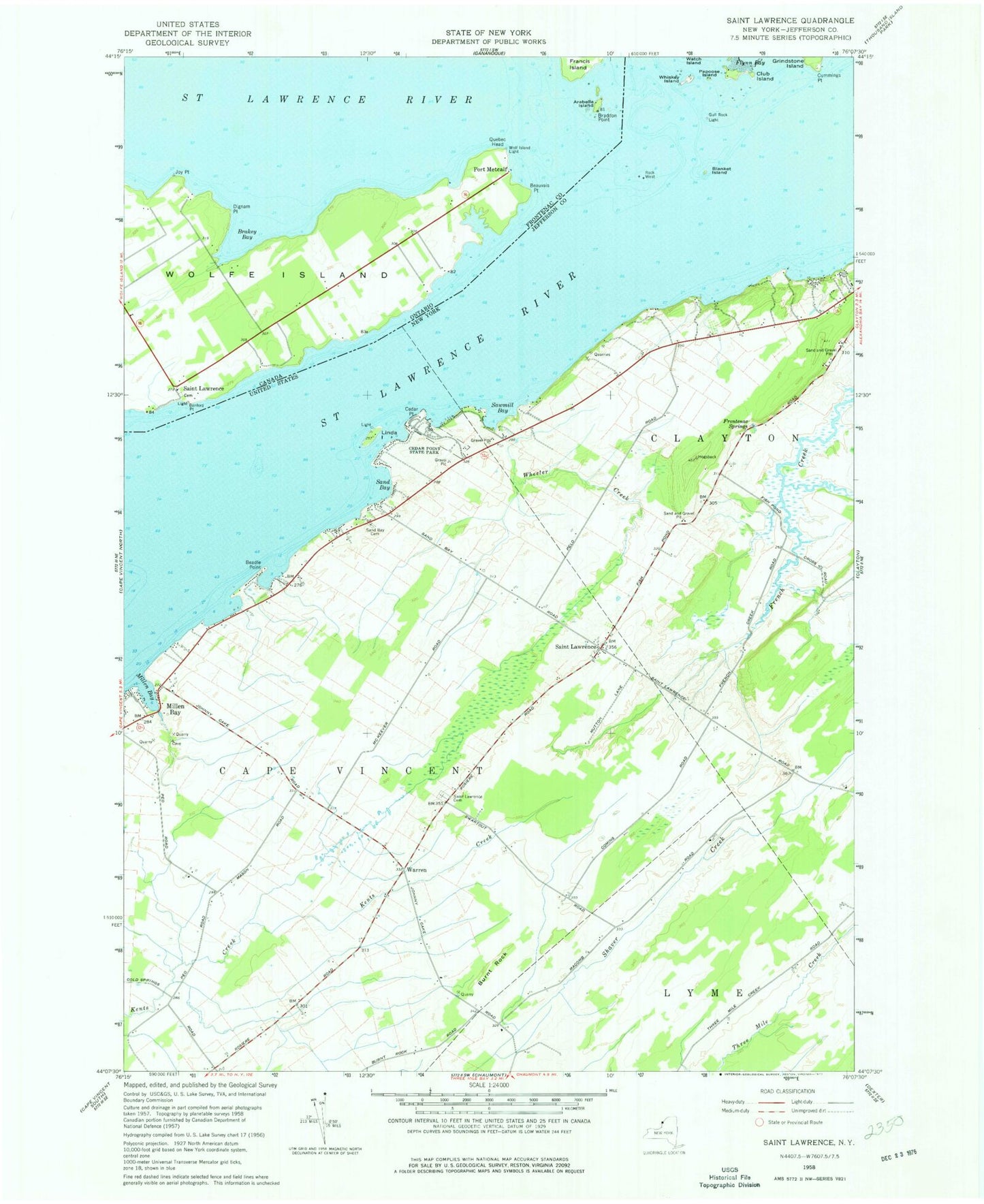
Classic USGS Saint Lawrence New York 7.5'x7.5' Topo Map
Couldn't load pickup availability
Historical USGS topographic quad map of Saint Lawrence in the state of New York. Map scale may vary for some years, but is generally around 1:24,000. Print size is approximately 24" x 27"
This quadrangle is in the following counties: Jefferson.
The map contains contour lines, roads, rivers, towns, and lakes. Printed on high-quality waterproof paper with UV fade-resistant inks, and shipped rolled.
Contains the following named places: Beadle Point, Blanket Island, Blanket Shoals, Burnt Rock, Cape Vincent Correctional Facility, Cedar Point, Cedar Point State Park, Club Island, Cummings Point, Dodge Bay, Frontenac Springs, Gull Rock, Gull Rock Island, Gull Rock Light, Lazy Acres Mobile Home Park, Linda Island, Merry Knoll Campground, Millen Bay, Millen Bay Marina, Millen Bay Yacht Club, Papoose Island, Rock West, Rock West Island, Rose Bay, Saint Lawrence, Saint Lawrence Cemetery, Sand Bay, Sand Bay Cemetery, Sawmill Bay, School Number 11, School Number 14, School Number 15, School Number 17, School Number 19, School Number 3, School Number 6, Sperrys Falls, Warren, Wheeler Creek, Whiskey Island, Wood Farms