MyTopo
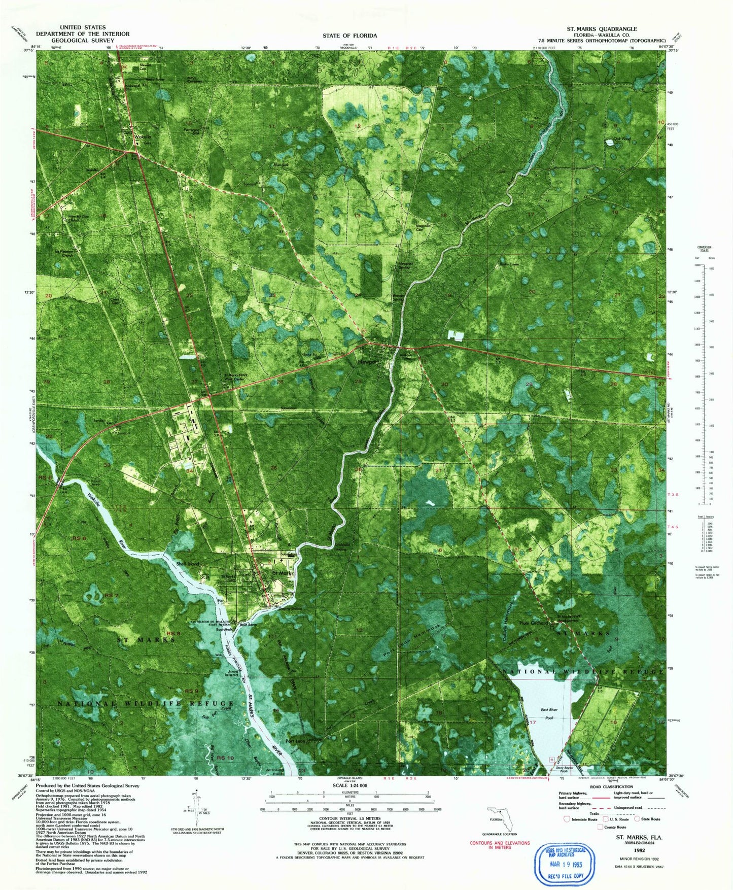
Classic USGS Saint Marks Florida 7.5'x7.5' Topo Map
Couldn't load pickup availability
Historical USGS topographic quad map of Saint Marks in the state of Florida. Map scale may vary for some years, but is generally around 1:24,000. Print size is approximately 24" x 27"
This quadrangle is in the following counties: Wakulla.
The map contains contour lines, roads, rivers, towns, and lakes. Printed on high-quality waterproof paper with UV fade-resistant inks, and shipped rolled.
Contains the following named places: Allround Point, Big Boggy Branch, Blue Sink, City of Saint Marks, Collins Hammock, East River Pool, East Wakulla Division, Fig Tree Landing, First Baptist Church of Saint Marks, First Branch, Joes Island, Lower Bridge, Magnolia Cemetery, Mays Cemetery, Miracle Temple Apostolic Holiness Church, Moriah Creek, New Mount Zion Church, Newport, Newport Bridge, Newport Lookout Tower, Newport Spring, Newport Station, Oak Pond, Old Fort Saint Marks, Patterson Sink, Pinewood Church, Plum Orchard, Port Leon, Port Leon Creek, Port Leon Hammock, Port Leon Lake, Rattlesnake Branch, Saint Marks, Saint Marks Post Office, Saint Marks Volunteer Fire Department Station 3, Salt Pan Creek, San Marcos, San Marcos De Apalache Historic State Park, Shell Island, Stewart Cemetery, Strickland Landing, Wakulla, Wakulla County Adult School, Wakulla River, Wakulla Station Volunteer Fire Department Station 2, WTMG-FM (Tallahassee), ZIP Code: 32355