
MyTopo
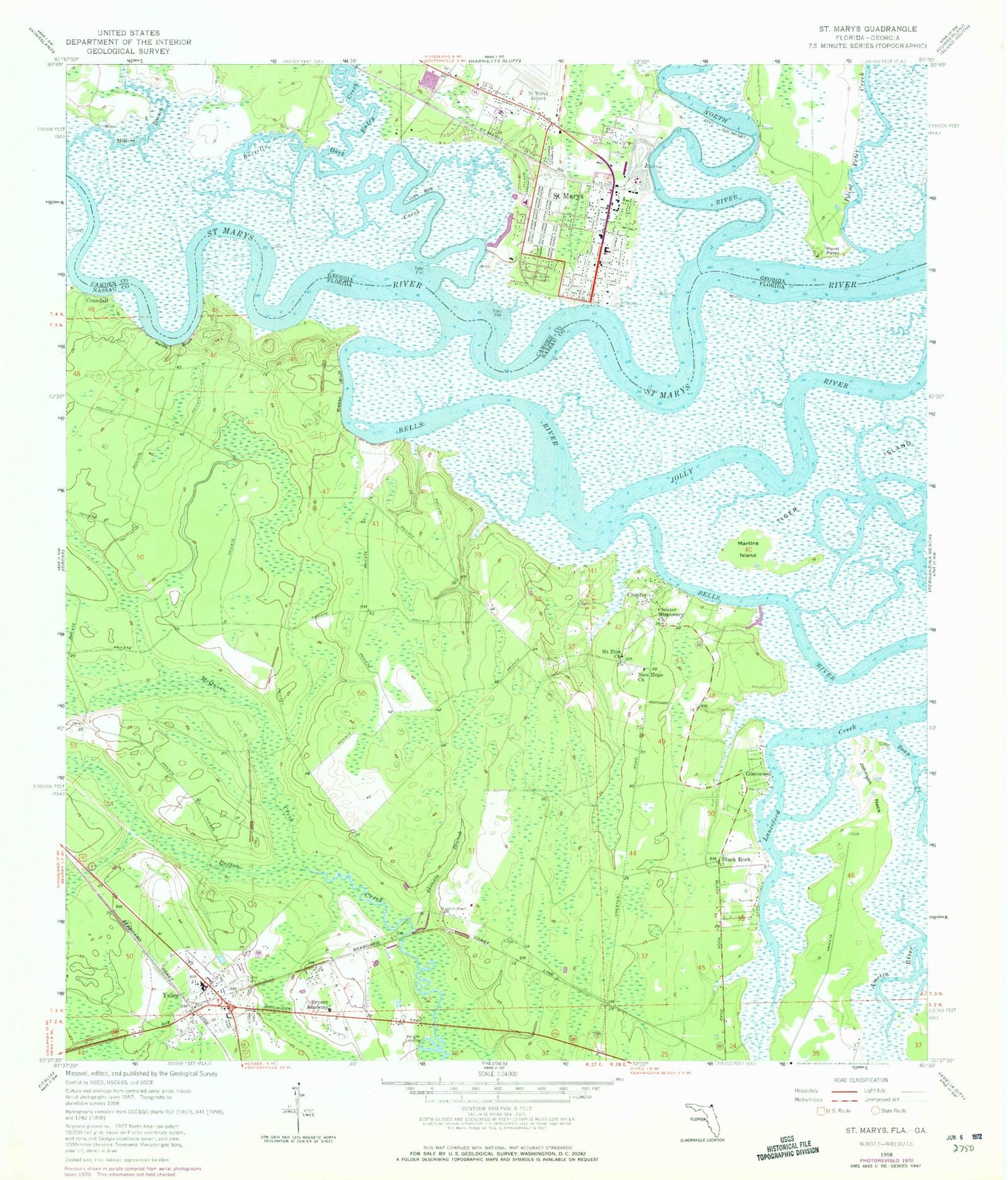
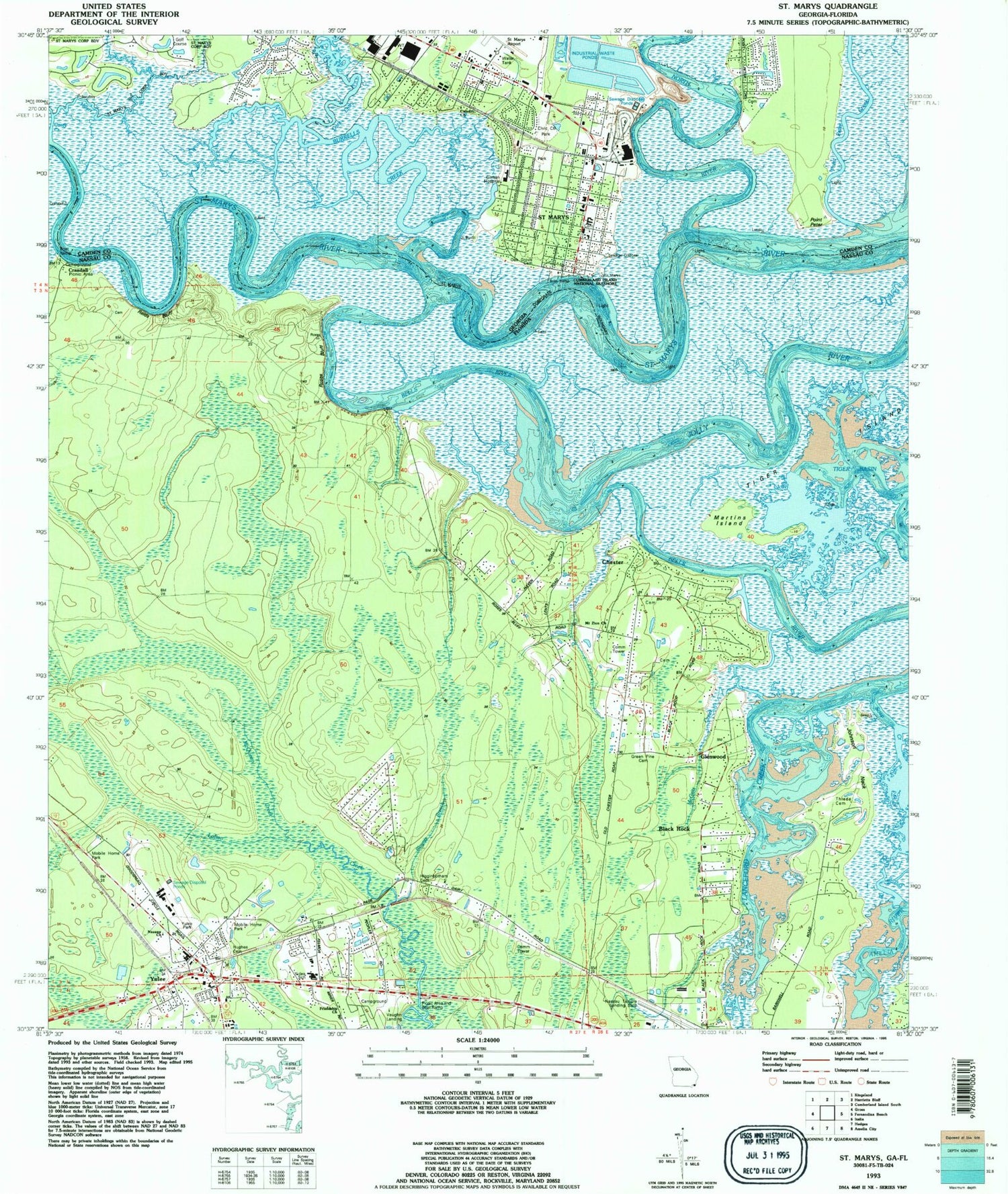
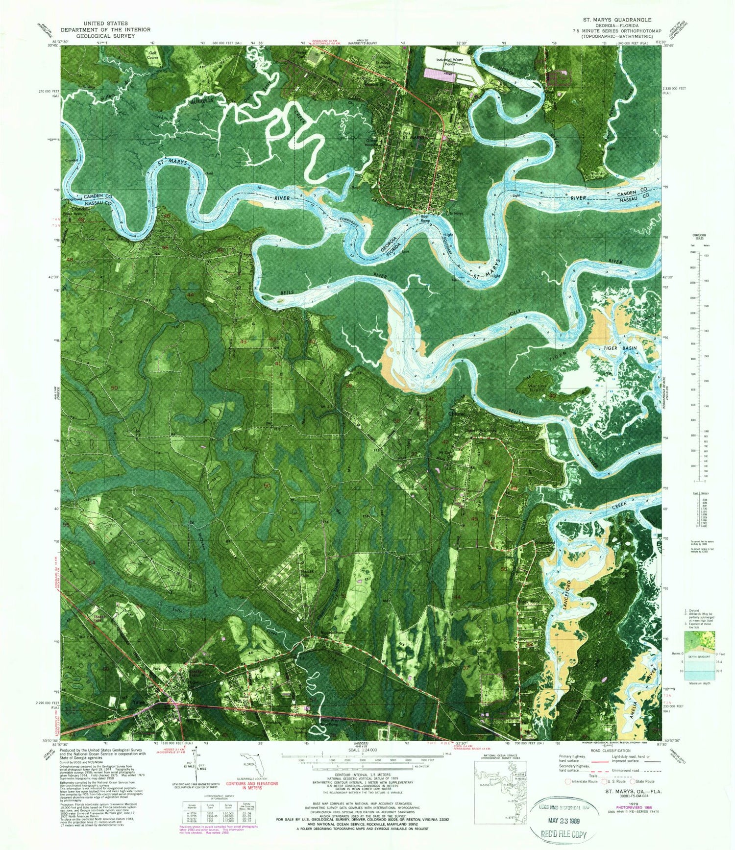
Classic USGS Saint Marys Georgia 7.5'x7.5' Topo Map
Couldn't load pickup availability
Historical USGS topographic quad map of Saint Marys in the states of Georgia, Florida. Typical map scale is 1:24,000, but may vary for certain years, if available. Print size: 24" x 27"
This quadrangle is in the following counties: Camden, Nassau.
The map contains contour lines, roads, rivers, towns, and lakes. Printed on high-quality waterproof paper with UV fade-resistant inks, and shipped rolled.
Contains the following named places: Burrells Creek, Dark Entry Creek, Millers Branch, North River, Oak Grove Cemetery, Point Peter Creek, St Marys Airport (historical), Point Peter, Saint Marys, Church of Our Savior (historical), Cypress Lake Estates, First Baptist Church of Saint Marys, Lands End, Millers Bluff, New Town Plantation (historical), Our Lady Star of the Sea Catholic Church, Peter Point Landing, Riverview, Saint Mary's Elementary School, Saint Marys Historic District, Shadowland, Devils Elbow, Christ Episcopal Church, Coastal Baptist Church, Evangelical Temple Assembly of God Church, First Presbyterian Church, Victory Baptist Church, Saint Marys Police Department, Saint Marys Public Library, Saint Marys City Hall, Saint Marys Water Pollution Control Plant, Osprey Cove Golf and Country Club, Camden County Fire Rescue Station 2, National Park Service Cumberland Island National Seashore Ranger Station, Blounts Branch, Bryant Academy, Chester, Chester Missionary Church, Higginbotham Cemetery, Johnson Neck, Martins Island, McQueen Creek, Mount Zion Church, New Hope Church, Reids Bluff, Roses Bluff, Yulee, Yulee Cemetery, Tiger Island, Glenwood, Crandall, Vaughn Landing, Yulee Elementary School, Nassau Airport, Yulee Division, Nassau County Criminal Court, Yulee Census Designated Place, Nassau Acres Mobile Home Park, Goodbread Mobile Home Park, Nassau County Fire and Rescue Station 30, Yulee Volunteer Fire Department, Nassau County Fire and Rescue Service Headquarters, Yulee Volunteer Fire Department Station 3B, Yulee Post Office, Burrells Creek, Dark Entry Creek, Millers Branch, North River, Oak Grove Cemetery, Point Peter Creek, St Marys Airport (historical), Point Peter, Saint Marys, Church of Our Savior (historical), Cypress Lake Estates, First Baptist Church of Saint Marys, Lands End, Millers Bluff, New Town Plantation (historical), Our Lady Star of the Sea Catholic Church, Peter Point Landing, Riverview, Saint Mary's Elementary School, Saint Marys Historic District, Shadowland, Devils Elbow, Christ Episcopal Church, Coastal Baptist Church, Evangelical Temple Assembly of God Church, First Presbyterian Church, Victory Baptist Church, Saint Marys Police Department, Saint Marys Public Library, Saint Marys City Hall, Saint Marys Water Pollution Control Plant, Osprey Cove Golf and Country Club, Camden County Fire Rescue Station 2, National Park Service Cumberland Island National Seashore Ranger Station, Blounts Branch, Bryant Academy, Chester, Chester Missionary Church, Higginbotham Cemetery, Johnson Neck, Martins Island, McQueen Creek, Mount Zion Church, New Hope Church, Reids Bluff, Roses Bluff, Yulee, Yulee Cemetery, Tiger Island, Glenwood, Crandall, Vaughn Landing, Yulee Elementary School, Nassau Airport, Yulee Division, Nassau County Criminal Court, Yulee Census Designated Place, Nassau Acres Mobile Home Park, Goodbread Mobile Home Park, Nassau County Fire and Rescue Station 30, Yulee Volunteer Fire Department, Nassau County Fire and Rescue Service Headquarters, Yulee Volunteer Fire Department Station 3B, Yulee Post Office