MyTopo
Classic USGS Saint Meinrad Indiana 7.5'x7.5' Topo Map
Couldn't load pickup availability
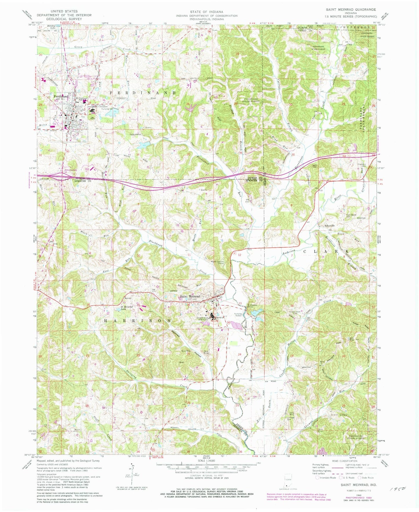
Historical USGS topographic quad map of Saint Meinrad in the state of Indiana. Map scale may vary for some years, but is generally around 1:24,000. Print size is approximately 24" x 27"
This quadrangle is in the following counties: Dubois, Perry, Spencer.
The map contains contour lines, roads, rivers, towns, and lakes. Printed on high-quality waterproof paper with UV fade-resistant inks, and shipped rolled.
Contains the following named places: Abbey Run, Adyeville, Bird Run, Black Run, Blackhawk Creek, Convent of the Immaculate Conception, Crooks Hollow Creek, Crooks Thom Cemetery, Cyclone Branch, Felmont Oil Company Dam, Felmont Oil Company Reservoir, Ferdinand, Ferdinand Consolidated School, Ferdinand Old Lake, Ferdinand Old Lake Dam, Ferdinand Police Department, Ferdinand Post Office, Ferdinand Run, Ferdinand State Forest, Ferdinand Volunteer Fire Department, Ferdinand Volunteer Fire Department Station 2, Ferdinand Water Supply Reservoir, Ferdinand Water Supply Reservoir Dam, Forest Park High School, Friday Branch, Hawk Run, Hurricane Creek, Lanman Cemetery, Meinrad Hollow, Monkey Hollow Ditch, Monte Cassino Shrine, Monte Run, Nest Run, Pale Run, Rock Run, Rockhouse Branch, Saint Josephs Shrine, Saint Meinrad, Saint Meinrad Archabbey Cemetery, Saint Meinrad Cemetery, Saint Meinrad Census Designated Place, Saint Meinrad College, Saint Meinrad Lake, Saint Meinrad Post Office, Saint Meinrad Volunteer Fire Department, Stapleton Cemetery, Stapleton Run, Swinging Creek, Taylor Cemetery, Tenn Beard Cemetery, Till Drain, Town of Ferdinand, Township of Ferdinand, Township of Harrison, Water Run, Wind Run, ZIP Codes: 47532, 47577