MyTopo
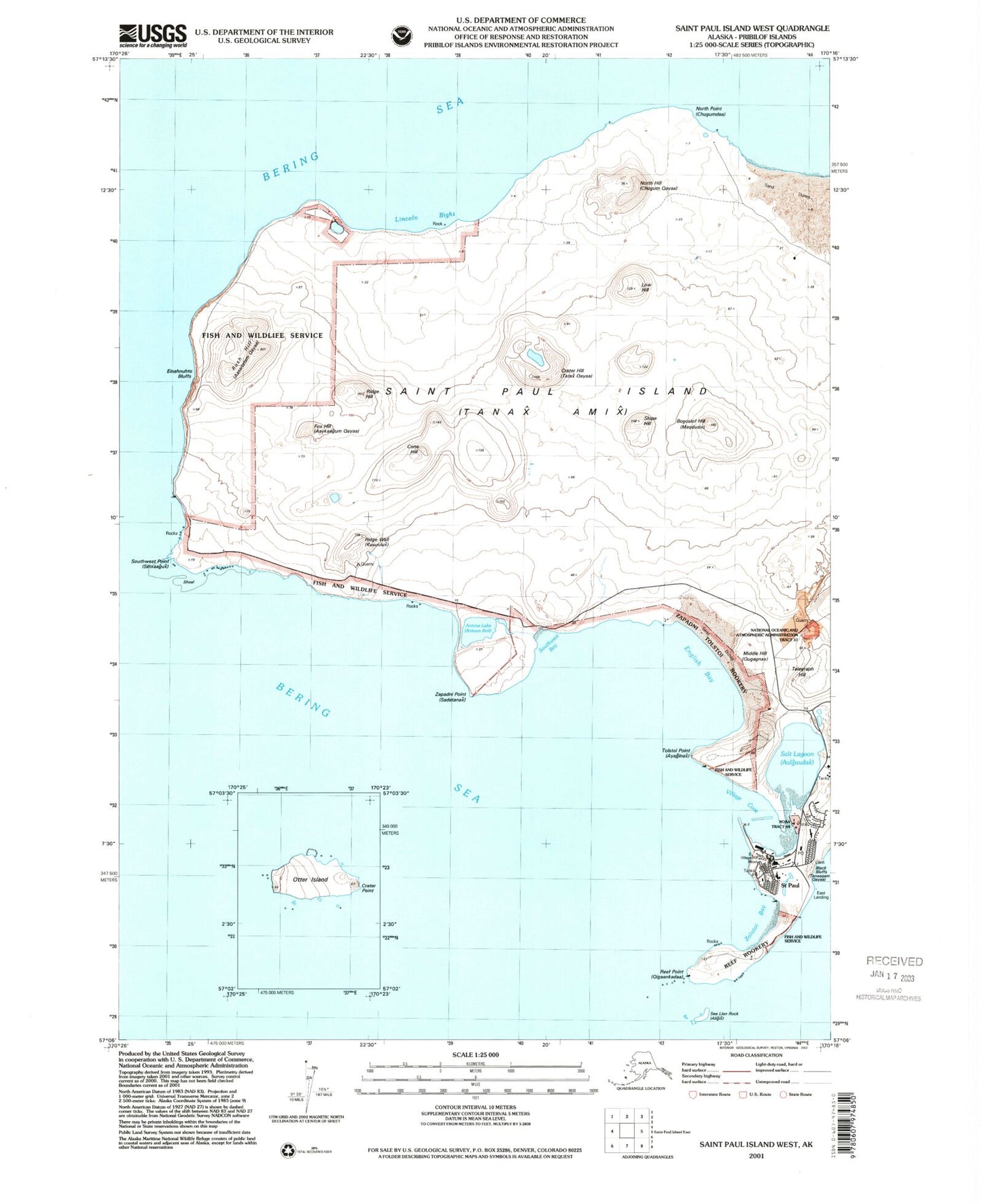
Classic USGS Saint Paul Island West Alaska 7.5'x7.5' Topo Map
Couldn't load pickup availability
Historical USGS topographic quad map of Saint Paul Island West in the state of Alaska. Map scale may vary for some years, but is generally around 1:24,000. Print size is approximately 24" x 27"
This quadrangle is in the following counties: Aleutians West (CA).
The map contains contour lines, roads, rivers, towns, and lakes. Printed on high-quality waterproof paper with UV fade-resistant inks, and shipped rolled.
Contains the following named places: Adguix, Aleutian Pribilof Islands Association Saint Paul Health Clinic, Angilasax, Antone Lake, Antones Island, Ardiguen, Axalux, Bogoslof Hill, Chiqix Hasax, Chmanax Anii, Chugix, Cone Hill, Crater Hill, Einahnuhto Hills, Emahnuhto Bluffs, English Bay, Fox Hill, Gidaax Anii, Gorbotch Rookery, Gull Hill, Iganuta, Kamenisti, Konglah, KUHB-FM (Saint Paul), Kursoolah, Lagoon Rookery, Lincoln Bight, Low Bluffs, Low Hill, Marunich, Maruniichax Anii, Middle Hill, Nah Speel, North Hill, North Point, Northwest Point, Pot Hill, Qdax Ulax Anii, Reef Point, Reef Rookery, Ridge Hill, Ridge Wall, Rush Hill, Saint Paul, Saint Paul Alaska Native Village Statistical Area, Saint Paul Island Post Office, Saint Paul Island Volunteer Fire Department, Saint Paul Police Department, Salt Lagoon, Schnag, Sea Lion Rock, Seethah, Slope Hill, Smiilix, Southwest Bay, Southwest Point, Tata Anii, Tatax Anii, Telegraph Hill, Tolstoi Point, Tolstoi Rookery, Tolstoi Sands, Tsammana, Village Cove, West Landing, Zapadni Point, Zapadni Rookery, Zolotoi Bay, Zolotoi Sands, ZIP Code: 99660