MyTopo
Classic USGS Saint Phillips Island South Carolina 7.5'x7.5' Topo Map
Couldn't load pickup availability
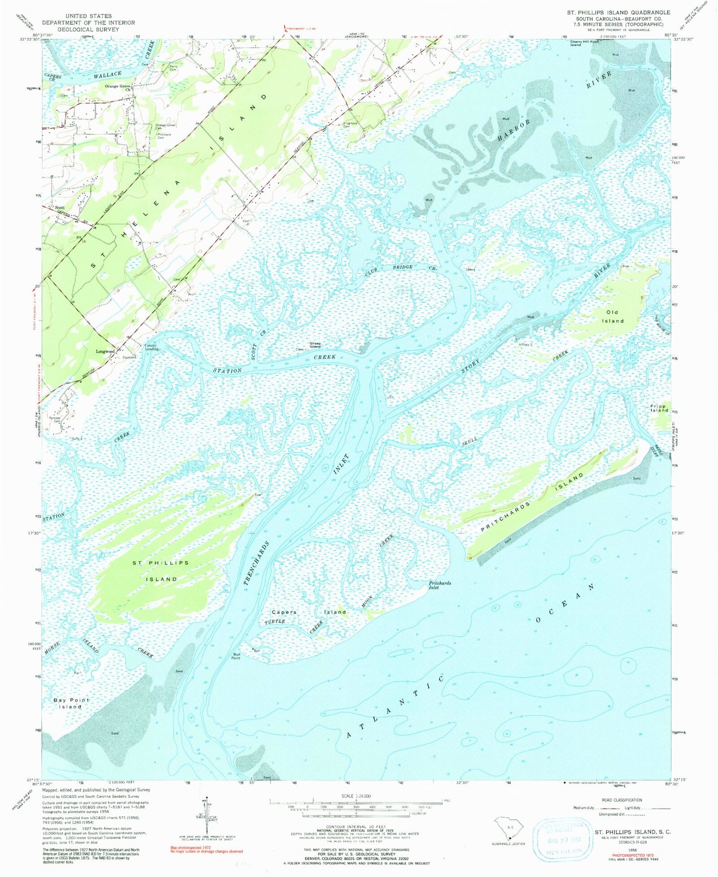
Historical USGS topographic quad map of Saint Phillips Island in the state of South Carolina. Map scale may vary for some years, but is generally around 1:24,000. Print size is approximately 24" x 27"
This quadrangle is in the following counties: Beaufort.
The map contains contour lines, roads, rivers, towns, and lakes. Printed on high-quality waterproof paper with UV fade-resistant inks, and shipped rolled.
Contains the following named places: Beaufort County Landing, Bull Point, Capers Island, Club Bridge Creek, County Landing, Frogmore Cemetery, Harbor River, Lady's - Saint Helena Island Fire Department Station 23, Lands End School, Longwood, Moon Creek, Morse Island Creek, Old Island, Orange Grove Cemetery, Orange Grove Church, Orange Grove Plantation, Perry Cemetery, Pritchard Cemetery, Pritchards Inlet, Pritchards Island, Saint Helena Island Division, Saint Phillips Island, Scott, Scott Creek, Sheep Island, Skull Creek, Skull Inlet, Station Creek, Story River, Tombee Cemetery, Towne-McDonald School, Trenchards Inlet, Turtle Creek, WOCW-FM (Parris Island), ZIP Code: 29920