MyTopo
Classic USGS Saint Regis Falls New York 7.5'x7.5' Topo Map
Couldn't load pickup availability
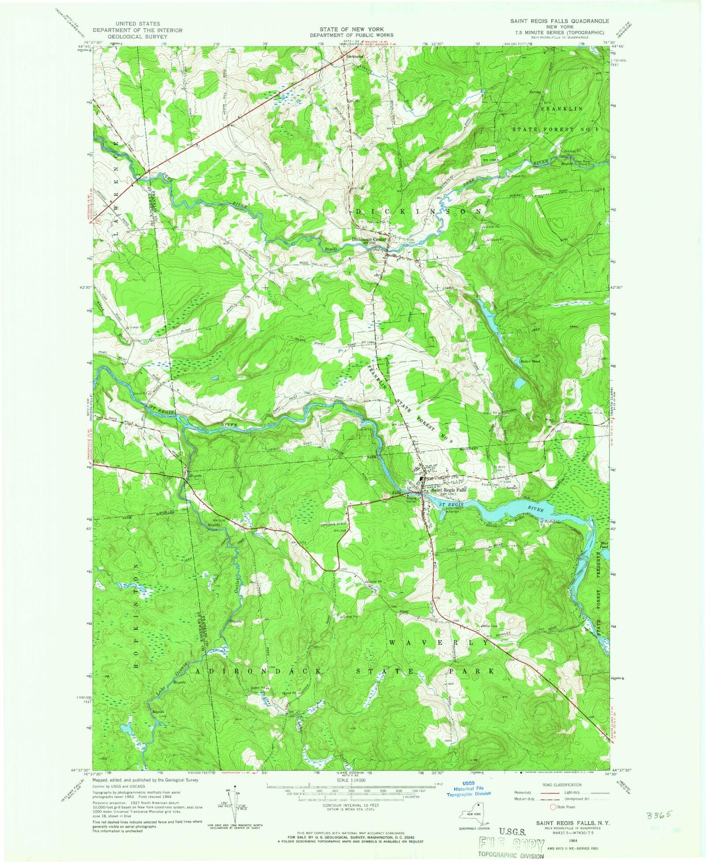
Historical USGS topographic quad map of Saint Regis Falls in the state of New York. Map scale may vary for some years, but is generally around 1:24,000. Print size is approximately 24" x 27"
This quadrangle is in the following counties: Franklin, St. Lawrence.
The map contains contour lines, roads, rivers, towns, and lakes. Printed on high-quality waterproof paper with UV fade-resistant inks, and shipped rolled.
Contains the following named places: Baker Pond, Deer River Picnic Area, Dexter Lake Outlet, Dickinson, Dickinson Center, Dickinson Center Post Office, Dickinson Volunteer Fire Department, Fairview Cemetery, Forest Cemetery, Franklin State Forest Number Nine, Guide Board School, Ives Cemetery, Lake Ozonia Outlet, Lake Ozonia School, Mud Pond, Palmer School, Saint Anns Cemetery, Saint Regis Falls, Saint Regis Falls Census Designated Place, Saint Regis Falls Central School, Saint Regis Falls Post Office, Saint Regis Falls Volunteer Fire Department, Saint Regis River Bridge, School Number 2, School Number 3, School Number 5, School Number 6, Town of Dickinson, ZIP Code: 12930