MyTopo
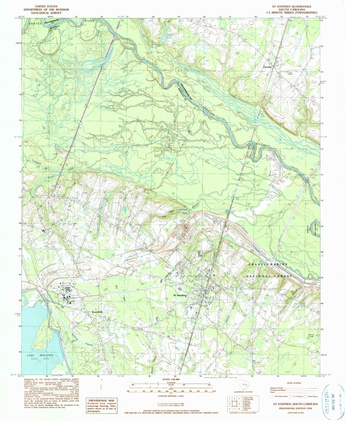
Classic USGS Saint Stephen South Carolina 7.5'x7.5' Topo Map
Couldn't load pickup availability
Historical USGS topographic quad map of Saint Stephen in the state of South Carolina. Map scale may vary for some years, but is generally around 1:24,000. Print size is approximately 24" x 27"
This quadrangle is in the following counties: Berkeley, Williamsburg.
The map contains contour lines, roads, rivers, towns, and lakes. Printed on high-quality waterproof paper with UV fade-resistant inks, and shipped rolled.
Contains the following named places: Berkeley County Library Saint Stephen Branch, Bible Way Church, Big Bay, Big Bay Branch, Bryant Chapel, Calvary Church, Doctor Pond, Gourdin, Halfway Swamp, Harris Town, I K Gourdin School, J K Gourdin Elementary School, J P Gamble Pond, J P Gamble Pond Dam, Keller Cemetery, Kelley Branch, Lane Airport, Lifeland Branch, Macedonia Church, Macedonia School, Milton Chapel, Mount Pismal Church, Murrays Ferry, Murrays Ferry Bridge, North End, Old Peru, Oldfield Plantation, Oldfield Plantation Cemetery, Penn Branch, Pineville Fire Department, Ponteaux Branch, Russellville, Russellville Cemetery, Russellville Census Designated Place, Russellville Christian Church, Russellville Post Office, Russellville School, Saint James Church, Saint James School, Saint Marys Holiness Church, Saint Matthews Church, Saint Michaels Church, Saint Peters Church, Saint Stephen, Saint Stephen Baptist Church, Saint Stephen Cemetery, Saint Stephen Elementary School, Saint Stephen Fire Department, Saint Stephen Golf Course, Saint Stephen High School, Saint Stephen Middle School, Saint Stephen Police Department, Saint Stephen Post Office, Saint Stephens Cemetery, Saint Stephens Episcopal Church, Santee, Sunset Memorial Cemetery, Swamp Fox, Town of Saint Stephen, WTUA-FM (Saint Stephen), ZIP Code: 29479