MyTopo
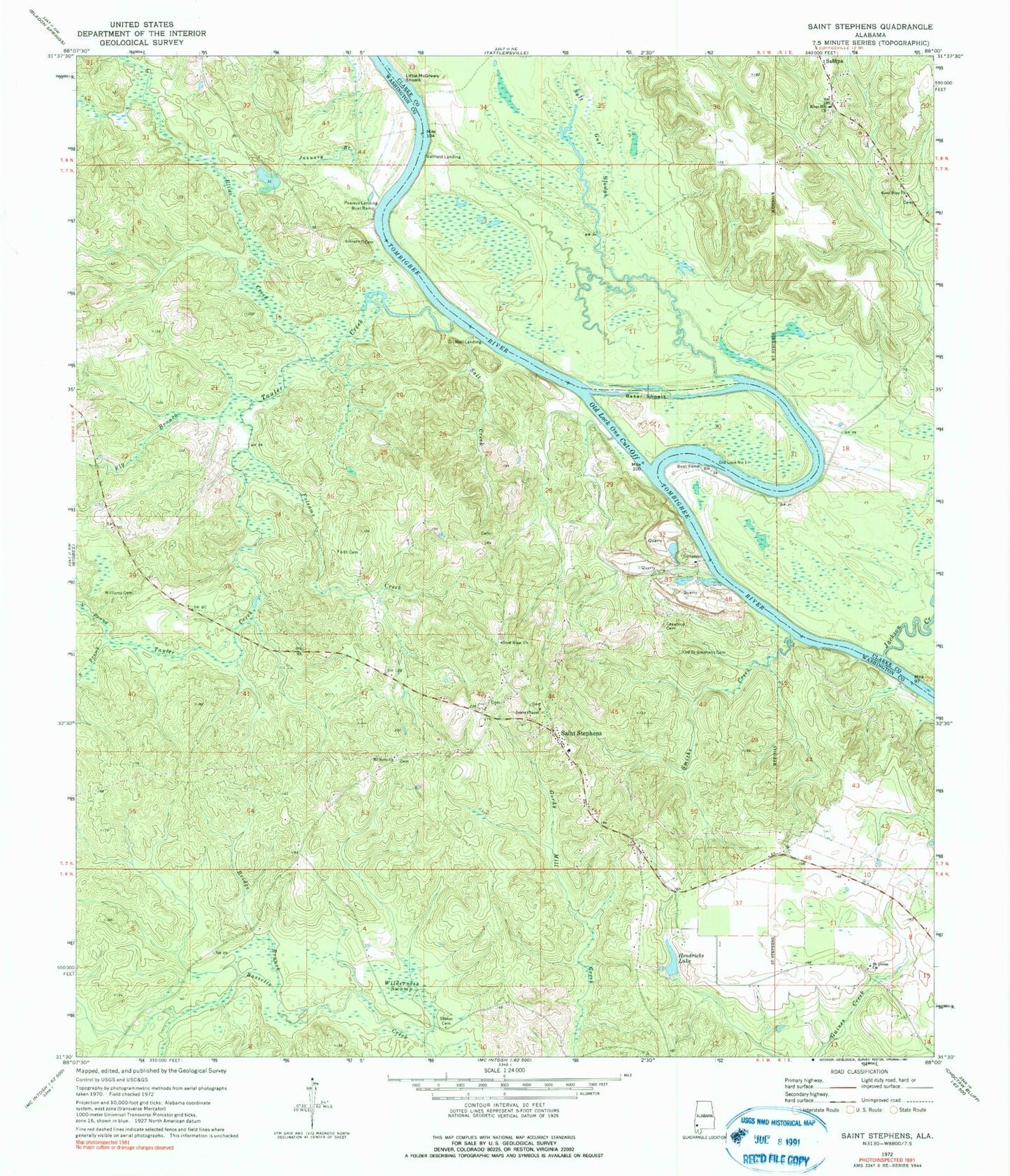
Classic USGS Saint Stephens Alabama 7.5'x7.5' Topo Map
Couldn't load pickup availability
Historical USGS topographic quad map of Saint Stephens in the state of Alabama. Map scale may vary for some years, but is generally around 1:24,000. Print size is approximately 24" x 27"
This quadrangle is in the following counties: Clarke, Washington.
The map contains contour lines, roads, rivers, towns, and lakes. Printed on high-quality waterproof paper with UV fade-resistant inks, and shipped rolled.
Contains the following named places: Atchison, Baker Shoals, Ballfield Landing, Beckhams Landing, Bowling Dam, Bowling Pond, Bridge Branch, Colemans Landing, Cowans Bluff, Cowans Landing, Crawford Cemetery, Elias Creek, Faith Cemetery, Fly Branch, Folsoms Creek, Gardys Landing, Good Hope Church, Gopher Landing, Hendricks Dam, Hendricks Lake, J B Wilson Landing, Jackson Creek, James Chapel Baptist Church, January Branch, L J Wilsons Landing, Little McGrews Shoals, Lock Number One Left Bank Public Use Area, Lovers Leap, McGrews Reserve, McGrews Shoals, Mount Nebo Cemetery, Mount Nebo Church, Mouth of Jackson Creek Landing, New Good Hope African Methodist Episcopal Zion Church, North Prong Tauler Creek, Oil Well Landing, Old Lock Number 1, Old Lock One Cut-Off, Old Saint Stephens, Old Saint Stephens Cemetery, Peaveys Landing Boat Ramp, Peavys Bar, Pelham Landing, River Hill Church, Saint Stephens, Saint Stephens Baptist Church, Saint Stephens Cemetery, Saint Stephens Census Designated Place, Saint Stephens Junior High School, Saint Stephens Landing, Saint Stephens Post Office, Saint Stephens United Methodist Church, Saint Stephens Volunteer Fire Department, Saint Union - Mount Stoney Cemetery, Saint Union Missionary Baptist Church, Salitpa Fire Department, Salt Creek, Salt Gut Slough, Smiths Creek, South Prong Tauler Creek, Springfiled Church, Stoker Cemetery, Stonewall Landing, Tauler Creek, Waites Landing, Wilderness Swamp, Williams Cemetery, Wilson, ZIP Code: 36569