MyTopo
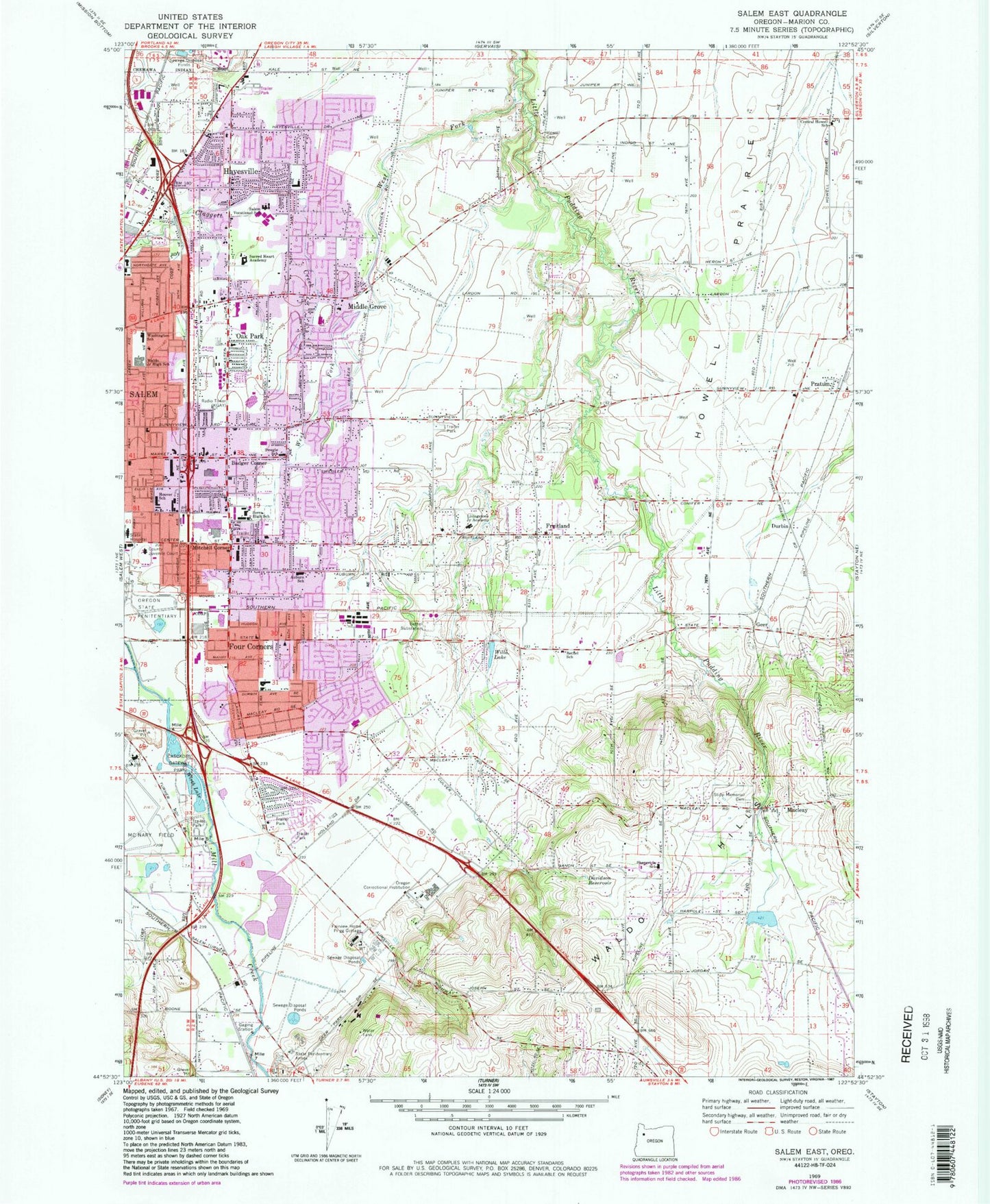
Classic USGS Salem East Oregon 7.5'x7.5' Topo Map
Couldn't load pickup availability
Historical USGS topographic quad map of Salem East in the state of Oregon. Map scale may vary for some years, but is generally around 1:24,000. Print size is approximately 24" x 27"
This quadrangle is in the following counties: Marion.
The map contains contour lines, roads, rivers, towns, and lakes. Printed on high-quality waterproof paper with UV fade-resistant inks, and shipped rolled.
Contains the following named places: Apostolic Christian Church of Silverton Oregon, Army National Guard McNary Field Helipad, Auburn Elementary School, Badger Corner, Bethel Elementary School, Bethel Substation, Blanchet Catholic School, Blossom Creek, Blue Gill Lake, Blue Skies Farm Airport, Bonesteele County Park, Broughton and Wiggins, Cascades Gateway City Park, Cascades Gateway City Park Boat Ramp, Central Howell, Central Howell Elementary School, Chemawa Indian School, Chemeketa Community College, Cherriots Christ Lutheran Church Park and Ride, Cherriots Grace Baptist Church Park and Ride, Cherriots Wal - Mart North Park and Ride, Concordia Lutheran School, Corban College, Davidson Reservoir, Denny County Park, Department of Motor Vehicles Salem North, Durbin, Early College High School, East Marion Justice Court Salem, Eastgate Basin City Park, Eoff Cemetery, Eyre Elementary School, Fairview Home Prigg Cottage, Fir, Fly 'N' W Airport, Four Corners, Four Corners Census Designated Place, Four Corners Elementary School, Four Corners Post Office, Fruitland, Fruitland Creek, Fruitland Elementary School, Fruitland Evangelical Church of North America, Fruitland Post Office, Geer, Gesner, Hallman Elementary School, Hammond Elementary School, Hammond School Park, Harry and Grace Thorp City Park, Haury Farms, Hayesville, Hayesville Cemetery, Hayesville Census Designated Place, Hayesville Elementary School, Hayesville School, Hoover Elementary School, Hoover School City Park, Houck Middle School, Howell Cemetery, Howell Post Office, Jane Goodall Environmental Middle Charter School, KGAY-AM, Lachmund, Lamb Elementary School, Livingston City Park, Livingstone Adventist Academy, Lusardi Field, Macleay, Macleay Post Office, Marion County Circuit Court Annex, Marion County Circuit Court Juvenile Department Court, Marion County Fairgrounds, Marion County Fire District 1 Station 1 Four Corners, Marion County Fire District 1 Station 2 Middle Grove, Marion County Fire District 1 Station 3 Pratum, Marion County Fire District 1 Station 4 Macleay, Marion County Health Center, Marion County Health Department Office, Marion County Jail, Marion County Public Works Department, Marion County Sheriff's Office Central District, Market Street Park and Ride, McKay High School, McKay School City Park, Messiah Lutheran Church, Middle Grove, Middle Grove Elementary School, Mill Creek Correctional Facility, Miller Elementary School, Mitchell Corner, North Reservoir, Northgate City Park, Oak Park, Oregon State Correctional Institution, Oregon State Police Headquarters, Parkdale County Park, Portland General Electric Salem Helipad, Pratum, Pratum Elementary School, Pratum Post Office, Renard, Rickey, Roberts High School, Rooster Gulch, Sacred Heart Academy, Salem Academy Christian School, Salem Academy High School, Salem Christian Center, Salem Division, Salem Fire Department Station 10, Salem Fire Department Station 3, Salem Fire Department Station 8, Salem Vocational School, Santana County Park, Santiam Correctional Facility, Scott Elementary School, Shangri-la School, State Lands Ballfields City Park, State School, Stephens Middle School, Stipp Memorial Cemetery, Stipp Post Office, Swegle, Swegle Elementary School, Trinity United Methodist Church, Vernon Post Office, Waldo Lake, Waldo Lake Reservoir Dam, Waldo Middle School, Washington Elementary School, West Fork Little Pudding River, Western Baptist College, Willa Lake, Wirth Lake, Yeoman, Yoshikai Elementary School, ZIP Code: 97317


